
60 Bus Route Map
View the 60 route map and see all 60 stops along the route. The map of 60 shows where the bus travels and the location of each stop, making it easy to understand the entire route at a glance.
Explore SamTrans routes on the map and see where SamTrans bus services operate. Use the 60 map to find bus stops and see how the 60 connects different areas along its trip.
All 60 stops on the map are displayed in route order, helping you follow the 60 bus from the first stop to the last.
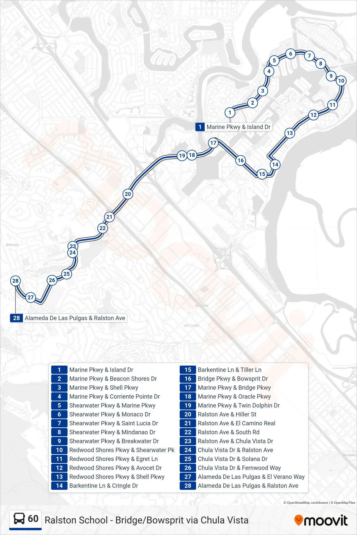
Stops list (60 - Carlmont Hs)
- Marine Pkwy & Island Dr
- Marine Pkwy & Beacon Shores Dr
- Marine Pkwy & Shell Pkwy
- Marine Pkwy & Corriente Pointe Dr
- Shearwater Pkwy & Marine Pkwy
- Shearwater Pkwy & Monaco Dr
- Shearwater Pkwy & Saint Lucia Dr
- Shearwater Pkwy & Mindanao Dr
- Shearwater Pkwy & Breakwater Dr
- Redwood Shores Pkwy & Shearwater Pk
- Redwood Shores Pkwy & Egret Ln
- Redwood Shores Pkwy & Avocet Dr
- Redwood Shores Pkwy & Shell Pkwy
- Barkentine Ln & Cringle Dr
- Barkentine Ln & Tiller Ln
- Bridge Pkwy & Bowsprit Dr
- Marine Pkwy & Bridge Pkwy
- Marine Pkwy & Oracle Pkwy
- Marine Pkwy & Twin Dolphin Dr
- Ralston Ave & Hiller St
- Ralston Ave & El Camino Real
- Ralston Ave & South Rd
- Ralston Ave & Chula Vista Dr
- Chula Vista Dr & Ralston Ave
- Chula Vista Dr & Solana Dr
- Chula Vista Dr & Fernwood Way
- Alameda De Las Pulgas & El Verano Way
- Alameda De Las Pulgas & Ralston Ave