
60 Bus Route Map
View the 60 route map and see all 60 stops along the route. The map of 60 shows where the bus travels and the location of each stop, making it easy to understand the entire route at a glance.
Explore GTT Urban Service routes on the map and see where GTT Urban Service bus services operate. Use the 60 map to find bus stops and see how the 60 connects different areas along its trip.
All 60 stops on the map are displayed in route order, helping you follow the 60 bus from the first stop to the last.
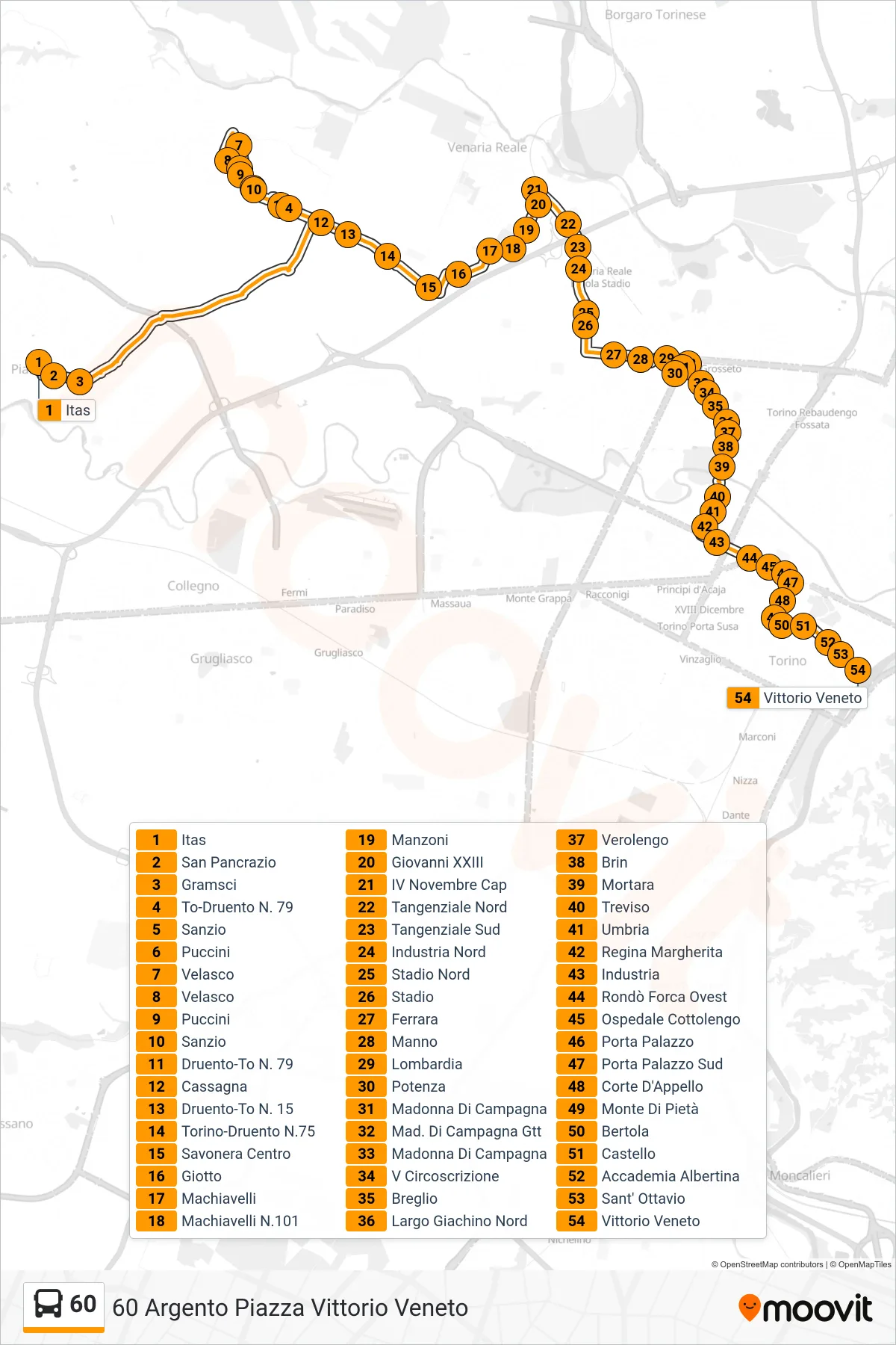
Stops list (60 - 60 Silver Vittorio Veneto Square)
- Itas
- San Pancrazio
- Gramsci
- Turin-Druento No. 79
- Sanzio
- Puccini
- Velasco
- Velasco
- Puccini
- Sanzio
- Druento-To N. 79
- Cassagna
- Druento-Turin N. 15
- Turin-Druento No.75
- Savonera Center
- Giotto
- Machiavelli
- Machiavelli 101
- Manzoni
- Giovanni XXIII
- IV November Terminal
- North Ring Road
- South Ring Road
- Industry North
- North Stadium
- Stadium
- Ferrara
- Manno
- Lombardy
- Potenza
- Madonna of Countryside
- Campagna GTT
- Madonna of Countryside
- V District
- Breglio
- Giachino Square North
- Verolengo
- Brin
- Mortara
- Treviso
- Umbria
- Queen Margherita
- Industry
- Rondo Forca West
- Cottolengo Hospital
- Porta Palazzo
- South Porta Palazzo
- Court of Appeal
- Monte Di Pietà
- Bertola
- Castello
- Accademia Albertina
- Sant' Ottavio
- Vittorio Veneto