
60 Bus Route Map
View the 60 route map and see all 60 stops along the route. The map of 60 shows where the bus travels and the location of each stop, making it easy to understand the entire route at a glance.
Explore Transit Services of Frederick County routes on the map and see where Transit Services of Frederick County bus services operate. Use the 60 map to find bus stops and see how the 60 connects different areas along its trip.
All 60 stops on the map are displayed in route order, helping you follow the 60 bus from the first stop to the last.
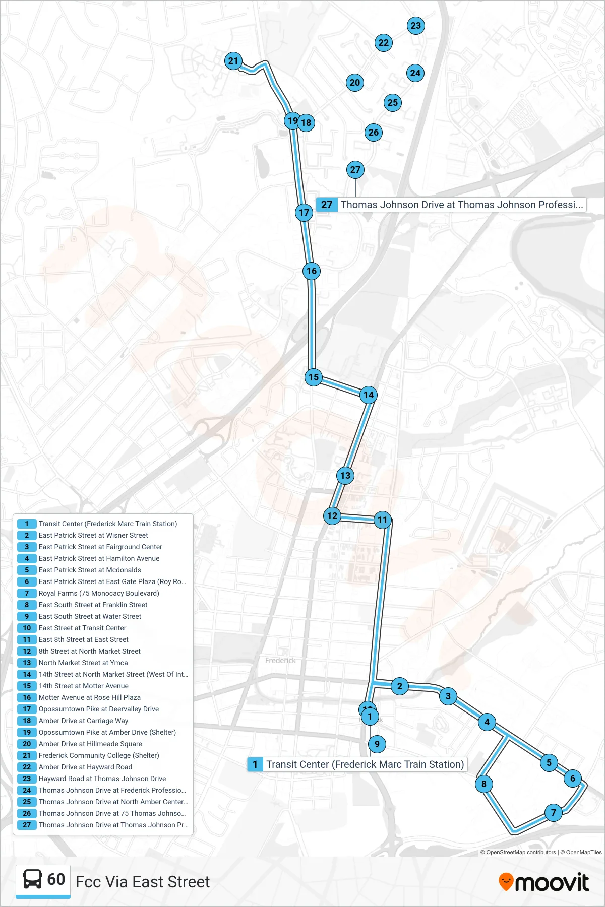
Stops list (60 - Fcc Via East Street)
- Transit Center (Frederick Marc Train Station)
- East Patrick Street at Wisner Street
- East Patrick Street at Fairground Center
- East Patrick Street at Hamilton Avenue
- East Patrick Street at Mcdonalds
- East Patrick Street at East Gate Plaza (Roy Rogers)
- Royal Farms (75 Monocacy Boulevard)
- East South Street at Franklin Street
- East South Street at Water Street
- East Street at Transit Center
- East 8th Street at East Street
- 8th Street at North Market Street
- North Market Street at Ymca
- 14th Street at North Market Street (West Of Intersection)
- 14th Street at Motter Avenue
- Motter Avenue at Rose Hill Plaza
- Opossumtown Pike at Deervalley Drive
- Amber Drive at Carriage Way
- Opossumtown Pike at Amber Drive (Shelter)
- Amber Drive at Hillmeade Square
- Frederick Community College (Shelter)
- Amber Drive at Hayward Road
- Hayward Road at Thomas Johnson Drive
- Thomas Johnson Drive at Frederick Professional Group (61 Tj Dr.)
- Thomas Johnson Drive at North Amber Center (67 Tj Dr.)
- Thomas Johnson Drive at 75 Thomas Johnson Drive
- Thomas Johnson Drive at Thomas Johnson Professional Center (87 Tj Dr.)