
600 Bus Route Map
View the 600 route map and see all 600 stops along the route. The map of 600 shows where the bus travels and the location of each stop, making it easy to understand the entire route at a glance.
Explore NJ Transit routes on the map and see where NJ Transit bus services operate. Use the 600 map to find bus stops and see how the 600 connects different areas along its trip.
All 600 stops on the map are displayed in route order, helping you follow the 600 bus from the first stop to the last.
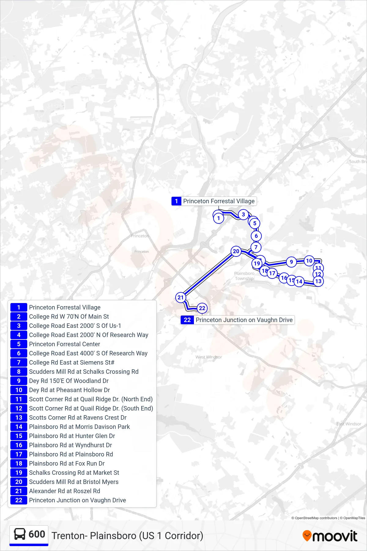
Stops list (600 - Princeton Jct Rail Station)
- Princeton Forrestal Village
- College Rd W 70'N Of Main St
- College Road East 2000' S Of Us-1
- College Road East 2000' N Of Research Way
- Princeton Forrestal Center
- College Road East 4000' S Of Research Way
- College Rd East at Siemens St#
- Scudders Mill Rd at Schalks Crossing Rd
- Dey Rd 150'E Of Woodland Dr
- Dey Rd at Pheasant Hollow Dr
- Scott Corner Rd at Quail Ridge Dr. (North End)
- Scott Corner Rd at Quail Ridge Dr. (South End)
- Scotts Corner Rd at Ravens Crest Dr
- Plainsboro Rd at Morris Davison Park
- Plainsboro Rd at Hunter Glen Dr
- Plainsboro Rd at Wyndhurst Dr
- Plainsboro Rd at Plainsboro Rd
- Plainsboro Rd at Fox Run Dr
- Schalks Crossing Rd at Market St
- Scudders Mill Rd at Bristol Myers
- Alexander Rd at Roszel Rd
- Princeton Junction on Vaughn Drive