
608 Bus Route Map
View the 608 route map and see all 608 stops along the route. The map of 608 shows where the bus travels and the location of each stop, making it easy to understand the entire route at a glance.
Explore SWB Stadtwerke Bonn Verkehrs GmbH routes on the map and see where SWB Stadtwerke Bonn Verkehrs GmbH bus services operate. Use the 608 map to find bus stops and see how the 608 connects different areas along its trip.
All 608 stops on the map are displayed in route order, helping you follow the 608 bus from the first stop to the last.
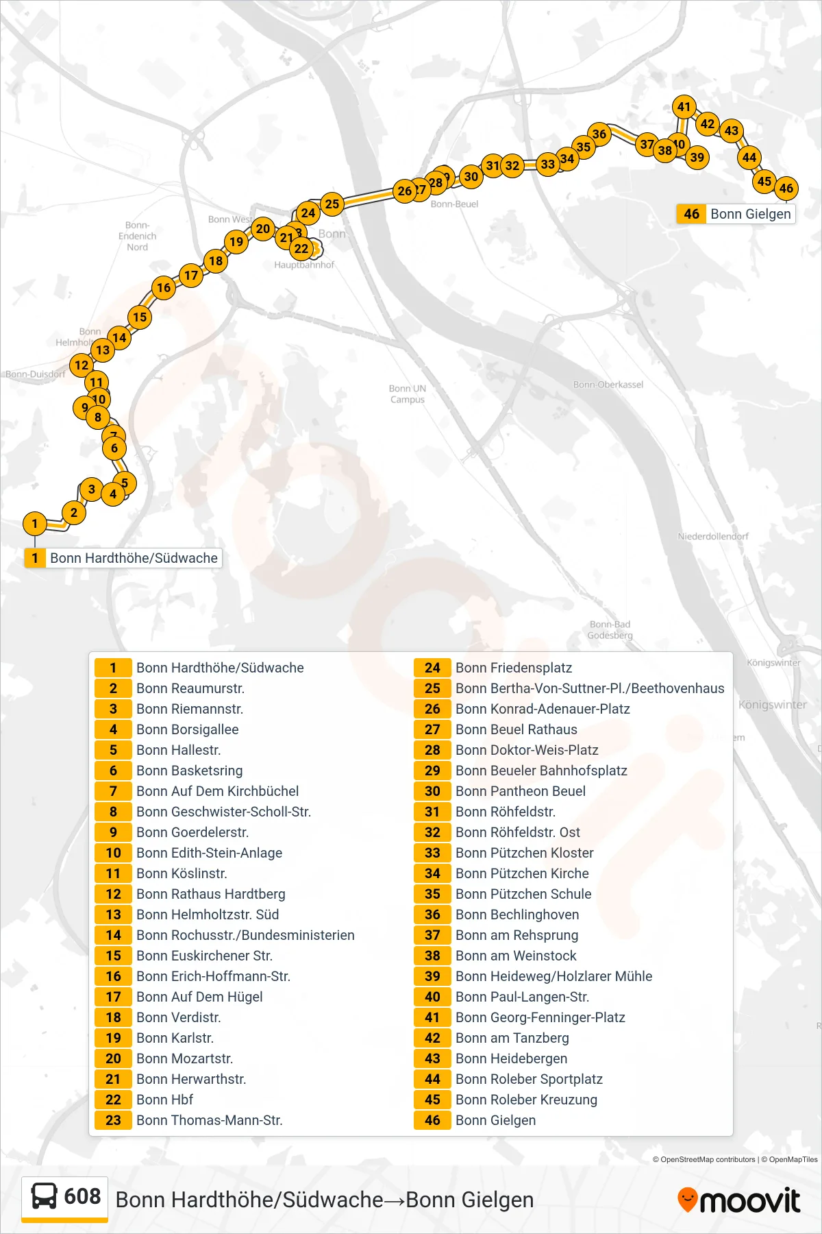
Stops list (608 - Bonn Hardthöhe/Südwache→Bonn Gielgen)
- Bonn Hardthöhe/Südwache
- Bonn Reaumurstr.
- Bonn Riemannstr.
- Bonn Borsigallee
- Bonn Hallestr.
- Bonn Basketsring
- Bonn Auf Dem Kirchbüchel
- Bonn Geschwister-Scholl-Str.
- Bonn Goerdelerstr.
- Bonn Edith-Stein-Anlage
- Bonn Köslinstr.
- Bonn Rathaus Hardtberg
- Bonn Helmholtzstr. Süd
- Bonn Rochusstr./Bundesministerien
- Bonn Euskirchener Str.
- Bonn Erich-Hoffmann-Str.
- Bonn Auf Dem Hügel
- Bonn Verdistr.
- Bonn Karlstr.
- Bonn Mozartstr.
- Bonn Herwarthstr.
- Bonn Hbf
- Bonn Thomas-Mann-Str.
- Bonn Friedensplatz
- Bonn Bertha-Von-Suttner-Pl./Beethovenhaus
- Bonn Konrad-Adenauer-Platz
- Bonn Beuel Rathaus
- Bonn Doktor-Weis-Platz
- Bonn Beueler Bahnhofsplatz
- Bonn Pantheon Beuel
- Bonn Röhfeldstr.
- Bonn Röhfeldstr. Ost
- Bonn Pützchen Kloster
- Bonn Pützchen Kirche
- Bonn Pützchen Schule
- Bonn Bechlinghoven
- Bonn am Rehsprung
- Bonn am Weinstock
- Bonn Heideweg/Holzlarer Mühle
- Bonn Paul-Langen-Str.
- Bonn Georg-Fenninger-Platz
- Bonn am Tanzberg
- Bonn Heidebergen
- Bonn Roleber Sportplatz
- Bonn Roleber Kreuzung
- Bonn Gielgen