
609 Bus Route Map
View the 609 route map and see all 609 stops along the route. The map of 609 shows where the bus travels and the location of each stop, making it easy to understand the entire route at a glance.
Explore Dr. Richard NÖ GmbH & Co KG routes on the map and see where Dr. Richard NÖ GmbH & Co KG bus services operate. Use the 609 map to find bus stops and see how the 609 connects different areas along its trip.
All 609 stops on the map are displayed in route order, helping you follow the 609 bus from the first stop to the last.
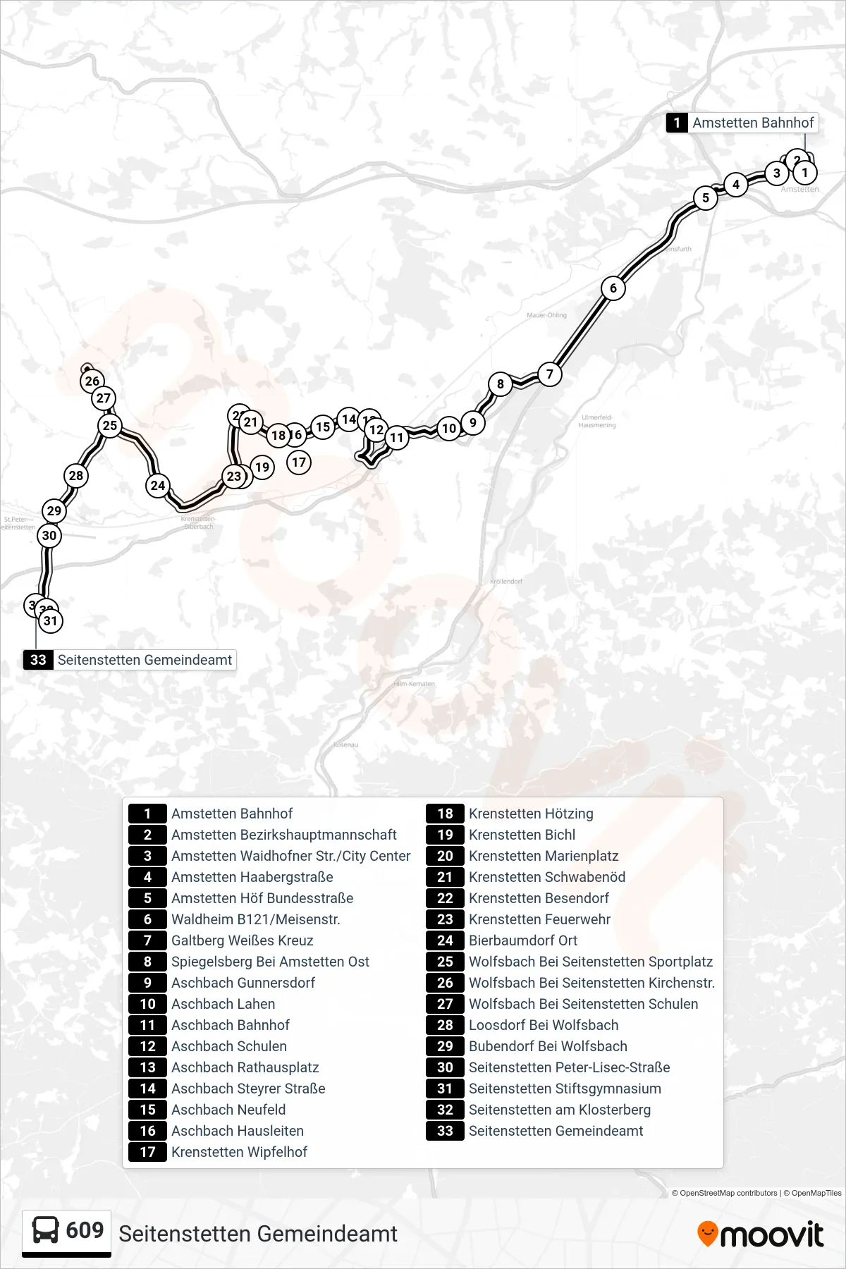
Stops list (609 - Seitenstetten Gemeindeamt)
- Amstetten Bahnhof
- Amstetten Bezirkshauptmannschaft
- Amstetten Waidhofner Str./City Center
- Amstetten Haabergstraße
- Amstetten Höf Bundesstraße
- Waldheim B121/Meisenstr.
- Galtberg Weißes Kreuz
- Spiegelsberg Bei Amstetten Ost
- Aschbach Gunnersdorf
- Aschbach Lahen
- Aschbach Bahnhof
- Aschbach Schulen
- Aschbach Rathausplatz
- Aschbach Steyrer Straße
- Aschbach Neufeld
- Aschbach Hausleiten
- Krenstetten Wipfelhof
- Krenstetten Hötzing
- Krenstetten Bichl
- Krenstetten Marienplatz
- Krenstetten Schwabenöd
- Krenstetten Besendorf
- Krenstetten Feuerwehr
- Bierbaumdorf Ort
- Wolfsbach Bei Seitenstetten Sportplatz
- Wolfsbach Bei Seitenstetten Kirchenstr.
- Wolfsbach Bei Seitenstetten Schulen
- Loosdorf Bei Wolfsbach
- Bubendorf Bei Wolfsbach
- Seitenstetten Peter-Lisec-Straße
- Seitenstetten Stiftsgymnasium
- Seitenstetten am Klosterberg
- Seitenstetten Gemeindeamt