
61 Bus Route Map
View the 61 route map and see all 61 stops along the route. The map of 61 shows where the bus travels and the location of each stop, making it easy to understand the entire route at a glance.
Explore Golan Regional Council routes on the map and see where Golan Regional Council bus services operate. Use the 61 map to find bus stops and see how the 61 connects different areas along its trip.
All 61 stops on the map are displayed in route order, helping you follow the 61 bus from the first stop to the last.
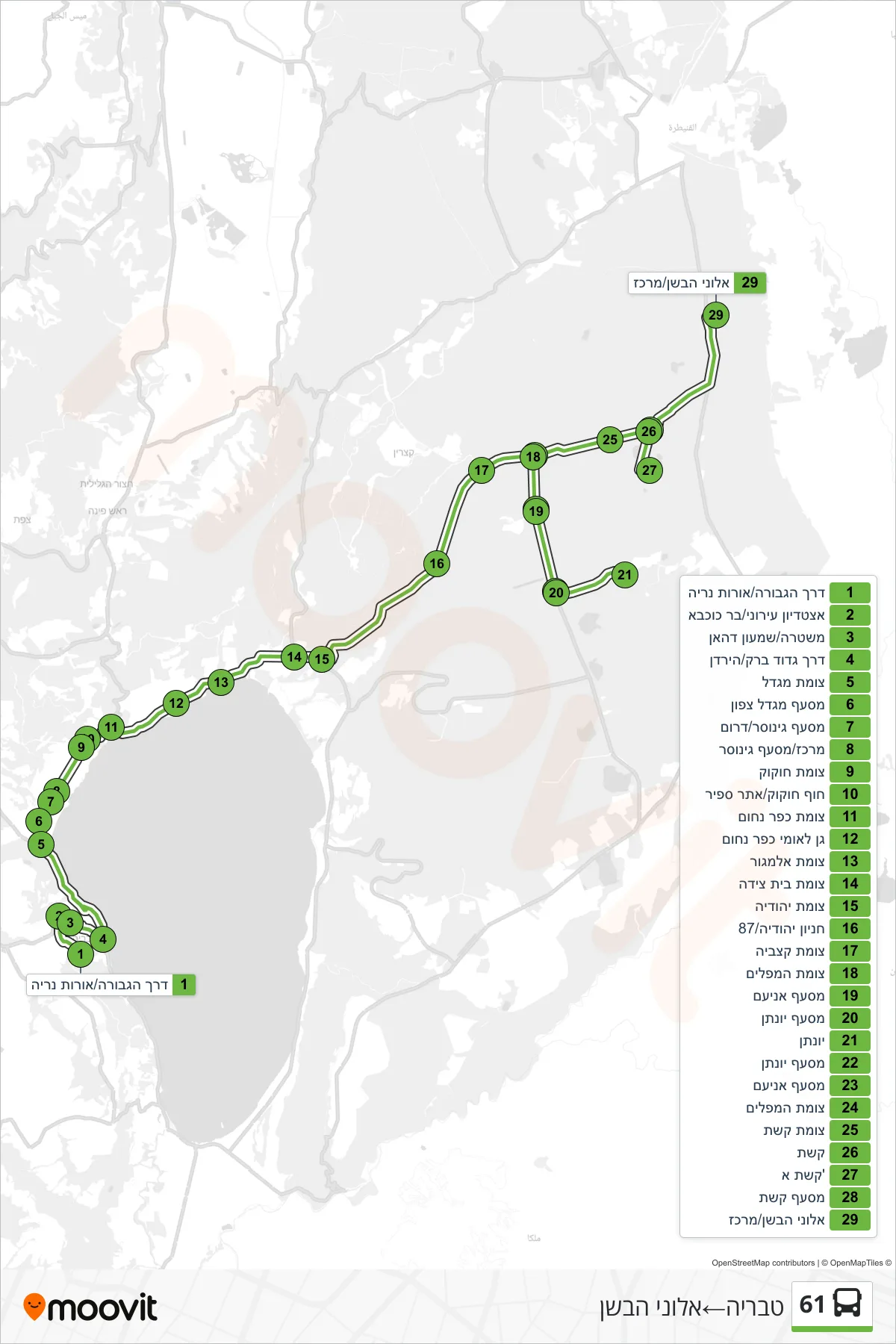
Stops list (61 - Tiberias→Alonei HaBashan)
- HaGvura Road/Orot Neriya
- Municipal Stadium/Bar Kochba
- Police/Shimon Dahan
- Barak Battalion Road/HaYarden
- Migdal Junction
- Migdal North Junction
- Ginosar Junction/South
- Center/Ginosar Junction
- Hukok Junction
- Hukok Beach/Sapir Site
- Kfar Nahum Junction
- Capernaum National Park
- Almog Junction
- Beit Tzeida Junction
- Yehudiya Junction
- Yehudiya Parking/87
- Katzbia Junction
- Maplim Junction
- Ani'am Junction
- Yonatan Junction
- Yonatan
- Yonatan Junction
- Ani'am Junction
- Maplim Junction
- Keshet Junction
- Keshet
- Keshet A
- Keshet Junction
- Alonei Bashan/Center