
61 Bus Route Map
View the 61 route map and see all 61 stops along the route. The map of 61 shows where the bus travels and the location of each stop, making it easy to understand the entire route at a glance.
Explore KSRTC Ordinary Bus Services routes on the map and see where KSRTC Ordinary Bus Services bus services operate. Use the 61 map to find bus stops and see how the 61 connects different areas along its trip.
All 61 stops on the map are displayed in route order, helping you follow the 61 bus from the first stop to the last.
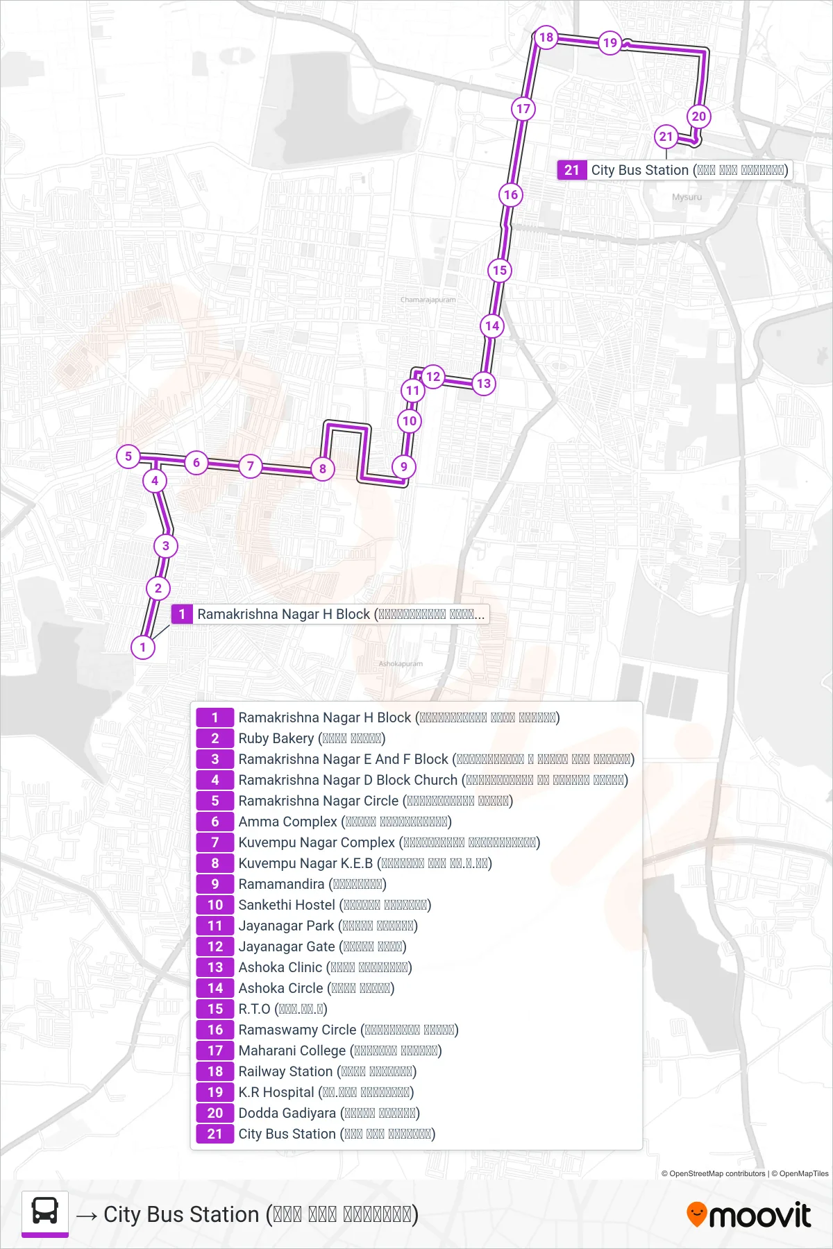
Stops list (61 - → City Bus Station (ನಗರ ಬಸ್ ನಿಲ್ದಾಣ))
- Ramakrishna Nagar H Block (ರಾಮಕೃಷ್ಣನಗರ ಹೆಚ್ ಬ್ಲಾಕ್)
- Ruby Bakery (ರೂಬಿ ಬೇಕರಿ)
- Ramakrishna Nagar E And F Block (ರಾಮಕೃಷ್ಣನಗರ ಇ ಮತ್ತು ಎಫ್ ಬ್ಲಾಕ್)
- Ramakrishna Nagar D Block Church (ರಾಮಕೃಷ್ಣನಗರ ಡಿ ಬ್ಲಾಕ್ ಚರ್ಚ್)
- Ramakrishna Nagar Circle (ರಾಮಕೃಷ್ಣನಗರ ವೃತ್ತ)
- Amma Complex (ಅಮ್ಮಾ ಕಾಂಪ್ಲೆಕ್ಸ್)
- Kuvempu Nagar Complex (ಕುವೆಂಪುನಗರ ಕಾಂಪ್ಲೆಕ್ಸ್)
- Kuvempu Nagar K.E.B (ಕುವೆಂಪು ನಗರ ಕೆ.ಇ.ಬಿ)
- Ramamandira (ರಾಮಮಂದಿರ)
- Sankethi Hostel (ಸಂಕೇತಿ ಹಾಸ್ಟಲ್)
- Jayanagar Park (ಜಯನಗರ ಪಾರ್ಕ್)
- Jayanagar Gate (ಜಯನಗರ ಗೇಟ್)
- Ashoka Clinic (ಅಶೋಕ ಕ್ಲಿನಿಕ್)
- Ashoka Circle (ಅಶೋಕ ವೃತ್ತ)
- R.T.O (ಆರ್.ಟಿ.ಓ)
- Ramaswamy Circle (ರಾಮಸ್ವಾಮಿ ವೃತ್ತ)
- Maharani College (ಮಹಾರಾಣಿ ಕಾಲೇಜು)
- Railway Station (ರೈಲು ನಿಲ್ದಾಣ)
- K.R Hospital (ಕೆ.ಆರ್ ಆಸ್ಪತ್ರೆ)
- Dodda Gadiyara (ದೊಡ್ಡ ಗಡಿಯಾರ)
- City Bus Station (ನಗರ ಬಸ್ ನಿಲ್ದಾಣ)