
61 Tram Route Map
View the 61 route map and see all 61 stops along the route. The map of 61 shows where the tram travels and the location of each stop, making it easy to understand the entire route at a glance.
Explore SWB Stadtwerke Bonn Verkehrs GmbH routes on the map and see where SWB Stadtwerke Bonn Verkehrs GmbH tram services operate. Use the 61 map to find tram stations and see how the 61 connects different areas along its trip.
All 61 stops on the map are displayed in route order, helping you follow the 61 tram from the first station to the last.
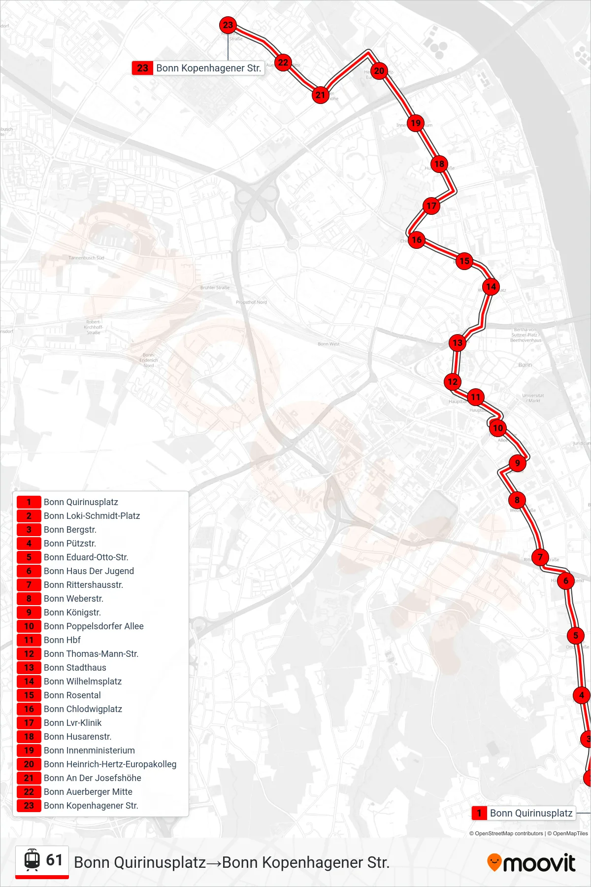
Stops list (61 - Bonn Quirinusplatz→Bonn Kopenhagener Str.)
- Bonn Quirinusplatz
- Bonn Loki-Schmidt-Platz
- Bonn Bergstr.
- Bonn Pützstr.
- Bonn Eduard-Otto-Str.
- Bonn Haus Der Jugend
- Bonn Rittershausstr.
- Bonn Weberstr.
- Bonn Königstr.
- Bonn Poppelsdorfer Allee
- Bonn Hbf
- Bonn Thomas-Mann-Str.
- Bonn Stadthaus
- Bonn Wilhelmsplatz
- Bonn Rosental
- Bonn Chlodwigplatz
- Bonn Lvr-Klinik
- Bonn Husarenstr.
- Bonn Innenministerium
- Bonn Heinrich-Hertz-Europakolleg
- Bonn An Der Josefshöhe
- Bonn Auerberger Mitte
- Bonn Kopenhagener Str.
Change direction
- Route Map - 61 - Bonn Konrad-Adenauer-Platz→Bonn Quirinusplatz
- Route Map - 61 - Bonn Hbf→Bonn Kopenhagener Str.
- Route Map - 61 - Bonn Quirinusplatz→Bonn Konrad-Adenauer-Platz
- Route Map - 61 - Bonn Kopenhagener Str.→Bonn Quirinusplatz
- Route Map - 61 - Bonn Hbf→Bonn Konrad-Adenauer-Platz
- Route Map - 61 - Bonn Kopenhagener Str.→Bonn Hbf