
61 Bus Route Map
View the 61 route map and see all 61 stops along the route. The map of 61 shows where the bus travels and the location of each stop, making it easy to understand the entire route at a glance.
Explore Stadtwerke Heilbronn - Verkehrsbetriebe routes on the map and see where Stadtwerke Heilbronn - Verkehrsbetriebe bus services operate. Use the 61 map to find bus stops and see how the 61 connects different areas along its trip.
All 61 stops on the map are displayed in route order, helping you follow the 61 bus from the first stop to the last.
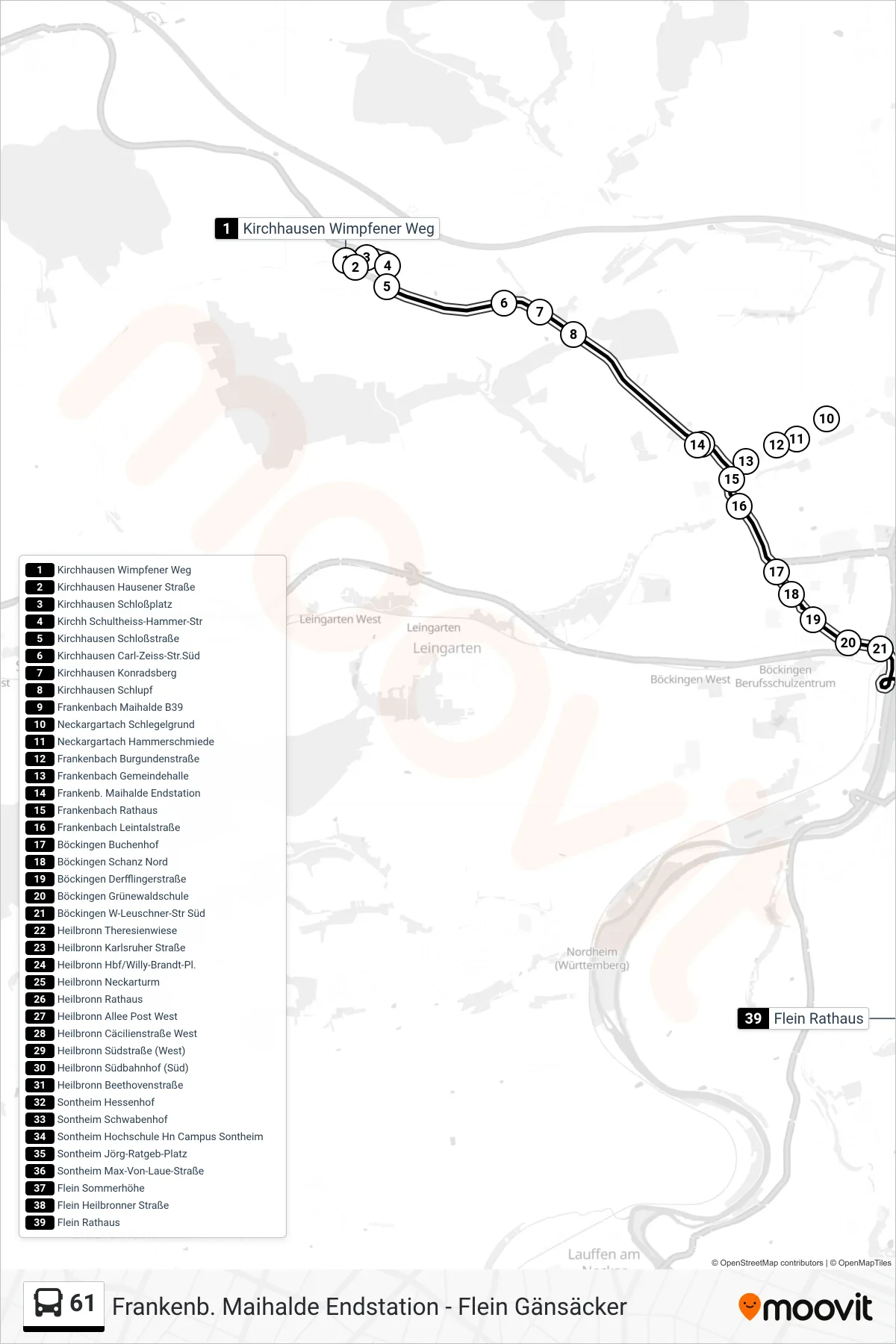
Stops list (61 - Flein Rathaus)
- Kirchhausen Wimpfener Weg
- Kirchhausen Hausener Straße
- Kirchhausen Schloßplatz
- Kirchh Schultheiss-Hammer-Str
- Kirchhausen Schloßstraße
- Kirchhausen Carl-Zeiss-Str.Süd
- Kirchhausen Konradsberg
- Kirchhausen Schlupf
- Frankenbach Maihalde B39
- Neckargartach Schlegelgrund
- Neckargartach Hammerschmiede
- Frankenbach Burgundenstraße
- Frankenbach Gemeindehalle
- Frankenb. Maihalde Endstation
- Frankenbach Rathaus
- Frankenbach Leintalstraße
- Böckingen Buchenhof
- Böckingen Schanz Nord
- Böckingen Derfflingerstraße
- Böckingen Grünewaldschule
- Böckingen W-Leuschner-Str Süd
- Heilbronn Theresienwiese
- Heilbronn Karlsruher Straße
- Heilbronn Hbf/Willy-Brandt-Pl.
- Heilbronn Neckarturm
- Heilbronn Rathaus
- Heilbronn Allee Post West
- Heilbronn Cäcilienstraße West
- Heilbronn Südstraße (West)
- Heilbronn Südbahnhof (Süd)
- Heilbronn Beethovenstraße
- Sontheim Hessenhof
- Sontheim Schwabenhof
- Sontheim Hochschule Hn Campus Sontheim
- Sontheim Jörg-Ratgeb-Platz
- Sontheim Max-Von-Laue-Straße
- Flein Sommerhöhe
- Flein Heilbronner Straße
- Flein Rathaus