
61 Bus Route Map
View the 61 route map and see all 61 stops along the route. The map of 61 shows where the bus travels and the location of each stop, making it easy to understand the entire route at a glance.
Explore Friedrich Müller Omnibusunternehmen GmbH routes on the map and see where Friedrich Müller Omnibusunternehmen GmbH bus services operate. Use the 61 map to find bus stops and see how the 61 connects different areas along its trip.
All 61 stops on the map are displayed in route order, helping you follow the 61 bus from the first stop to the last.
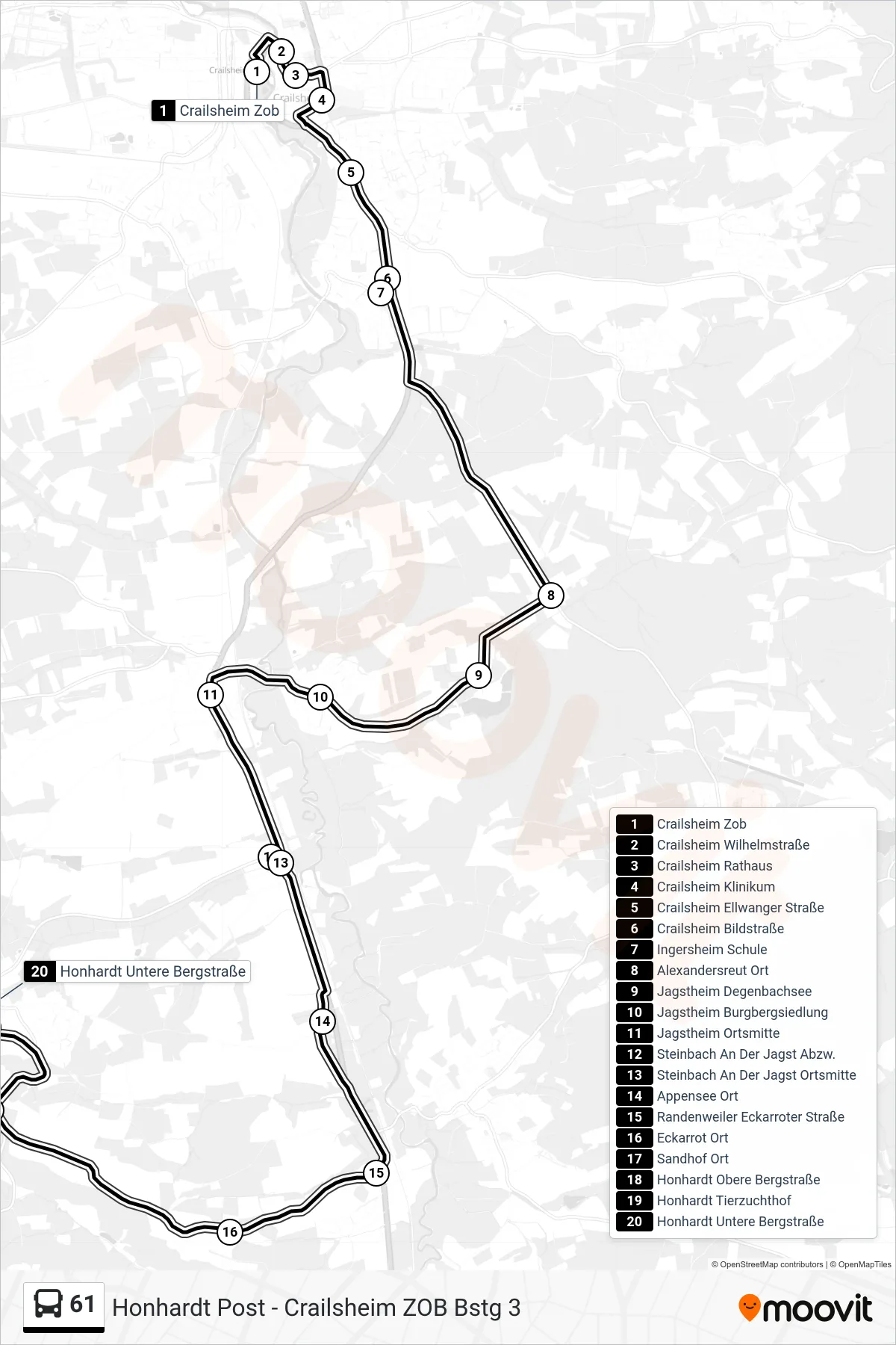
Stops list (61 - Honhardt Untere Bergstraße)
- Crailsheim Zob
- Crailsheim Wilhelmstraße
- Crailsheim Rathaus
- Crailsheim Klinikum
- Crailsheim Ellwanger Straße
- Crailsheim Bildstraße
- Ingersheim Schule
- Alexandersreut Ort
- Jagstheim Degenbachsee
- Jagstheim Burgbergsiedlung
- Jagstheim Ortsmitte
- Steinbach An Der Jagst Abzw.
- Steinbach An Der Jagst Ortsmitte
- Appensee Ort
- Randenweiler Eckarroter Straße
- Eckarrot Ort
- Sandhof Ort
- Honhardt Obere Bergstraße
- Honhardt Tierzuchthof
- Honhardt Untere Bergstraße
Change direction
- Route Map - 61 - Stimpfach Schule
- Route Map - 61 - Crailsheim Zob
- Route Map - 61 - Honhardt Post
- Route Map - 61 - Stetten Ort
- Route Map - 61 - Vorderuhlberg Ort
- Route Map - 61 - Honhardt Tierzuchthof
- Route Map - 61 - Crailsheim Rathaus
- Route Map - 61 - Rosenberg-Hummelsweiler
- Route Map - 61 - Rosenberg, Sieger-Köder-Zentr.
- Route Map - 61 - Crailsheim Schulzentrum
- Route Map - 61 - Honhardt Untere Bergstraße