
610 Bus Route Map
View the 610 route map and see all 610 stops along the route. The map of 610 shows where the bus travels and the location of each stop, making it easy to understand the entire route at a glance.
Explore Metropoline routes on the map and see where Metropoline bus services operate. Use the 610 map to find bus stops and see how the 610 connects different areas along its trip.
All 610 stops on the map are displayed in route order, helping you follow the 610 bus from the first stop to the last.
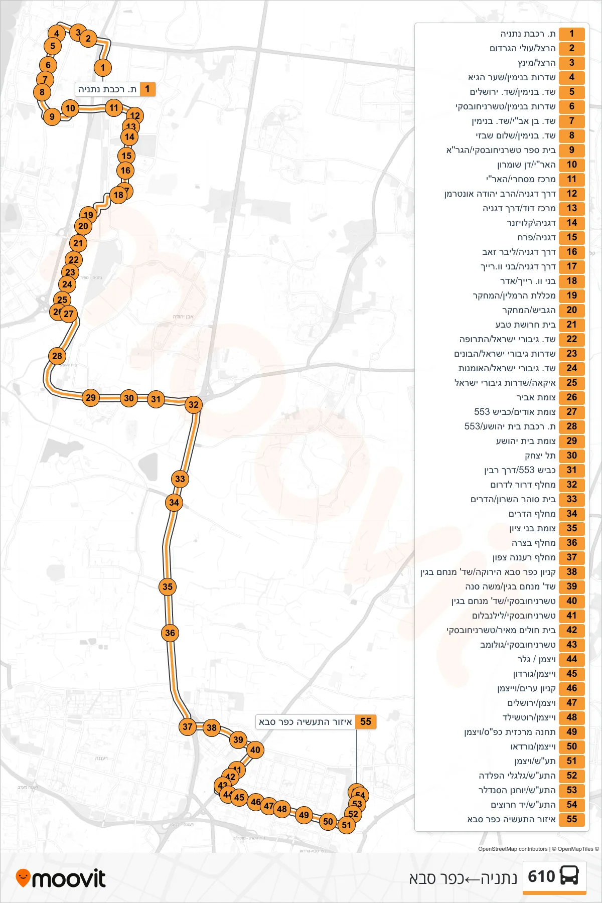
Stops list (610 - Netanya→Kfar Saba)
- Netanya Railway Station
- Herzl/Olei HaGardom
- Herzl/Mintz
- Benjamin Boulevard/Shaar HaGai
- Sderot Benjamin/Sderot Jerusalem
- Benjamin Boulevard/Tchernichovsky
- Ben Avi Blvd/Benjamin Blvd
- Benjamin Boulevard/Shalom Shabazi
- Tchernichovsky School/HaGra
- HaAri/Dan Shomron
- Commercial Center/Ha'Ari
- Degania Road/Rabbi Yehuda Unterman
- David Center/Degania Road
- Degania/Klausner
- Degania/Perach
- Degania Road/Lieber Zeev
- Degania Road/Benny W. Reich
- Benny W. Reich/Adar
- Hamlin College/HaMechkar
- HaGavish/HaMehkar
- Teva Factory
- Israel Heroes Boulevard/Hatrufa
- Sderot Giborei Israel/HaBonim
- Giborei Israel Ave/HaOmanut
- IKEA/Giborei Israel Boulevard
- Avir Junction
- Udim Junction/Road 553
- Beit Yehoshua Railway Station/553
- Beit Yehoshua Junction
- Tel Yitzhak
- Road 553/Rabin Road
- Dror Interchange South
- Sharon Prison/Hadarim
- Hadarim Interchange
- Bnei Zion Junction
- Bazra Interchange
- Raanana North Interchange
- Kfar Saba Green Mall/Menachem Begin Blvd
- Menachem Begin Boulevard/Moshe Sneh
- Tchernichovsky/Menachem Begin Blvd
- Tchernichovsky/Lilienblum
- Meir Hospital/Tchernichovsky
- Tchernichovsky/Golomb
- Weizmann/Geller
- Weizmann/Gordon
- Arim Mall/Weizmann
- Weizmann/Jerusalem
- Weizmann/Rothschild
- Kfar Saba Central Station/Weizmann
- Weizmann/Nordau
- IMI/Weizmann
- Taas/Galgalei HaPelada
- HaTaas/Yochanan HaSandlar
- HaTa'as/Yad Harutzim
- Kfar Saba Industrial Zone