
610 Bus Route Map
View the 610 route map and see all 610 stops along the route. The map of 610 shows where the bus travels and the location of each stop, making it easy to understand the entire route at a glance.
Explore SWB Stadtwerke Bonn Verkehrs GmbH routes on the map and see where SWB Stadtwerke Bonn Verkehrs GmbH bus services operate. Use the 610 map to find bus stops and see how the 610 connects different areas along its trip.
All 610 stops on the map are displayed in route order, helping you follow the 610 bus from the first stop to the last.
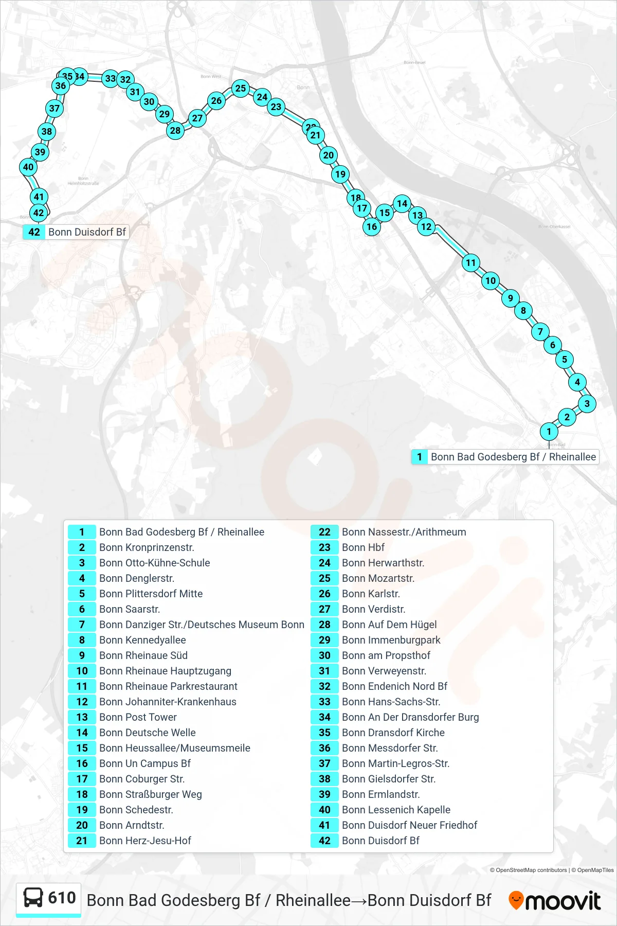
Stops list (610 - Bonn Bad Godesberg Bf / Rheinallee→Bonn Duisdorf Bf)
- Bonn Bad Godesberg Bf / Rheinallee
- Bonn Kronprinzenstr.
- Bonn Otto-Kühne-Schule
- Bonn Denglerstr.
- Bonn Plittersdorf Mitte
- Bonn Saarstr.
- Bonn Danziger Str./Deutsches Museum Bonn
- Bonn Kennedyallee
- Bonn Rheinaue Süd
- Bonn Rheinaue Hauptzugang
- Bonn Rheinaue Parkrestaurant
- Bonn Johanniter-Krankenhaus
- Bonn Post Tower
- Bonn Deutsche Welle
- Bonn Heussallee/Museumsmeile
- Bonn Un Campus Bf
- Bonn Coburger Str.
- Bonn Straßburger Weg
- Bonn Schedestr.
- Bonn Arndtstr.
- Bonn Herz-Jesu-Hof
- Bonn Nassestr./Arithmeum
- Bonn Hbf
- Bonn Herwarthstr.
- Bonn Mozartstr.
- Bonn Karlstr.
- Bonn Verdistr.
- Bonn Auf Dem Hügel
- Bonn Immenburgpark
- Bonn am Propsthof
- Bonn Verweyenstr.
- Bonn Endenich Nord Bf
- Bonn Hans-Sachs-Str.
- Bonn An Der Dransdorfer Burg
- Bonn Dransdorf Kirche
- Bonn Messdorfer Str.
- Bonn Martin-Legros-Str.
- Bonn Gielsdorfer Str.
- Bonn Ermlandstr.
- Bonn Lessenich Kapelle
- Bonn Duisdorf Neuer Friedhof
- Bonn Duisdorf Bf
Change direction
- Route Map - 610 - Bonn Hbf→Bonn Post Tower
- Route Map - 610 - Bonn Rheinaue Hauptzugang→Bonn Giselherstr.
- Route Map - 610 - Bonn Hochkreuz/Deutsches Museum Bonn→Bonn Hbf
- Route Map - 610 - Bonn Giselherstr.→Bonn Duisdorf Bf
- Route Map - 610 - Bonn Duisdorf Bf→Bonn Giselherstr.
- Route Map - 610 - Bonn Giselherstr.→Bonn Hbf
- Route Map - 610 - Bonn Duisdorf Bf→Bonn Bad Godesberg Bf / Rheinallee
- Route Map - 610 - Bonn Bad Godesberg Bf / Rheinallee→Bonn Giselherstr.
- Route Map - 610 - Bonn Hbf→Bonn Hochkreuz/Deutsches Museum Bonn