
610 Bus Route Map
View the 610 route map and see all 610 stops along the route. The map of 610 shows where the bus travels and the location of each stop, making it easy to understand the entire route at a glance.
Explore Viação Redentor routes on the map and see where Viação Redentor bus services operate. Use the 610 map to find bus stops and see how the 610 connects different areas along its trip.
All 610 stops on the map are displayed in route order, helping you follow the 610 bus from the first stop to the last.
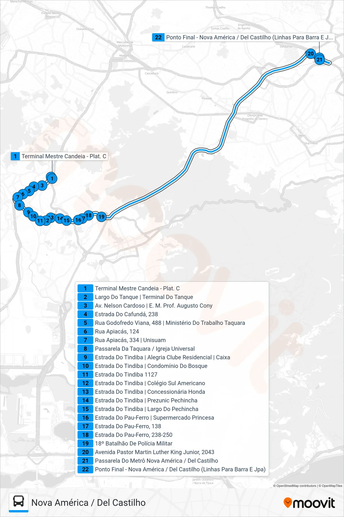
Stops list (610 - Nova América / Del Castilho)
- Terminal Mestre Candeia - Plat. C
- Largo Do Tanque | Terminal Do Tanque
- Av. Nelson Cardoso | E. M. Prof. Augusto Cony
- Estrada Do Cafundá, 238
- Rua Godofredo Viana, 488 | Ministério Do Trabalho Taquara
- Rua Apiacás, 124
- Rua Apiacás, 334 | Unisuam
- Passarela Da Taquara / Igreja Universal
- Estrada Do Tindiba | Alegria Clube Residencial | Caixa
- Estrada Do Tindiba | Condomínio Do Bosque
- Estrada Do Tindiba 1127
- Estrada Do Tindiba | Colégio Sul Americano
- Estrada Do Tindiba | Concessionária Honda
- Estrada Do Tindiba | Prezunic Pechincha
- Estrada Do Tindiba | Largo Do Pechincha
- Estrada Do Pau-Ferro | Supermercado Princesa
- Estrada Do Pau-Ferro, 138
- Estrada Do Pau-Ferro, 238-250
- 18º Batalhão De Polícia Militar
- Avenida Pastor Martin Luther King Junior, 2043
- Passarela Do Metrô Nova América / Del Castilho
- Ponto Final - Nova América / Del Castilho (Linhas Para Barra E Jpa)