
611 Bus Route Map
View the 611 route map and see all 611 stops along the route. The map of 611 shows where the bus travels and the location of each stop, making it easy to understand the entire route at a glance.
Explore NJ Transit routes on the map and see where NJ Transit bus services operate. Use the 611 map to find bus stops and see how the 611 connects different areas along its trip.
All 611 stops on the map are displayed in route order, helping you follow the 611 bus from the first stop to the last.
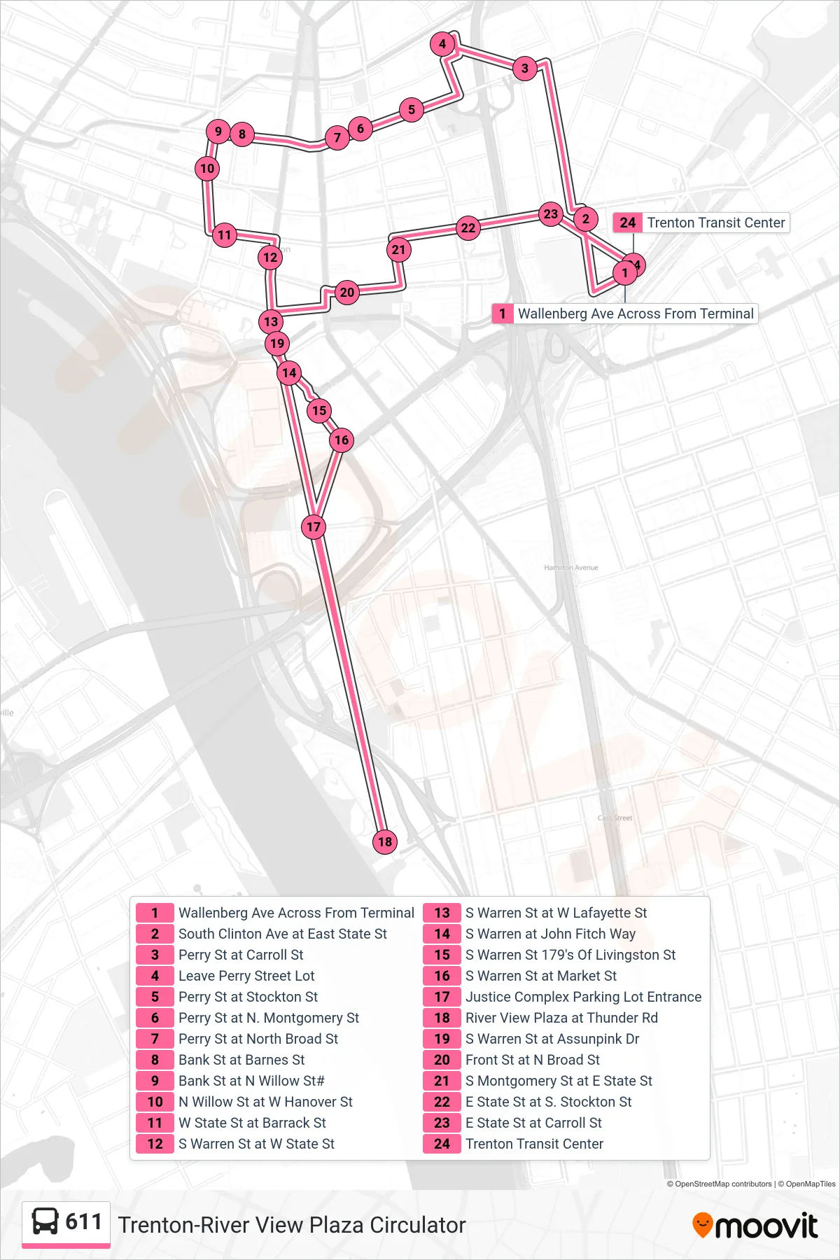
Stops list (611 - Trenton Circ Justice Cmplx Trenton Circ Riverview Plz)
- Wallenberg Ave Across From Terminal
- South Clinton Ave at East State St
- Perry St at Carroll St
- Leave Perry Street Lot
- Perry St at Stockton St
- Perry St at N. Montgomery St
- Perry St at North Broad St
- Bank St at Barnes St
- Bank St at N Willow St#
- N Willow St at W Hanover St
- W State St at Barrack St
- S Warren St at W State St
- S Warren St at W Lafayette St
- S Warren at John Fitch Way
- S Warren St 179's Of Livingston St
- S Warren St at Market St
- Justice Complex Parking Lot Entrance
- River View Plaza at Thunder Rd
- S Warren St at Assunpink Dr
- Front St at N Broad St
- S Montgomery St at E State St
- E State St at S. Stockton St
- E State St at Carroll St
- Trenton Transit Center