
611 Bus Route Map
View the 611 route map and see all 611 stops along the route. The map of 611 shows where the bus travels and the location of each stop, making it easy to understand the entire route at a glance.
Explore SWB Stadtwerke Bonn Verkehrs GmbH routes on the map and see where SWB Stadtwerke Bonn Verkehrs GmbH bus services operate. Use the 611 map to find bus stops and see how the 611 connects different areas along its trip.
All 611 stops on the map are displayed in route order, helping you follow the 611 bus from the first stop to the last.
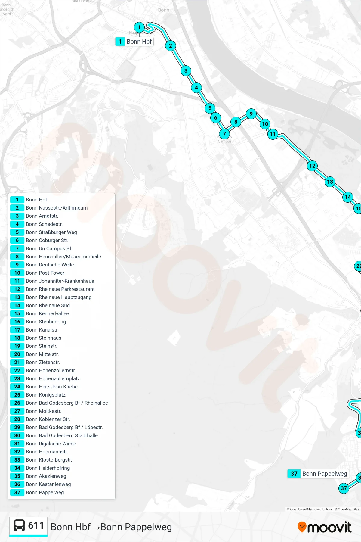
Stops list (611 - Bonn Hbf→Bonn Pappelweg)
- Bonn Hbf
- Bonn Nassestr./Arithmeum
- Bonn Arndtstr.
- Bonn Schedestr.
- Bonn Straßburger Weg
- Bonn Coburger Str.
- Bonn Un Campus Bf
- Bonn Heussallee/Museumsmeile
- Bonn Deutsche Welle
- Bonn Post Tower
- Bonn Johanniter-Krankenhaus
- Bonn Rheinaue Parkrestaurant
- Bonn Rheinaue Hauptzugang
- Bonn Rheinaue Süd
- Bonn Kennedyallee
- Bonn Steubenring
- Bonn Kanalstr.
- Bonn Steinhaus
- Bonn Steinstr.
- Bonn Mittelstr.
- Bonn Zietenstr.
- Bonn Hohenzollernstr.
- Bonn Hohenzollernplatz
- Bonn Herz-Jesu-Kirche
- Bonn Königsplatz
- Bonn Bad Godesberg Bf / Rheinallee
- Bonn Moltkestr.
- Bonn Koblenzer Str.
- Bonn Bad Godesberg Bf / Löbestr.
- Bonn Bad Godesberg Stadthalle
- Bonn Rigalsche Wiese
- Bonn Hopmannstr.
- Bonn Klosterbergstr.
- Bonn Heiderhofring
- Bonn Akazienweg
- Bonn Kastanienweg
- Bonn Pappelweg
Change direction
- Route Map - 611 - Bonn Lessenich Sportplatz→Bonn Pappelweg
- Route Map - 611 - Bonn Pappelweg→Bonn Kennedyallee
- Route Map - 611 - Bonn Bad Godesberg Bf / Rheinallee→Bonn Lessenich Sportplatz
- Route Map - 611 - Bonn Hbf→Bonn Lessenich Sportplatz
- Route Map - 611 - Bonn Pappelweg→Bonn Lessenich Sportplatz