
612 Bus Route Map
View the 612 route map and see all 612 stops along the route. The map of 612 shows where the bus travels and the location of each stop, making it easy to understand the entire route at a glance.
Explore Verkehrsverbund Potsdam routes on the map and see where Verkehrsverbund Potsdam bus services operate. Use the 612 map to find bus stops and see how the 612 connects different areas along its trip.
All 612 stops on the map are displayed in route order, helping you follow the 612 bus from the first stop to the last.
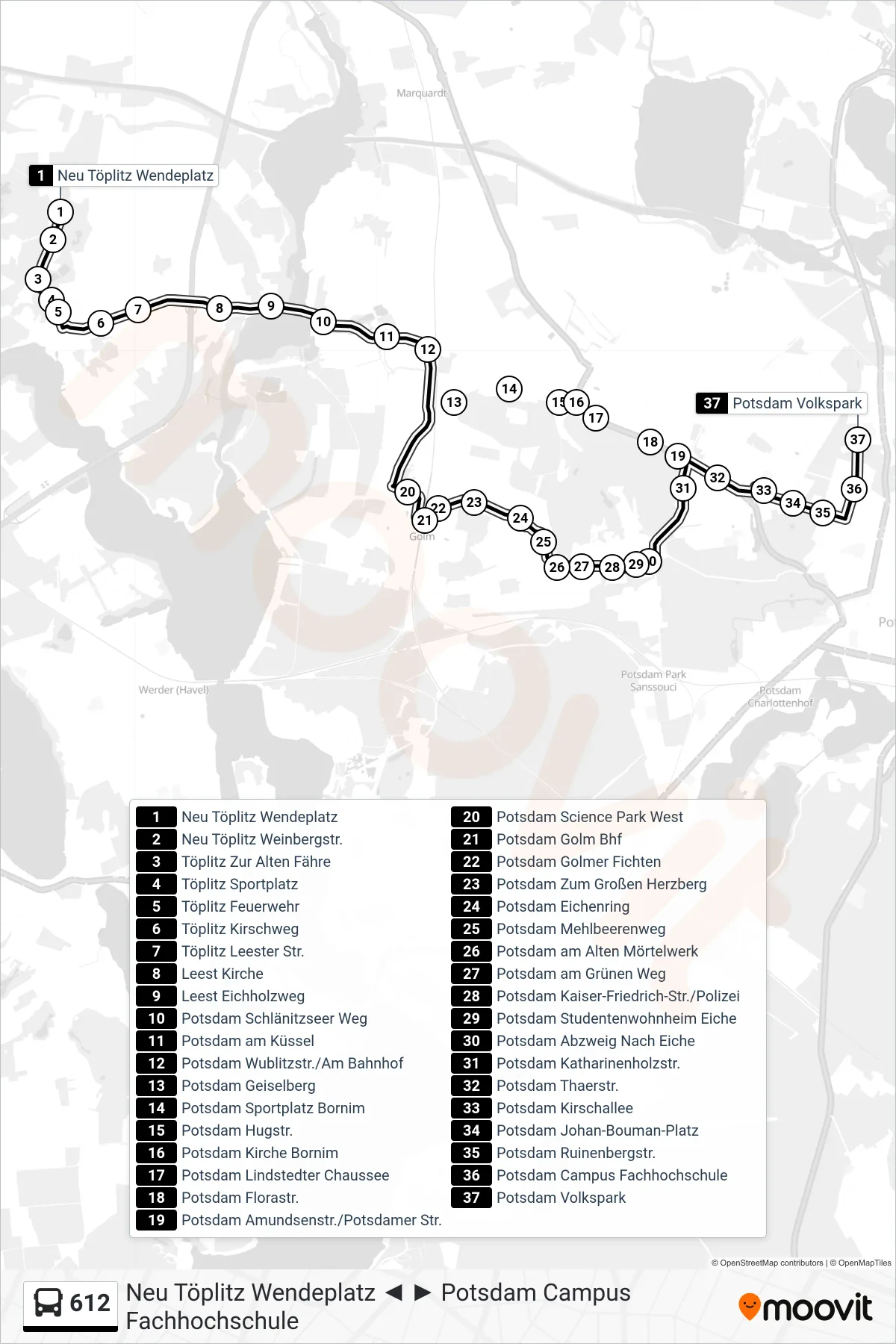
Stops list (612 - Potsdam Volkspark)
- Neu Töplitz Wendeplatz
- Neu Töplitz Weinbergstr.
- Töplitz Zur Alten Fähre
- Töplitz Sportplatz
- Töplitz Feuerwehr
- Töplitz Kirschweg
- Töplitz Leester Str.
- Leest Kirche
- Leest Eichholzweg
- Potsdam Schlänitzseer Weg
- Potsdam am Küssel
- Potsdam Wublitzstr./Am Bahnhof
- Potsdam Geiselberg
- Potsdam Sportplatz Bornim
- Potsdam Hugstr.
- Potsdam Kirche Bornim
- Potsdam Lindstedter Chaussee
- Potsdam Florastr.
- Potsdam Amundsenstr./Potsdamer Str.
- Potsdam Science Park West
- Potsdam Golm Bhf
- Potsdam Golmer Fichten
- Potsdam Zum Großen Herzberg
- Potsdam Eichenring
- Potsdam Mehlbeerenweg
- Potsdam am Alten Mörtelwerk
- Potsdam am Grünen Weg
- Potsdam Kaiser-Friedrich-Str./Polizei
- Potsdam Studentenwohnheim Eiche
- Potsdam Abzweig Nach Eiche
- Potsdam Katharinenholzstr.
- Potsdam Thaerstr.
- Potsdam Kirschallee
- Potsdam Johan-Bouman-Platz
- Potsdam Ruinenbergstr.
- Potsdam Campus Fachhochschule
- Potsdam Volkspark