
613 Bus Route Map
View the 613 route map and see all 613 stops along the route. The map of 613 shows where the bus travels and the location of each stop, making it easy to understand the entire route at a glance.
Explore Hock routes on the map and see where Hock bus services operate. Use the 613 map to find bus stops and see how the 613 connects different areas along its trip.
All 613 stops on the map are displayed in route order, helping you follow the 613 bus from the first stop to the last.
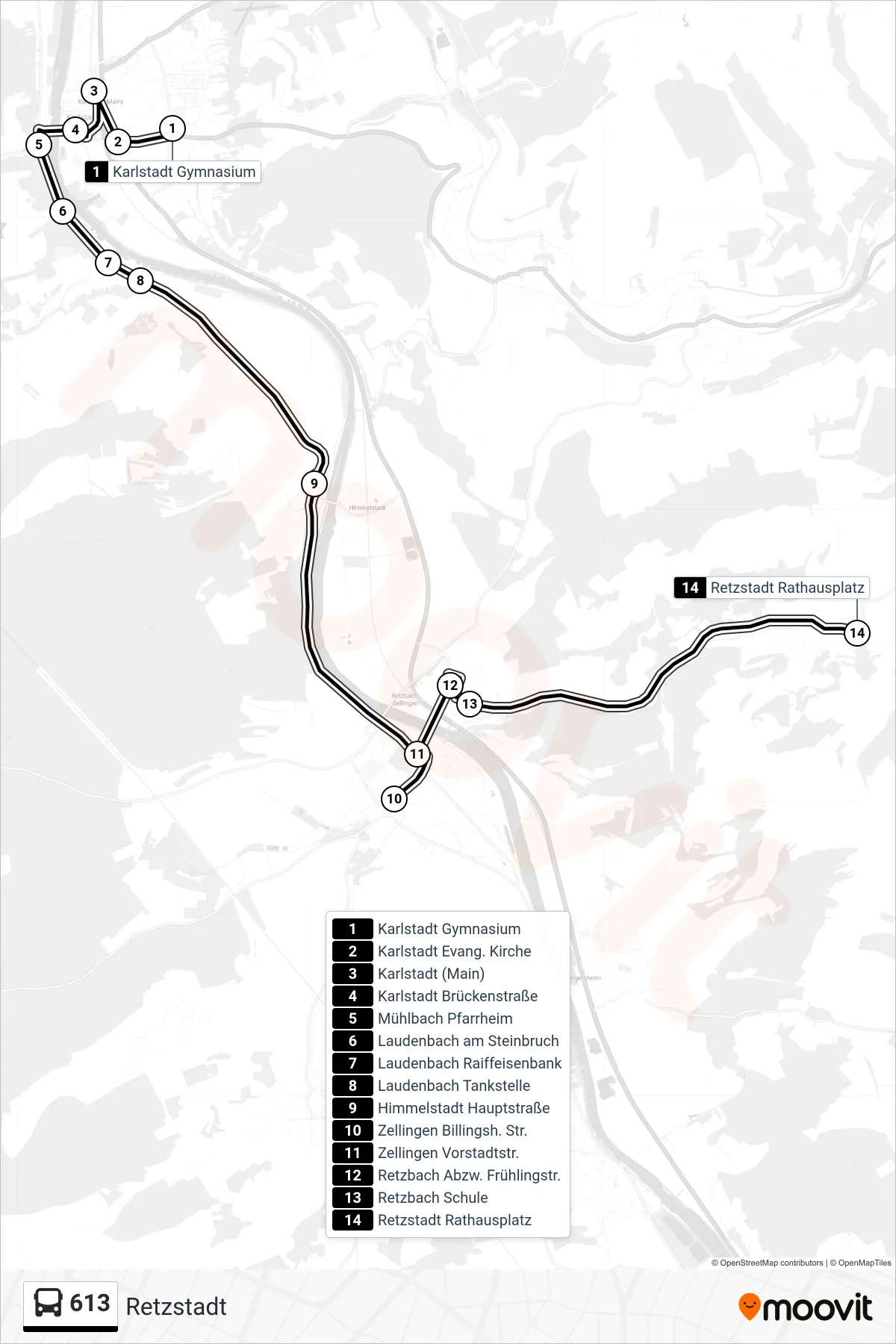
Stops list (613 - Retzstadt)
- Karlstadt Gymnasium
- Karlstadt Evang. Kirche
- Karlstadt (Main)
- Karlstadt Brückenstraße
- Mühlbach Pfarrheim
- Laudenbach am Steinbruch
- Laudenbach Raiffeisenbank
- Laudenbach Tankstelle
- Himmelstadt Hauptstraße
- Zellingen Billingsh. Str.
- Zellingen Vorstadtstr.
- Retzbach Abzw. Frühlingstr.
- Retzbach Schule
- Retzstadt Rathausplatz
Change direction
- Route Map - 613 - Lohr Zob
- Route Map - 613 - Himmelstadt
- Route Map - 613 - Lohr (M.) Rexroth,Werk 2
- Route Map - 613 - Karlstadt Realschule
- Route Map - 613 - Karlstadt Förderschule
- Route Map - 613 - Karlstadt Gymnasium
- Route Map - 613 - Karlstadt Bahnhof
- Route Map - 613 - Lohr Nägelseeschule
- Route Map - 613 - Würzburg, Hauptbahnhof (Bismarckstraße)
- Route Map - 613 - Erlabrunn
- Route Map - 613 - Lohr (M.) Zob
- Route Map - 613 - Zellingen Mittelschule
- Route Map - 613 - Wiesenfeld Tankst.
- Route Map - 613 - Duttenbrunn
- Route Map - 613 - Lohr (M.) Schulzentrum
- Route Map - 613 - Zellingen
- Route Map - 613 - Laudenbach
- Route Map - 613 - Würzburg Hbf / Bismarckstraße Über Karlstadt
- Route Map - 613 - Würzburg Hbf Bismarckstraße
- Route Map - 613 - Retzbach Bahnhof
- Route Map - 613 - Karlstadt Bahnhof
- Route Map - 613 - Lohr Rexroth Werk 2