
613 Bus Route Map
View the 613 route map and see all 613 stops along the route. The map of 613 shows where the bus travels and the location of each stop, making it easy to understand the entire route at a glance.
Explore WSW routes on the map and see where WSW bus services operate. Use the 613 map to find bus stops and see how the 613 connects different areas along its trip.
All 613 stops on the map are displayed in route order, helping you follow the 613 bus from the first stop to the last.
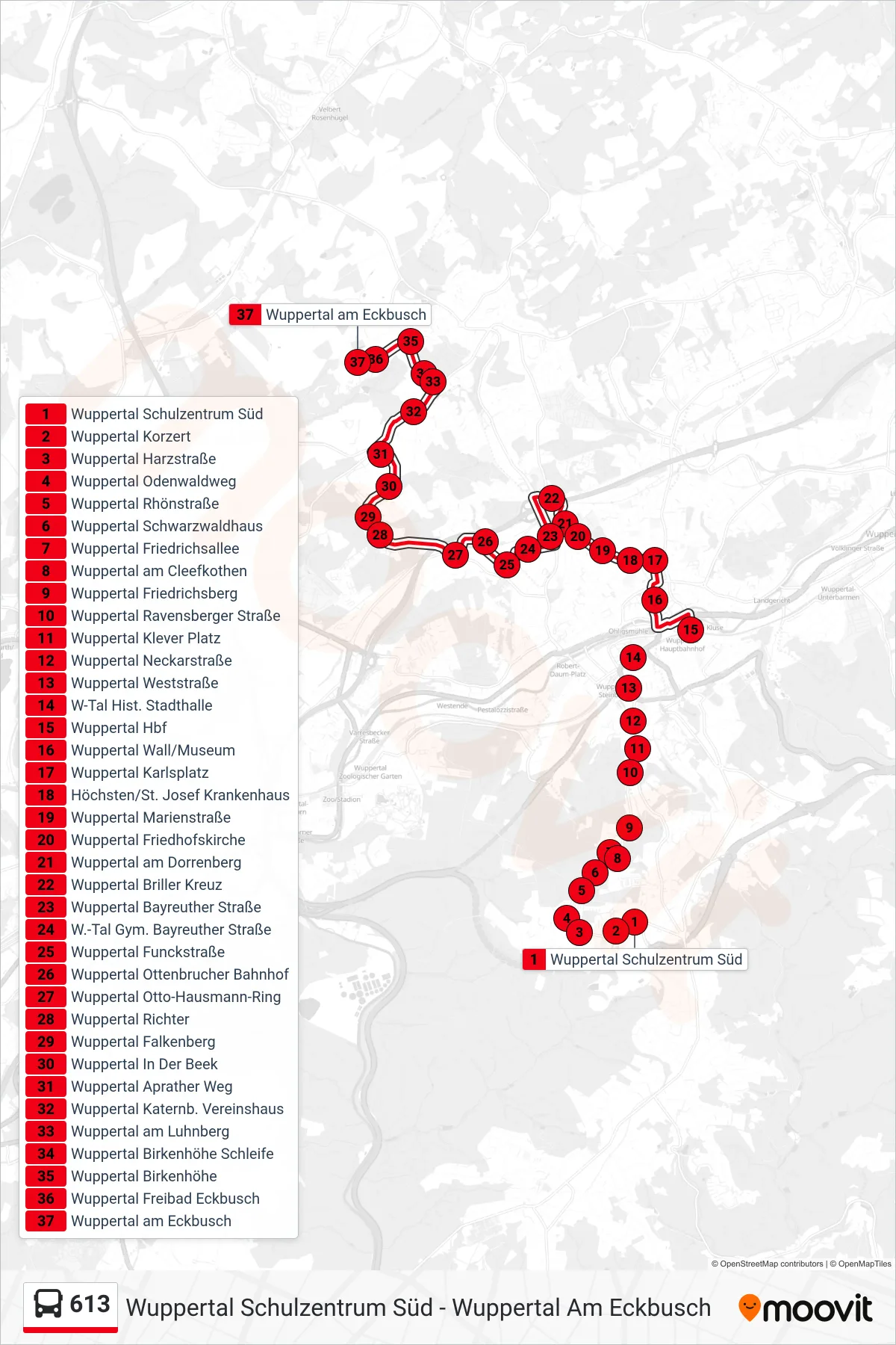
Stops list (613 - Wuppertal am Eckbusch)
- Wuppertal Schulzentrum Süd
- Wuppertal Korzert
- Wuppertal Harzstraße
- Wuppertal Odenwaldweg
- Wuppertal Rhönstraße
- Wuppertal Schwarzwaldhaus
- Wuppertal Friedrichsallee
- Wuppertal am Cleefkothen
- Wuppertal Friedrichsberg
- Wuppertal Ravensberger Straße
- Wuppertal Klever Platz
- Wuppertal Neckarstraße
- Wuppertal Weststraße
- W-Tal Hist. Stadthalle
- Wuppertal Hbf
- Wuppertal Wall/Museum
- Wuppertal Karlsplatz
- Höchsten/St. Josef Krankenhaus
- Wuppertal Marienstraße
- Wuppertal Friedhofskirche
- Wuppertal am Dorrenberg
- Wuppertal Briller Kreuz
- Wuppertal Bayreuther Straße
- W.-Tal Gym. Bayreuther Straße
- Wuppertal Funckstraße
- Wuppertal Ottenbrucher Bahnhof
- Wuppertal Otto-Hausmann-Ring
- Wuppertal Richter
- Wuppertal Falkenberg
- Wuppertal In Der Beek
- Wuppertal Aprather Weg
- Wuppertal Katernb. Vereinshaus
- Wuppertal am Luhnberg
- Wuppertal Birkenhöhe Schleife
- Wuppertal Birkenhöhe
- Wuppertal Freibad Eckbusch
- Wuppertal am Eckbusch