
62 Bus Route Map
View the 62 route map and see all 62 stops along the route. The map of 62 shows where the bus travels and the location of each stop, making it easy to understand the entire route at a glance.
Explore Autobuses routes on the map and see where Autobuses bus services operate. Use the 62 map to find bus stops and see how the 62 connects different areas along its trip.
All 62 stops on the map are displayed in route order, helping you follow the 62 bus from the first stop to the last.
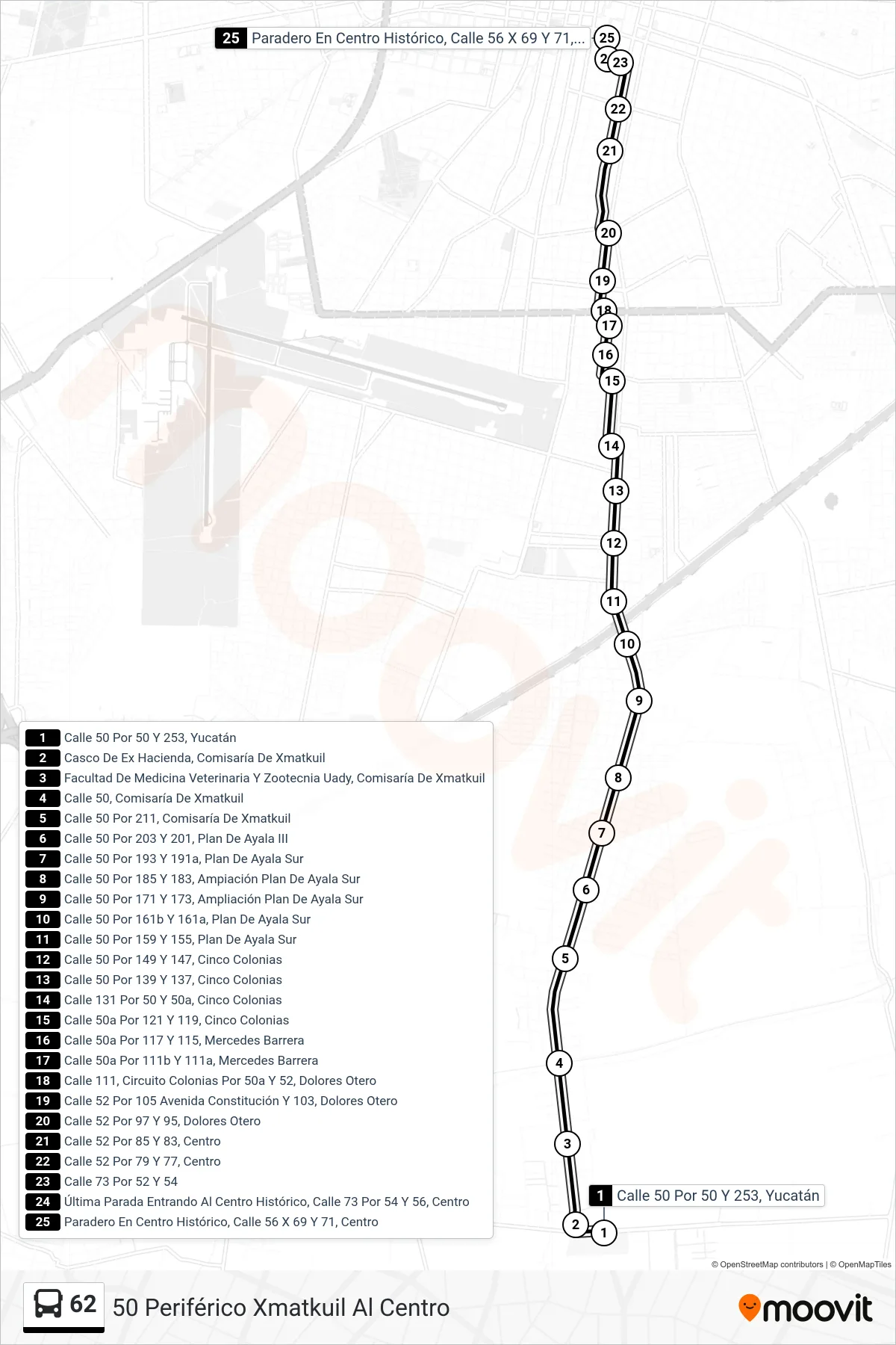
Stops list (62 - 50 Periférico Xmatkuil Al Centro)
- Calle 50 Por 50 Y 253, Yucatán
- Casco De Ex Hacienda, Comisaría De Xmatkuil
- Facultad De Medicina Veterinaria Y Zootecnia Uady, Comisaría De Xmatkuil
- Calle 50, Comisaría De Xmatkuil
- Calle 50 Por 211, Comisaría De Xmatkuil
- Calle 50 Por 203 Y 201, Plan De Ayala III
- Calle 50 Por 193 Y 191a, Plan De Ayala Sur
- Calle 50 Por 185 Y 183, Ampiación Plan De Ayala Sur
- Calle 50 Por 171 Y 173, Ampliación Plan De Ayala Sur
- Calle 50 Por 161b Y 161a, Plan De Ayala Sur
- Calle 50 Por 159 Y 155, Plan De Ayala Sur
- Calle 50 Por 149 Y 147, Cinco Colonias
- Calle 50 Por 139 Y 137, Cinco Colonias
- Calle 131 Por 50 Y 50a, Cinco Colonias
- Calle 50a Por 121 Y 119, Cinco Colonias
- Calle 50a Por 117 Y 115, Mercedes Barrera
- Calle 50a Por 111b Y 111a, Mercedes Barrera
- Calle 111, Circuito Colonias Por 50a Y 52, Dolores Otero
- Calle 52 Por 105 Avenida Constitución Y 103, Dolores Otero
- Calle 52 Por 97 Y 95, Dolores Otero
- Calle 52 Por 85 Y 83, Centro
- Calle 52 Por 79 Y 77, Centro
- Calle 73 Por 52 Y 54
- Última Parada Entrando Al Centro Histórico, Calle 73 Por 54 Y 56, Centro
- Paradero En Centro Histórico, Calle 56 X 69 Y 71, Centro