
620 Bus Route Map
View the 620 route map and see all 620 stops along the route. The map of 620 shows where the bus travels and the location of each stop, making it easy to understand the entire route at a glance.
Explore Kavim routes on the map and see where Kavim bus services operate. Use the 620 map to find bus stops and see how the 620 connects different areas along its trip.
All 620 stops on the map are displayed in route order, helping you follow the 620 bus from the first stop to the last.
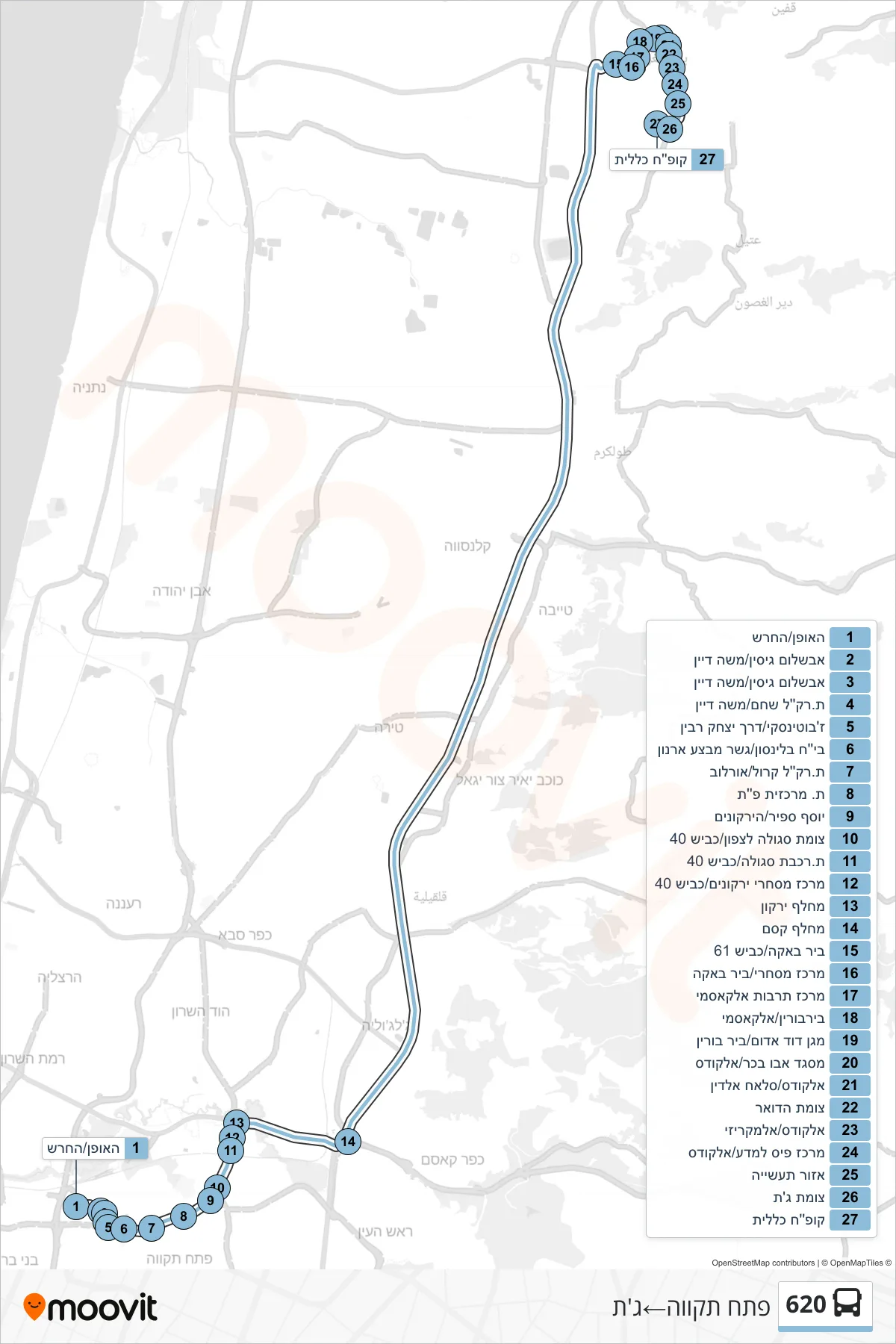
Stops list (620 - Petah Tikva→Jatt)
- HaOfen/HaCharash
- Avshalom Gisin/Moshe Dayan
- Avshalom Gisin/Moshe Dayan
- Shoham Light Rail Station/Moshe Dayan
- Jabotinsky/Yitzhak Rabin Road
- Beilinson Hospital/Mivtza Arnon Bridge
- Carol Light Rail Station/Orlov
- Petah Tikva Central Station
- Yosef Sapir/HaYarkonim
- Segula North Junction/Road 40
- Segula Railway Station/Road 40
- Yarkonim Commercial Center/Road 40
- Yarkon Interchange
- Kesem Interchange
- Bir Baka/Road 61
- Commercial Center/Bir Baka
- Al-Qasemi Cultural Center
- Birburin/Al-Qasmi
- Magen David Adom/Bir Borin
- Abu Bakr Mosque/Al-Quds
- Al-Quds/Salah al-Din
- Post Office Junction
- Al-Quds/Al-Maqrizi
- PAIS Science Center/Al-Quds
- Industrial Zone
- Jatt Junction
- Kupat Holim Clalit