
620 Bus Route Map
View the 620 route map and see all 620 stops along the route. The map of 620 shows where the bus travels and the location of each stop, making it easy to understand the entire route at a glance.
Explore KVG Zickenheiner GmbH routes on the map and see where KVG Zickenheiner GmbH bus services operate. Use the 620 map to find bus stops and see how the 620 connects different areas along its trip.
All 620 stops on the map are displayed in route order, helping you follow the 620 bus from the first stop to the last.
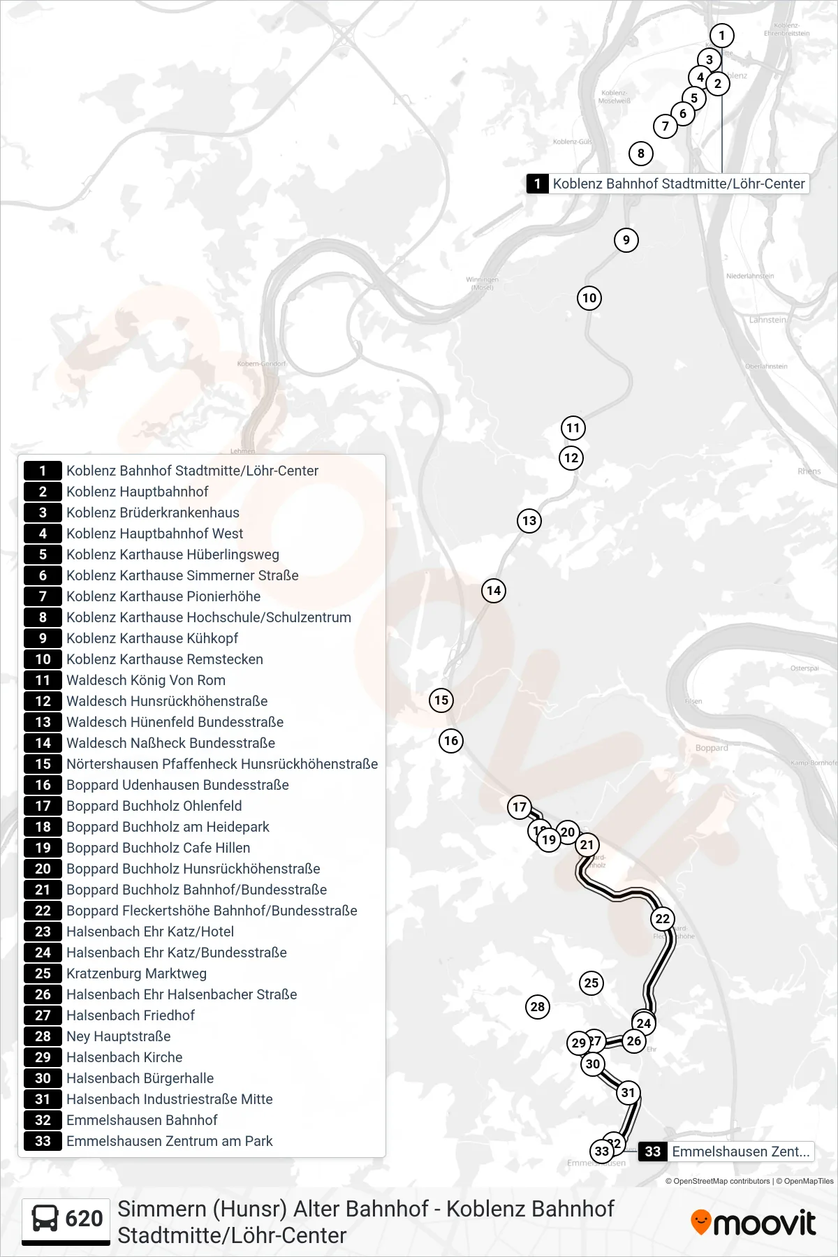
Stops list (620 - Emmelshausen Zentrum am Park)
- Koblenz Bahnhof Stadtmitte/Löhr-Center
- Koblenz Hauptbahnhof
- Koblenz Brüderkrankenhaus
- Koblenz Hauptbahnhof West
- Koblenz Karthause Hüberlingsweg
- Koblenz Karthause Simmerner Straße
- Koblenz Karthause Pionierhöhe
- Koblenz Karthause Hochschule/Schulzentrum
- Koblenz Karthause Kühkopf
- Koblenz Karthause Remstecken
- Waldesch König Von Rom
- Waldesch Hunsrückhöhenstraße
- Waldesch Hünenfeld Bundesstraße
- Waldesch Naßheck Bundesstraße
- Nörtershausen Pfaffenheck Hunsrückhöhenstraße
- Boppard Udenhausen Bundesstraße
- Boppard Buchholz Ohlenfeld
- Boppard Buchholz am Heidepark
- Boppard Buchholz Cafe Hillen
- Boppard Buchholz Hunsrückhöhenstraße
- Boppard Buchholz Bahnhof/Bundesstraße
- Boppard Fleckertshöhe Bahnhof/Bundesstraße
- Halsenbach Ehr Katz/Hotel
- Halsenbach Ehr Katz/Bundesstraße
- Kratzenburg Marktweg
- Halsenbach Ehr Halsenbacher Straße
- Halsenbach Friedhof
- Ney Hauptstraße
- Halsenbach Kirche
- Halsenbach Bürgerhalle
- Halsenbach Industriestraße Mitte
- Emmelshausen Bahnhof
- Emmelshausen Zentrum am Park
Change direction
- Route Map - 620 - Koblenz Bahnhof Stadtmitte/Löhr-Center
- Route Map - 620 - Kastellaun Busbahnhof
- Route Map - 620 - Halsenbach Industriestraße Mitte
- Route Map - 620 - Kastellaun Busbahnhof
- Route Map - 620 - Boppard Buchholz Hunsrückhöhenstraße
- Route Map - 620 - Simmern (Hunsr) Rottmannschule
- Route Map - 620 - Emmelshausen Bahnhof
- Route Map - 620 - Halsenbach Ehr Halsenbacher Straße
- Route Map - 620 - Simmern (Hunsr) Alter Bahnhof
- Route Map - 620 - Nörtershausen Auf Der Leimkaul
- Route Map - 620 - Koblenz Brüderkrankenhaus
- Route Map - 620 - Boppard Buchholz Cafe Hillen
- Route Map - 620 - Kastellaun Marktplatz