
629 Bus Route Map
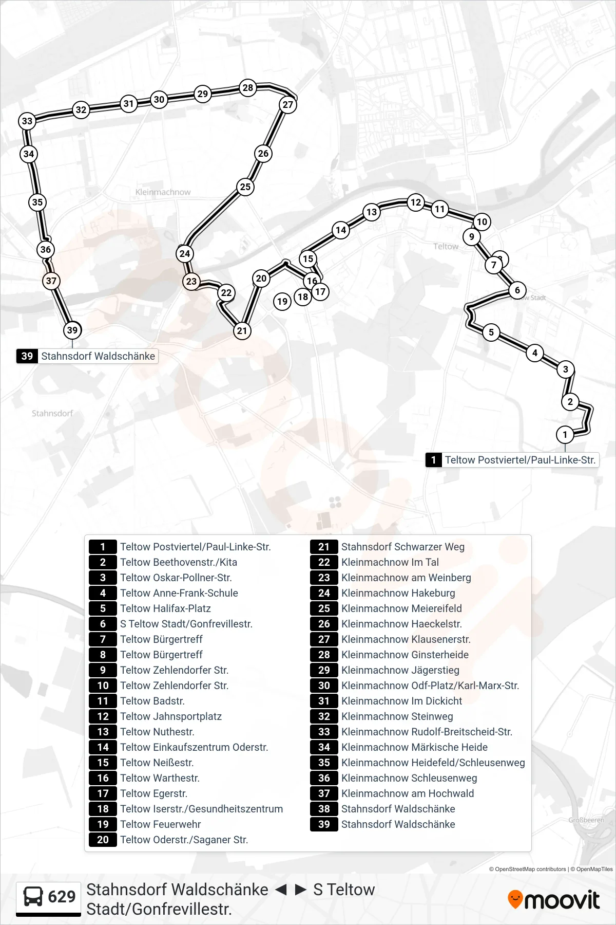
View the 629 route map and see all 629 stops along the route. The map of 629 shows where the bus travels and the location of each stop, making it easy to understand the entire route at a glance.
Explore VBB routes on the map and see where VBB bus services operate. Use the 629 map to find bus stops and see how the 629 connects different areas along its trip.
All 629 stops on the map are displayed in route order, helping you follow the 629 bus from the first stop to the last.
Stops list (629 - Stahnsdorf Waldschänke)
- Teltow Postviertel/Paul-Linke-Str.
- Teltow Beethovenstr./Kita
- Teltow Oskar-Pollner-Str.
- Teltow Anne-Frank-Schule
- Teltow Halifax-Platz
- S Teltow Stadt/Gonfrevillestr.
- Teltow Bürgertreff
- Teltow Zehlendorfer Str.
- Teltow Badstr.
- Teltow Jahnsportplatz
- Teltow Nuthestr.
- Teltow Einkaufszentrum Oderstr.
- Teltow Neißestr.
- Teltow Warthestr.
- Teltow Egerstr.
- Teltow Iserstr./Gesundheitszentrum
- Teltow Feuerwehr
- Teltow Oderstr./Saganer Str.
- Stahnsdorf Schwarzer Weg
- Kleinmachnow Im Tal
- Kleinmachnow am Weinberg
- Kleinmachnow Hakeburg
- Kleinmachnow Meiereifeld
- Kleinmachnow Haeckelstr.
- Kleinmachnow Klausenerstr.
- Kleinmachnow Ginsterheide
- Kleinmachnow Jägerstieg
- Kleinmachnow Odf-Platz/Karl-Marx-Str.
- Kleinmachnow Im Dickicht
- Kleinmachnow Steinweg
- Kleinmachnow Rudolf-Breitscheid-Str.
- Kleinmachnow Märkische Heide
- Kleinmachnow Heidefeld/Schleusenweg
- Kleinmachnow Schleusenweg
- Kleinmachnow am Hochwald
- Stahnsdorf Waldschänke
- Stahnsdorf Waldschänke