
63 Bus Route Map
View the 63 route map and see all 63 stops along the route. The map of 63 shows where the bus travels and the location of each stop, making it easy to understand the entire route at a glance.
Explore Rhode Island Public Transit Authority routes on the map and see where Rhode Island Public Transit Authority bus services operate. Use the 63 map to find bus stops and see how the 63 connects different areas along its trip.
All 63 stops on the map are displayed in route order, helping you follow the 63 bus from the first stop to the last.
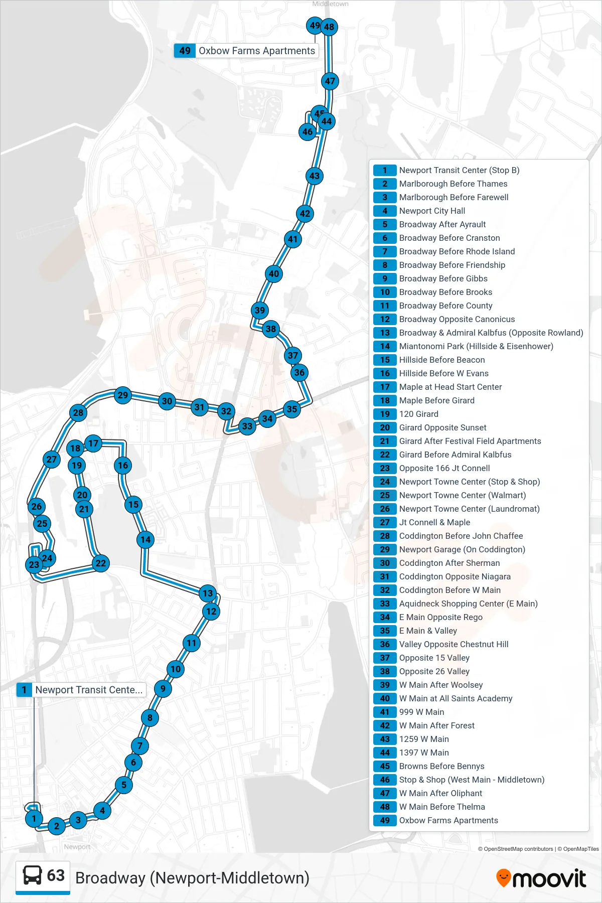
Stops list (63 - Oxbow Apartments)
- Newport Transit Center (Stop B)
- Marlborough Before Thames
- Marlborough Before Farewell
- Newport City Hall
- Broadway After Ayrault
- Broadway Before Cranston
- Broadway Before Rhode Island
- Broadway Before Friendship
- Broadway Before Gibbs
- Broadway Before Brooks
- Broadway Before County
- Broadway Opposite Canonicus
- Broadway & Admiral Kalbfus (Opposite Rowland)
- Miantonomi Park (Hillside & Eisenhower)
- Hillside Before Beacon
- Hillside Before W Evans
- Maple at Head Start Center
- Maple Before Girard
- 120 Girard
- Girard Opposite Sunset
- Girard After Festival Field Apartments
- Girard Before Admiral Kalbfus
- Opposite 166 Jt Connell
- Newport Towne Center (Stop & Shop)
- Newport Towne Center (Walmart)
- Newport Towne Center (Laundromat)
- Jt Connell & Maple
- Coddington Before John Chaffee
- Newport Garage (On Coddington)
- Coddington After Sherman
- Coddington Opposite Niagara
- Coddington Before W Main
- Aquidneck Shopping Center (E Main)
- E Main Opposite Rego
- E Main & Valley
- Valley Opposite Chestnut Hill
- Opposite 15 Valley
- Opposite 26 Valley
- W Main After Woolsey
- W Main at All Saints Academy
- 999 W Main
- W Main After Forest
- 1259 W Main
- 1397 W Main
- Browns Before Bennys
- Stop & Shop (West Main - Middletown)
- W Main After Oliphant
- W Main Before Thelma
- Oxbow Farms Apartments