
63 Bus Route Map
View the 63 route map and see all 63 stops along the route. The map of 63 shows where the bus travels and the location of each stop, making it easy to understand the entire route at a glance.
Explore Rīgas satiksme routes on the map and see where Rīgas satiksme bus services operate. Use the 63 map to find bus stops and see how the 63 connects different areas along its trip.
All 63 stops on the map are displayed in route order, helping you follow the 63 bus from the first stop to the last.
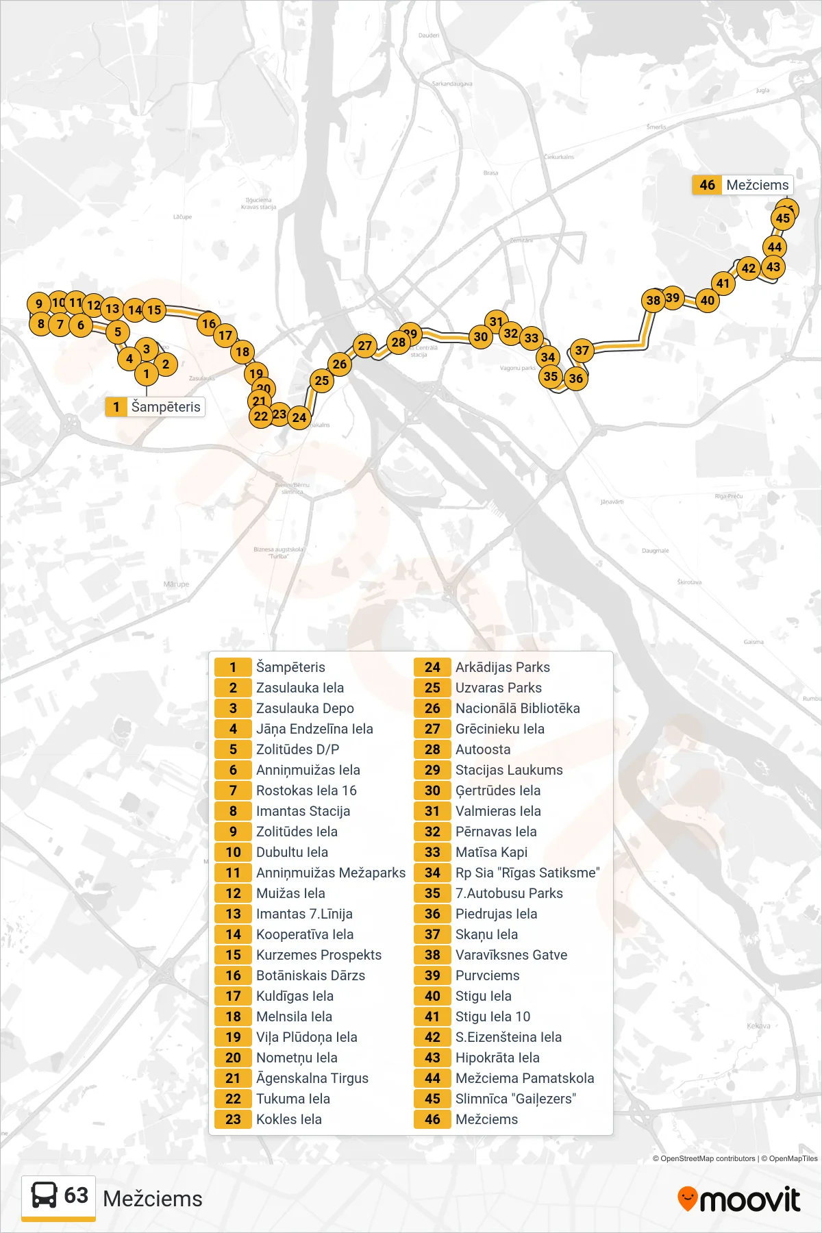
Stops list (63 - Mežciems)
- Šampēteris
- Zasulauka Iela
- Zasulauka Depo
- Jāņa Endzelīna Iela
- Zolitūdes D/P
- Anniņmuižas Iela
- Rostokas Iela 16
- Imantas Stacija
- Zolitūdes Iela
- Dubultu Iela
- Anniņmuižas Mežaparks
- Muižas Iela
- Imantas 7.Līnija
- Kooperatīva Iela
- Kurzemes Prospekts
- Botāniskais Dārzs
- Kuldīgas Iela
- Melnsila Iela
- Viļa Plūdoņa Iela
- Nometņu Iela
- Āgenskalna Tirgus
- Tukuma Iela
- Kokles Iela
- Arkādijas Parks
- Uzvaras Parks
- Nacionālā Bibliotēka
- Grēcinieku Iela
- Autoosta
- Stacijas Laukums
- Ģertrūdes Iela
- Valmieras Iela
- Pērnavas Iela
- Matīsa Kapi
- Rp Sia "Rīgas Satiksme"
- 7.Autobusu Parks
- Piedrujas Iela
- Skaņu Iela
- Varavīksnes Gatve
- Purvciems
- Stigu Iela
- Stigu Iela 10
- S.Eizenšteina Iela
- Hipokrāta Iela
- Mežciema Pamatskola
- Slimnīca "Gaiļezers"
- Mežciems