
63 Bus Route Map
View the 63 route map and see all 63 stops along the route. The map of 63 shows where the bus travels and the location of each stop, making it easy to understand the entire route at a glance.
Explore Montgomery County Ride On routes on the map and see where Montgomery County Ride On bus services operate. Use the 63 map to find bus stops and see how the 63 connects different areas along its trip.
All 63 stops on the map are displayed in route order, helping you follow the 63 bus from the first stop to the last.
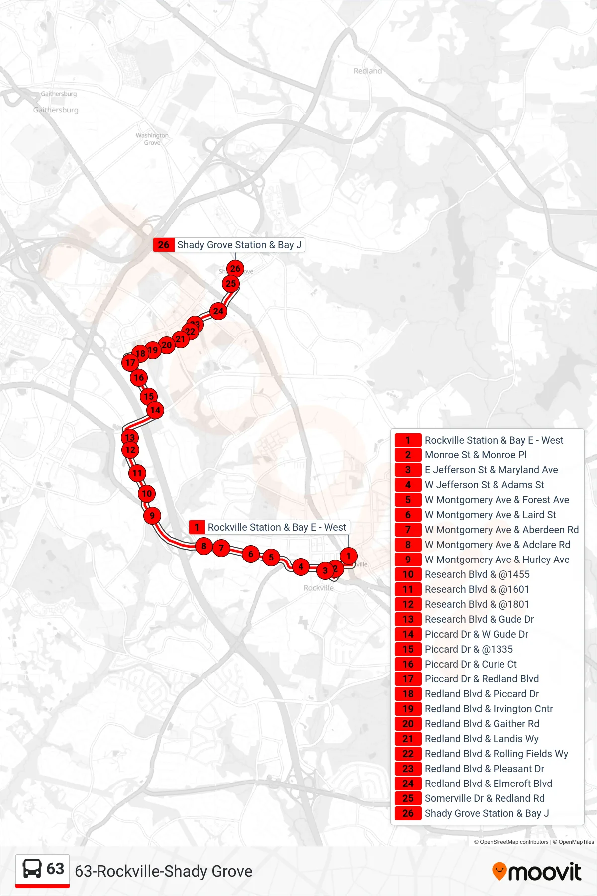
Stops list (63 - Shady Grove)
- Rockville Station & Bay E - West
- Monroe St & Monroe Pl
- E Jefferson St & Maryland Ave
- W Jefferson St & Adams St
- W Montgomery Ave & Forest Ave
- W Montgomery Ave & Laird St
- W Montgomery Ave & Aberdeen Rd
- W Montgomery Ave & Adclare Rd
- W Montgomery Ave & Hurley Ave
- Research Blvd & @1455
- Research Blvd & @1601
- Research Blvd & @1801
- Research Blvd & Gude Dr
- Piccard Dr & W Gude Dr
- Piccard Dr & @1335
- Piccard Dr & Curie Ct
- Piccard Dr & Redland Blvd
- Redland Blvd & Piccard Dr
- Redland Blvd & Irvington Cntr
- Redland Blvd & Gaither Rd
- Redland Blvd & Landis Wy
- Redland Blvd & Rolling Fields Wy
- Redland Blvd & Pleasant Dr
- Redland Blvd & Elmcroft Blvd
- Somerville Dr & Redland Rd
- Shady Grove Station & Bay J