
638 Bus Route Map
View the 638 route map and see all 638 stops along the route. The map of 638 shows where the bus travels and the location of each stop, making it easy to understand the entire route at a glance.
Explore SWB Stadtwerke Bonn Verkehrs GmbH routes on the map and see where SWB Stadtwerke Bonn Verkehrs GmbH bus services operate. Use the 638 map to find bus stops and see how the 638 connects different areas along its trip.
All 638 stops on the map are displayed in route order, helping you follow the 638 bus from the first stop to the last.
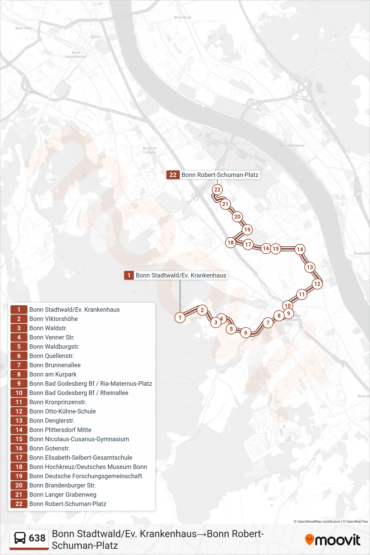
Stops list (638 - Bonn Stadtwald/Ev. Krankenhaus→Bonn Robert-Schuman-Platz)
- Bonn Stadtwald/Ev. Krankenhaus
- Bonn Viktorshöhe
- Bonn Waldstr.
- Bonn Venner Str.
- Bonn Waldburgstr.
- Bonn Quellenstr.
- Bonn Brunnenallee
- Bonn am Kurpark
- Bonn Bad Godesberg Bf / Ria-Maternus-Platz
- Bonn Bad Godesberg Bf / Rheinallee
- Bonn Kronprinzenstr.
- Bonn Otto-Kühne-Schule
- Bonn Denglerstr.
- Bonn Plittersdorf Mitte
- Bonn Nicolaus-Cusanus-Gymnasium
- Bonn Gotenstr.
- Bonn Elisabeth-Selbert-Gesamtschule
- Bonn Hochkreuz/Deutsches Museum Bonn
- Bonn Deutsche Forschungsgemeinschaft
- Bonn Brandenburger Str.
- Bonn Langer Grabenweg
- Bonn Robert-Schuman-Platz