
63/9 Bus Route Map
View the 63/9 route map and see all 63/9 stops along the route. The map of 63/9 shows where the bus travels and the location of each stop, making it easy to understand the entire route at a glance.
Explore FMO routes on the map and see where FMO bus services operate. Use the 63/9 map to find bus stops and see how the 63/9 connects different areas along its trip.
All 63/9 stops on the map are displayed in route order, helping you follow the 63/9 bus from the first stop to the last.
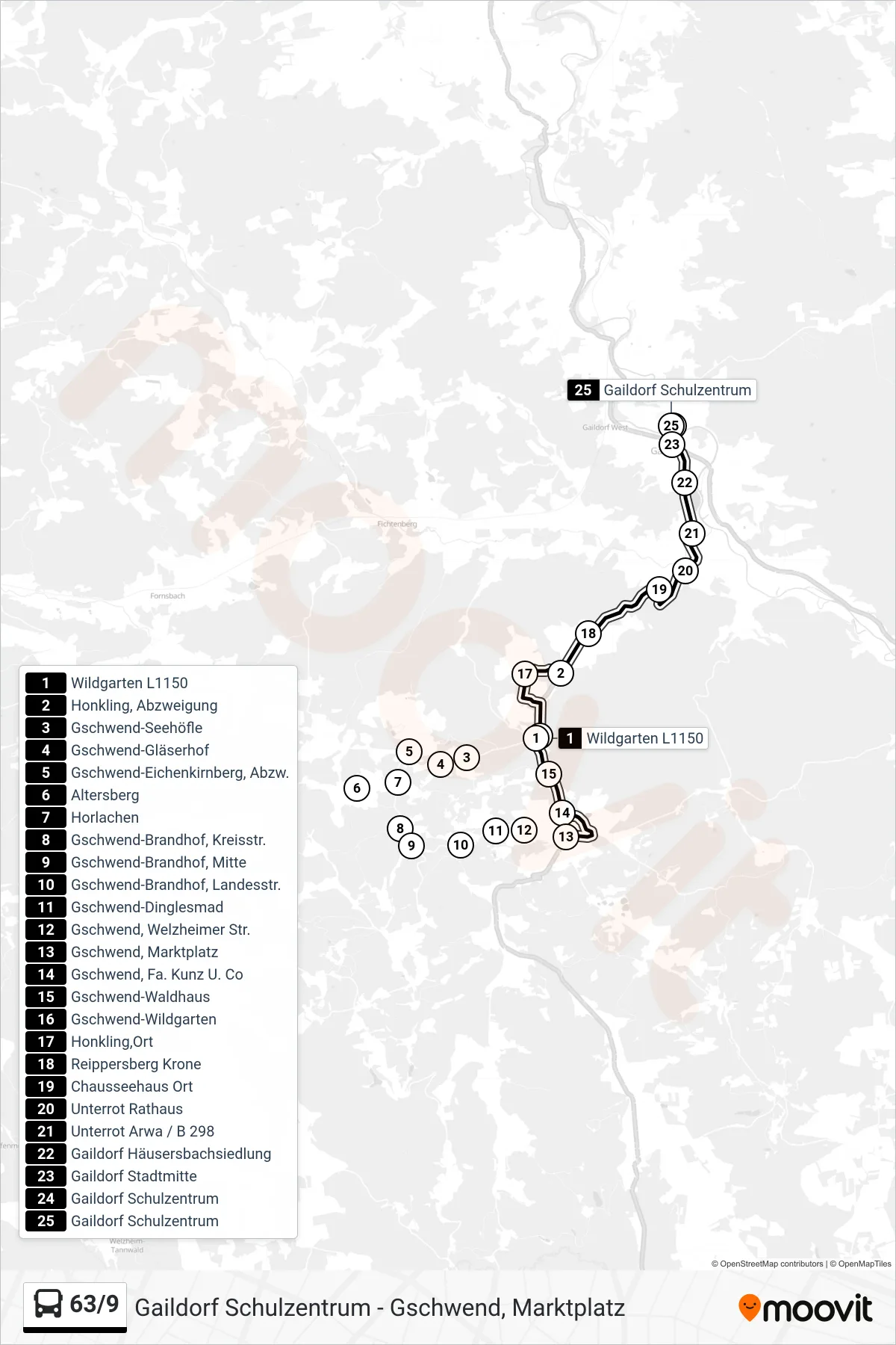
Stops list (63/9 - Gaildorf Schulzentrum)
- Wildgarten L1150
- Honkling, Abzweigung
- Gschwend-Seehöfle
- Gschwend-Gläserhof
- Gschwend-Eichenkirnberg, Abzw.
- Altersberg
- Horlachen
- Gschwend-Brandhof, Kreisstr.
- Gschwend-Brandhof, Mitte
- Gschwend-Brandhof, Landesstr.
- Gschwend-Dinglesmad
- Gschwend, Welzheimer Str.
- Gschwend, Marktplatz
- Gschwend, Fa. Kunz U. Co
- Gschwend-Waldhaus
- Gschwend-Wildgarten
- Honkling,Ort
- Reippersberg Krone
- Chausseehaus Ort
- Unterrot Rathaus
- Unterrot Arwa / B 298
- Gaildorf Häusersbachsiedlung
- Gaildorf Stadtmitte
- Gaildorf Schulzentrum
- Gaildorf Schulzentrum