
64 Bus Route Map
View the 64 route map and see all 64 stops along the route. The map of 64 shows where the bus travels and the location of each stop, making it easy to understand the entire route at a glance.
Explore MBTA routes on the map and see where MBTA bus services operate. Use the 64 map to find bus stops and see how the 64 connects different areas along its trip.
All 64 stops on the map are displayed in route order, helping you follow the 64 bus from the first stop to the last.
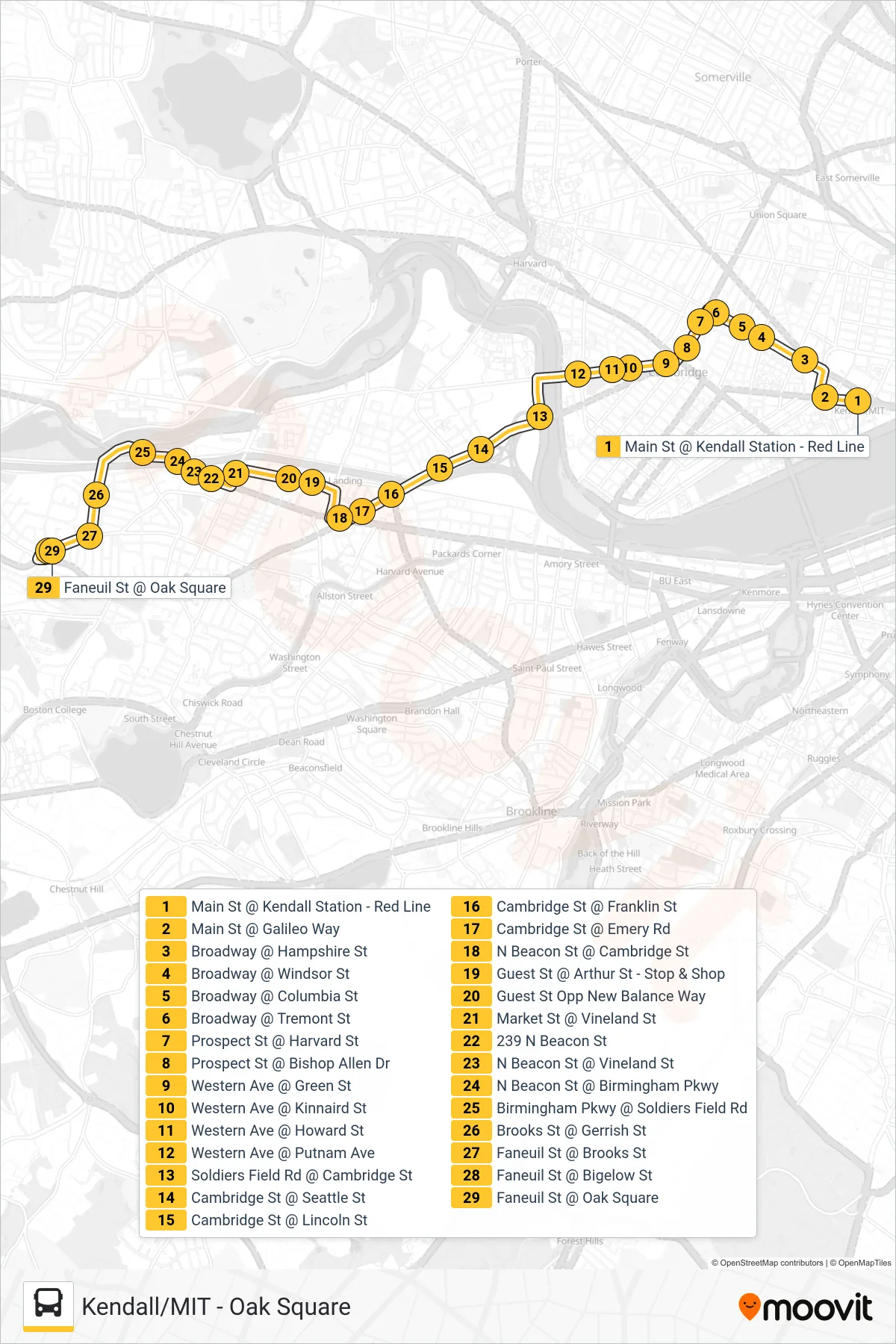
Stops list (64 - Oak Square)
- Main St @ Kendall Station - Red Line
- Main St @ Galileo Way
- Broadway @ Hampshire St
- Broadway @ Windsor St
- Broadway @ Columbia St
- Broadway @ Tremont St
- Prospect St @ Harvard St
- Prospect St @ Bishop Allen Dr
- Western Ave @ Green St
- Western Ave @ Kinnaird St
- Western Ave @ Howard St
- Western Ave @ Putnam Ave
- Soldiers Field Rd @ Cambridge St
- Cambridge St @ Seattle St
- Cambridge St @ Lincoln St
- Cambridge St @ Franklin St
- Cambridge St @ Emery Rd
- N Beacon St @ Cambridge St
- Guest St @ Arthur St - Stop & Shop
- Guest St Opp New Balance Way
- Market St @ Vineland St
- 239 N Beacon St
- N Beacon St @ Vineland St
- N Beacon St @ Birmingham Pkwy
- Birmingham Pkwy @ Soldiers Field Rd
- Brooks St @ Gerrish St
- Faneuil St @ Brooks St
- Faneuil St @ Bigelow St
- Faneuil St @ Oak Square