
64 Bus Route Map
View the 64 route map and see all 64 stops along the route. The map of 64 shows where the bus travels and the location of each stop, making it easy to understand the entire route at a glance.
Explore Metro Transit-City of Madison routes on the map and see where Metro Transit-City of Madison bus services operate. Use the 64 map to find bus stops and see how the 64 connects different areas along its trip.
All 64 stops on the map are displayed in route order, helping you follow the 64 bus from the first stop to the last.
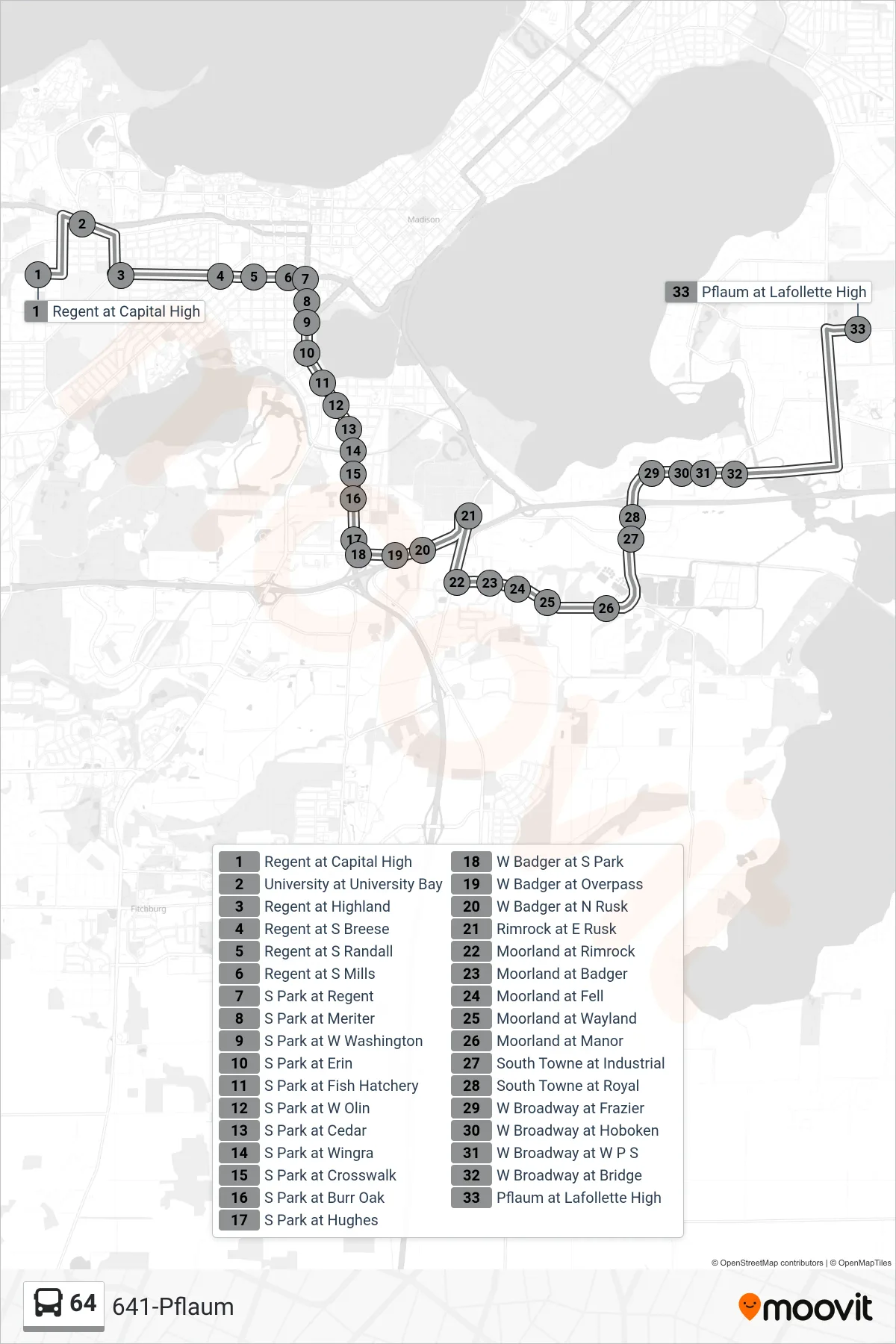
Stops list (64 - 641-Pflaum)
- Regent at Capital High
- University at University Bay
- Regent at Highland
- Regent at S Breese
- Regent at S Randall
- Regent at S Mills
- S Park at Regent
- S Park at Meriter
- S Park at W Washington
- S Park at Erin
- S Park at Fish Hatchery
- S Park at W Olin
- S Park at Cedar
- S Park at Wingra
- S Park at Crosswalk
- S Park at Burr Oak
- S Park at Hughes
- W Badger at S Park
- W Badger at Overpass
- W Badger at N Rusk
- Rimrock at E Rusk
- Moorland at Rimrock
- Moorland at Badger
- Moorland at Fell
- Moorland at Wayland
- Moorland at Manor
- South Towne at Industrial
- South Towne at Royal
- W Broadway at Frazier
- W Broadway at Hoboken
- W Broadway at W P S
- W Broadway at Bridge
- Pflaum at Lafollette High