
64 Bus Route Map
View the 64 route map and see all 64 stops along the route. The map of 64 shows where the bus travels and the location of each stop, making it easy to understand the entire route at a glance.
Explore Autobuses routes on the map and see where Autobuses bus services operate. Use the 64 map to find bus stops and see how the 64 connects different areas along its trip.
All 64 stops on the map are displayed in route order, helping you follow the 64 bus from the first stop to the last.
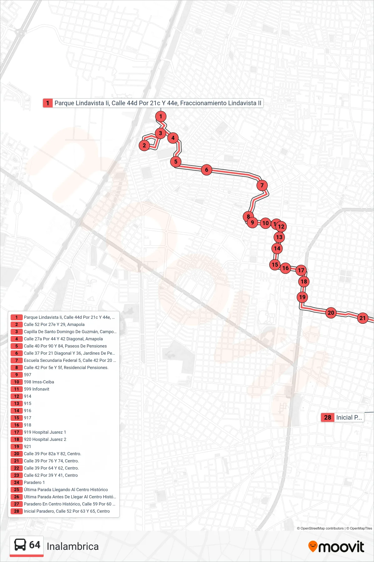
Stops list (64 - Inalambrica)
- Parque Lindavista Ii, Calle 44d Por 21c Y 44e, Fraccionamiento Lindavista II
- Calle 52 Por 27e Y 29, Amapola
- Capilla De Santo Domingo De Guzmán, Campo Deportivo Amapolita, Calle 40 Por 27d Y 27a, Amapola
- Calle 27a Por 44 Y 42 Diagonal, Amapola
- Calle 40 Por 90 Y 84, Paseos De Pensiones
- Calle 37 Por 21 Diagonal Y 36, Jardines De Pensiones.
- Escuela Secundaria Federal 5, Calle 42 Por 20 Y 117, Limones
- Calle 42 Por 5e Y 5f, Residencial Pensiones.
- 597
- 598 Imss-Ceiba
- 599 Infonavit
- 914
- 915
- 916
- 917
- 918
- 919 Hospital Juarez 1
- 920 Hospital Juarez 2
- 921
- Calle 39 Por 82a Y 82, Centro.
- Calle 39 Por 76 Y 74, Centro.
- Calle 39 Por 64 Y 62, Centro.
- Calle 62 Por 39 Y 41, Centro
- Paradero 1
- Última Parada Llegando Al Centro Histórico
- Ultima Parada Antes De Llegar Al Centro Histórico, Calle 62 Por 55 Y 57, Centro
- Paradero En Centro Histórico, Calle 59 Por 60 Y 58, Centro
- Inicial Paradero, Calle 52 Por 63 Y 65, Centro