
64 Bus Route Map
View the 64 route map and see all 64 stops along the route. The map of 64 shows where the bus travels and the location of each stop, making it easy to understand the entire route at a glance.
Explore FRENTE ÚNICO DE TRABAJADORES DEL VOLANTE routes on the map and see where FRENTE ÚNICO DE TRABAJADORES DEL VOLANTE bus services operate. Use the 64 map to find bus stops and see how the 64 connects different areas along its trip.
All 64 stops on the map are displayed in route order, helping you follow the 64 bus from the first stop to the last.
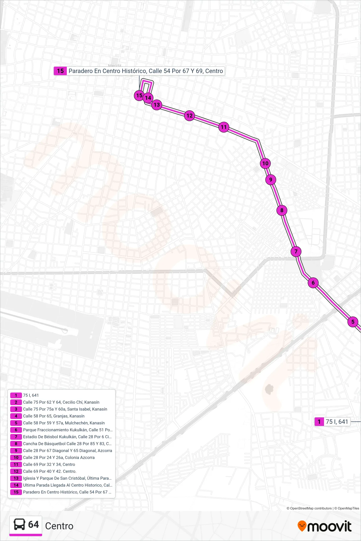
Stops list (64 - Centro)
- 75 I, 641
- Calle 75 Por 62 Y 64, Cecilio Chí, Kanasín
- Calle 75 Por 75a Y 60a, Santa Isabel, Kanasín
- Calle 58 Por 65, Granjas, Kanasín
- Calle 58 Por 59 Y 57a, Mulchechén, Kanasín
- Parque Fraccionamiento Kukulkán, Calle 51 Por 2 Sur, Fraccionamiento Kukulkán
- Estadio De Béisbol Kukulkán, Calle 28 Por 6 Circuito Colonias Y 93, Colonia Morelos Oriente
- Cancha De Básquetbol Calle 28 Por 85 Y 83, Colonia Morelos Oriente
- Calle 28 Por 67 Diagonal Y 65 Diagonal, Azcorra
- Calle 28 Por 24 Y 26a, Colonia Azcorra
- Calle 69 Por 32 Y 34, Centro
- Calle 69 Por 40 Y 42. Centro.
- Iglesia Y Parque De San Cristóbal, Última Parada Llegando Al Centro Histórico, Calle 69 Por 48 Y 50, Centro
- Ultima Parada Llegada Al Centro Historico, Calle 52 Por 67 Y 69 Centro
- Paradero En Centro Histórico, Calle 54 Por 67 Y 69, Centro