
642 Tram Route Map
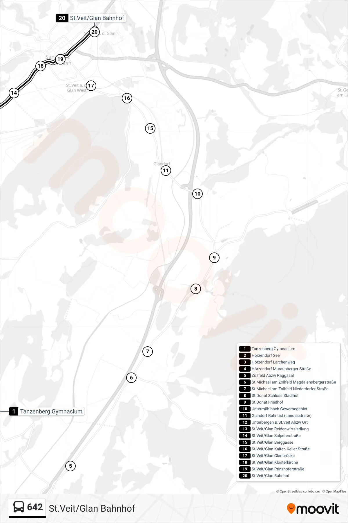
View the 642 route map and see all 642 stops along the route. The map of 642 shows where the tram travels and the location of each stop, making it easy to understand the entire route at a glance.
Explore routes on the map and see where tram services operate. Use the 642 map to find tram stations and see how the 642 connects different areas along its trip.
All 642 stops on the map are displayed in route order, helping you follow the 642 tram from the first station to the last.
Stops list (642 - St.Veit/Glan Bahnhof)
- Tanzenberg Gymnasium
- Hörzendorf See
- Hörzendorf Lärchenweg
- Hörzendorf Muraunberger Straße
- Zollfeld Abzw Raggasal
- St.Michael am Zollfeld Magdalensbergerstraße
- St.Michael am Zollfeld Niederdorfer Straße
- St.Donat Schloss Stadlhof
- St.Donat Friedhof
- Untermühlbach Gewerbegebiet
- Glandorf Bahnhst (Landesstraße)
- Unterbergen B.St.Veit Abzw Ort
- St.Veit/Glan Reidenwirtsiedlung
- St.Veit/Glan Salpeterstraße
- St.Veit/Glan Berggasse
- St.Veit/Glan Kalten Keller Straße
- St.Veit/Glan Glanbrücke
- St.Veit/Glan Klosterkirche
- St.Veit/Glan Prinzhoferstraße
- St.Veit/Glan Bahnhof