
645 Bus Route Map
View the 645 route map and see all 645 stops along the route. The map of 645 shows where the bus travels and the location of each stop, making it easy to understand the entire route at a glance.
Explore VBB routes on the map and see where VBB bus services operate. Use the 645 map to find bus stops and see how the 645 connects different areas along its trip.
All 645 stops on the map are displayed in route order, helping you follow the 645 bus from the first stop to the last.
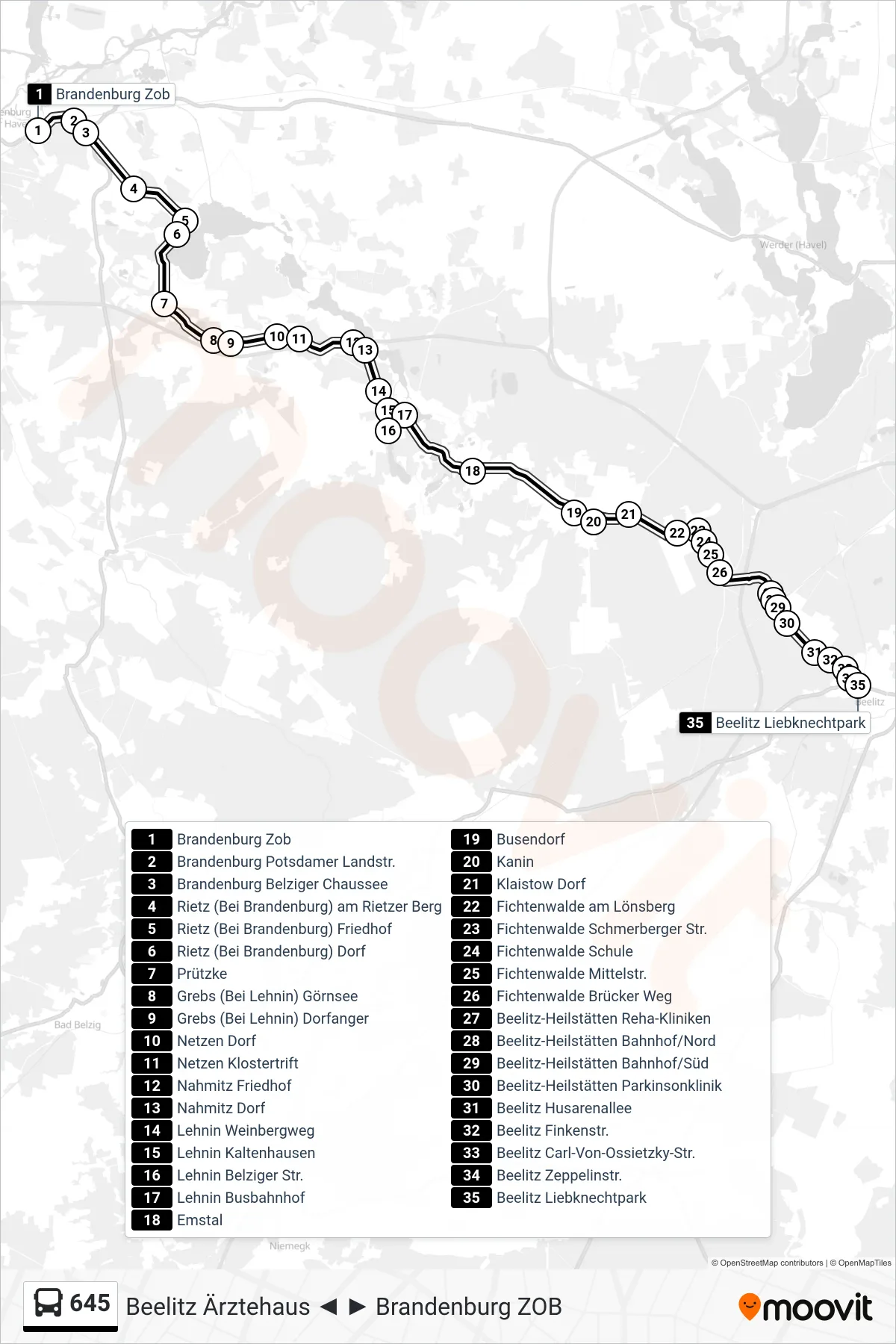
Stops list (645 - Beelitz Liebknechtpark)
- Brandenburg Zob
- Brandenburg Potsdamer Landstr.
- Brandenburg Belziger Chaussee
- Rietz (Bei Brandenburg) am Rietzer Berg
- Rietz (Bei Brandenburg) Friedhof
- Rietz (Bei Brandenburg) Dorf
- Prützke
- Grebs (Bei Lehnin) Görnsee
- Grebs (Bei Lehnin) Dorfanger
- Netzen Dorf
- Netzen Klostertrift
- Nahmitz Friedhof
- Nahmitz Dorf
- Lehnin Weinbergweg
- Lehnin Kaltenhausen
- Lehnin Belziger Str.
- Lehnin Busbahnhof
- Emstal
- Busendorf
- Kanin
- Klaistow Dorf
- Fichtenwalde am Lönsberg
- Fichtenwalde Schmerberger Str.
- Fichtenwalde Schule
- Fichtenwalde Mittelstr.
- Fichtenwalde Brücker Weg
- Beelitz-Heilstätten Reha-Kliniken
- Beelitz-Heilstätten Bahnhof/Nord
- Beelitz-Heilstätten Bahnhof/Süd
- Beelitz-Heilstätten Parkinsonklinik
- Beelitz Husarenallee
- Beelitz Finkenstr.
- Beelitz Carl-Von-Ossietzky-Str.
- Beelitz Zeppelinstr.
- Beelitz Liebknechtpark
Change direction
- Route Map - 645 - Beelitz Platanenring
- Route Map - 645 - Brandenburg Zob
- Route Map - 645 - Schmerzke
- Route Map - 645 - Lehnin Busbahnhof
- Route Map - 645 - Netzen Dorf
- Route Map - 645 - Fichtenwalde am Lönsberg
- Route Map - 645 - Lehnin Busbahnhof
- Route Map - 645 - Beelitz Lustgarten
- Route Map - 645 - Beelitz Ärztehaus
- Route Map - 645 - Brandenburg Hauptbahnhof