
65 Bus Route Map
View the 65 route map and see all 65 stops along the route. The map of 65 shows where the bus travels and the location of each stop, making it easy to understand the entire route at a glance.
Explore MBTA routes on the map and see where MBTA bus services operate. Use the 65 map to find bus stops and see how the 65 connects different areas along its trip.
All 65 stops on the map are displayed in route order, helping you follow the 65 bus from the first stop to the last.
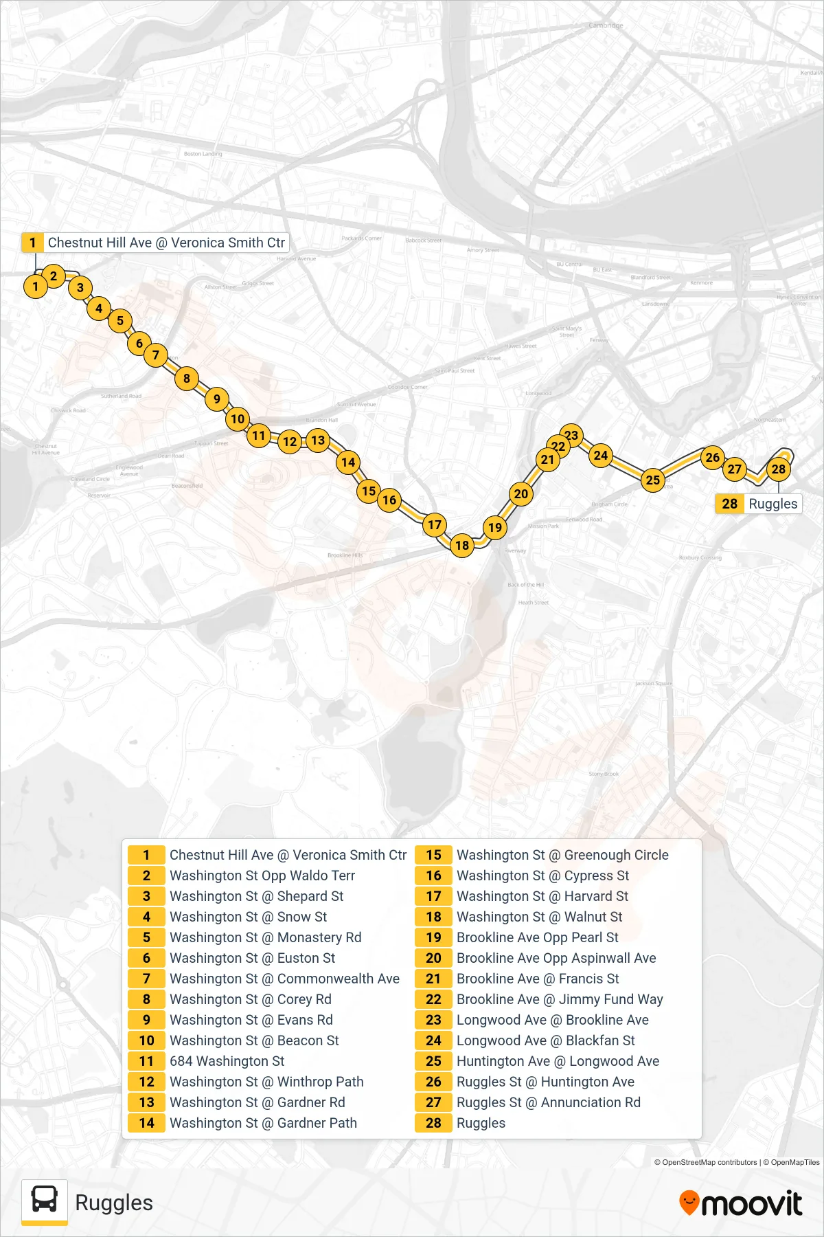
Stops list (65 - Ruggles)
- Chestnut Hill Ave @ Veronica Smith Ctr
- Washington St Opp Waldo Terr
- Washington St @ Shepard St
- Washington St @ Snow St
- Washington St @ Monastery Rd
- Washington St @ Euston St
- Washington St @ Commonwealth Ave
- Washington St @ Corey Rd
- Washington St @ Evans Rd
- Washington St @ Beacon St
- 684 Washington St
- Washington St @ Winthrop Path
- Washington St @ Gardner Rd
- Washington St @ Gardner Path
- Washington St @ Greenough Circle
- Washington St @ Cypress St
- Washington St @ Harvard St
- Washington St @ Walnut St
- Brookline Ave Opp Pearl St
- Brookline Ave Opp Aspinwall Ave
- Brookline Ave @ Francis St
- Brookline Ave @ Jimmy Fund Way
- Longwood Ave @ Brookline Ave
- Longwood Ave @ Blackfan St
- Huntington Ave @ Longwood Ave
- Ruggles St @ Huntington Ave
- Ruggles St @ Annunciation Rd
- Ruggles