
65 Bus Route Map
View the 65 route map and see all 65 stops along the route. The map of 65 shows where the bus travels and the location of each stop, making it easy to understand the entire route at a glance.
Explore Pittsburgh Regional Transit routes on the map and see where Pittsburgh Regional Transit bus services operate. Use the 65 map to find bus stops and see how the 65 connects different areas along its trip.
All 65 stops on the map are displayed in route order, helping you follow the 65 bus from the first stop to the last.
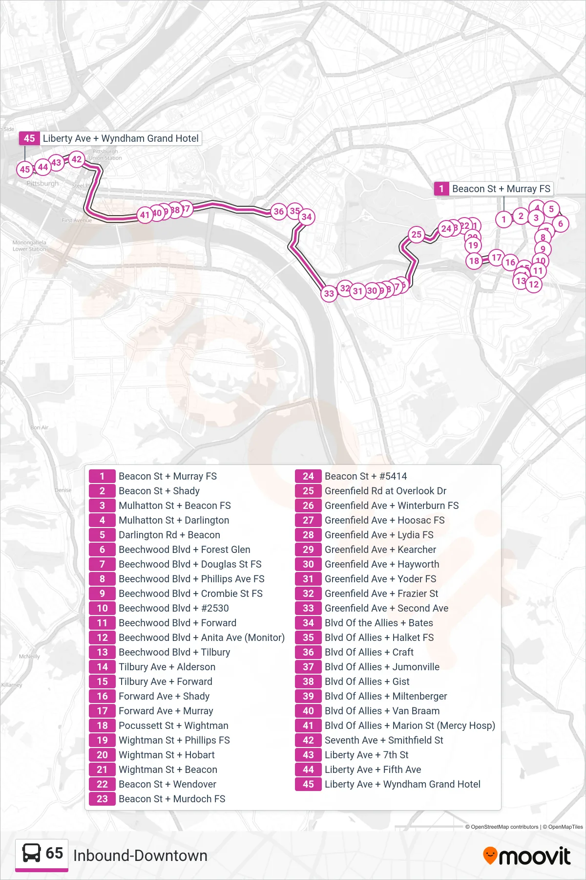
Stops list (65 - Inbound-Downtown)
- Beacon St + Murray FS
- Beacon St + Shady
- Mulhatton St + Beacon FS
- Mulhatton St + Darlington
- Darlington Rd + Beacon
- Beechwood Blvd + Forest Glen
- Beechwood Blvd + Douglas St FS
- Beechwood Blvd + Phillips Ave FS
- Beechwood Blvd + Crombie St FS
- Beechwood Blvd + #2530
- Beechwood Blvd + Forward
- Beechwood Blvd + Anita Ave (Monitor)
- Beechwood Blvd + Tilbury
- Tilbury Ave + Alderson
- Tilbury Ave + Forward
- Forward Ave + Shady
- Forward Ave + Murray
- Pocussett St + Wightman
- Wightman St + Phillips FS
- Wightman St + Hobart
- Wightman St + Beacon
- Beacon St + Wendover
- Beacon St + Murdoch FS
- Beacon St + #5414
- Greenfield Rd at Overlook Dr
- Greenfield Ave + Winterburn FS
- Greenfield Ave + Hoosac FS
- Greenfield Ave + Lydia FS
- Greenfield Ave + Kearcher
- Greenfield Ave + Hayworth
- Greenfield Ave + Yoder FS
- Greenfield Ave + Frazier St
- Greenfield Ave + Second Ave
- Blvd Of the Allies + Bates
- Blvd Of Allies + Halket FS
- Blvd Of Allies + Craft
- Blvd Of Allies + Jumonville
- Blvd Of Allies + Gist
- Blvd Of Allies + Miltenberger
- Blvd Of Allies + Van Braam
- Blvd Of Allies + Marion St (Mercy Hosp)
- Seventh Ave + Smithfield St
- Liberty Ave + 7th St
- Liberty Ave + Fifth Ave
- Liberty Ave + Wyndham Grand Hotel