
65 Bus Route Map
View the 65 route map and see all 65 stops along the route. The map of 65 shows where the bus travels and the location of each stop, making it easy to understand the entire route at a glance.
Explore DB Bahn Rheinlandbus routes on the map and see where DB Bahn Rheinlandbus bus services operate. Use the 65 map to find bus stops and see how the 65 connects different areas along its trip.
All 65 stops on the map are displayed in route order, helping you follow the 65 bus from the first stop to the last.
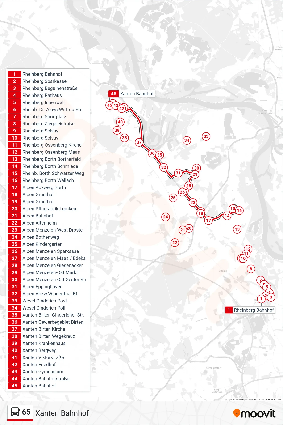
Stops list (65 - Xanten Bahnhof)
- Rheinberg Bahnhof
- Rheinberg Sparkasse
- Rheinberg Beguinenstraße
- Rheinberg Rathaus
- Rheinberg Innenwall
- Rheinb. Dr.-Aloys-Wittrup-Str.
- Rheinberg Sportplatz
- Rheinberg Ziegeleistraße
- Rheinberg Solvay
- Rheinberg Solvay
- Rheinberg Ossenberg Kirche
- Rheinberg Ossenberg Maas
- Rheinberg Borth Bortherfeld
- Rheinberg Borth Schmiede
- Rheinb. Borth Schwarzer Weg
- Rheinberg Borth Wallach
- Alpen Abzweig Borth
- Alpen Grünthal
- Alpen Grünthal
- Alpen Pflugfabrik Lemken
- Alpen Bahnhof
- Alpen Altenheim
- Alpen Menzelen-West Droste
- Alpen Bothenweg
- Alpen Kindergarten
- Alpen Menzelen Sparkasse
- Alpen Menzelen Maas / Edeka
- Alpen Menzelen Giesenacker
- Alpen Menzelen-Ost Markt
- Alpen Menzelen-Ost Gester Str.
- Alpen Eppinghoven
- Alpen Abzw.Winnenthal Bf
- Wesel Ginderich Post
- Wesel Ginderich Poll
- Xanten Birten Gindericher Str.
- Xanten Gewerbegebiet Birten
- Xanten Birten Kirche
- Xanten Birten Wegekreuz
- Xanten Krankenhaus
- Xanten Bergweg
- Xanten Viktorstraße
- Xanten Friedhof
- Xanten Gymnasium
- Xanten Bahnhofstraße
- Xanten Bahnhof