
65 Bus Route Map
View the 65 route map and see all 65 stops along the route. The map of 65 shows where the bus travels and the location of each stop, making it easy to understand the entire route at a glance.
Explore Mendocino Transit Authority routes on the map and see where Mendocino Transit Authority bus services operate. Use the 65 map to find bus stops and see how the 65 connects different areas along its trip.
All 65 stops on the map are displayed in route order, helping you follow the 65 bus from the first stop to the last.
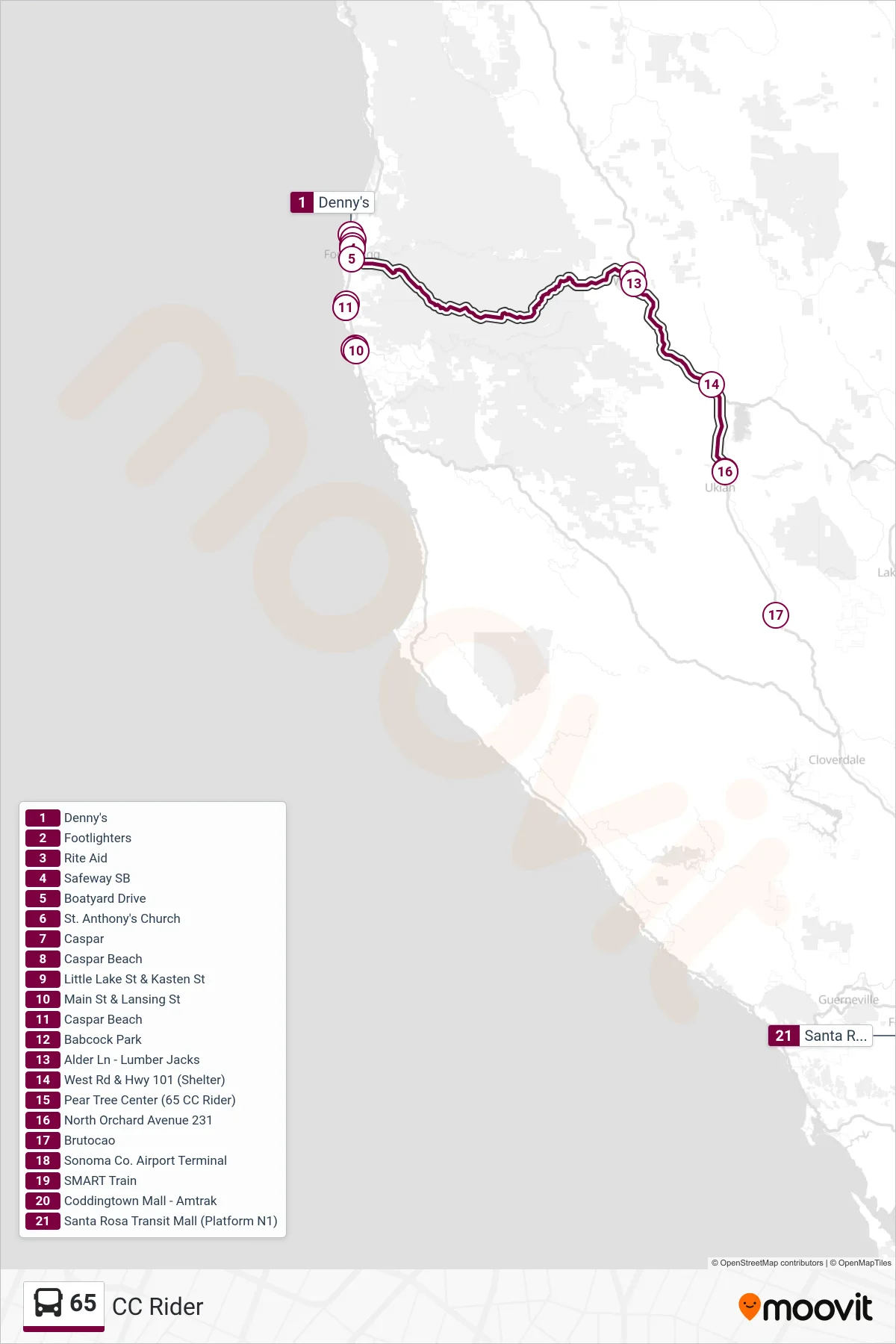
Stops list (65 - Southbound)
- Denny's
- Footlighters
- Rite Aid
- Safeway SB
- Boatyard Drive
- St. Anthony's Church
- Caspar
- Caspar Beach
- Little Lake St & Kasten St
- Main St & Lansing St
- Caspar Beach
- Babcock Park
- Alder Ln - Lumber Jacks
- West Rd & Hwy 101 (Shelter)
- Pear Tree Center (65 CC Rider)
- North Orchard Avenue 231
- Brutocao
- Sonoma Co. Airport Terminal
- SMART Train
- Coddingtown Mall - Amtrak
- Santa Rosa Transit Mall (Platform N1)