
65 Bus Route Map
View the 65 route map and see all 65 stops along the route. The map of 65 shows where the bus travels and the location of each stop, making it easy to understand the entire route at a glance.
Explore AC Transit routes on the map and see where AC Transit bus services operate. Use the 65 map to find bus stops and see how the 65 connects different areas along its trip.
All 65 stops on the map are displayed in route order, helping you follow the 65 bus from the first stop to the last.
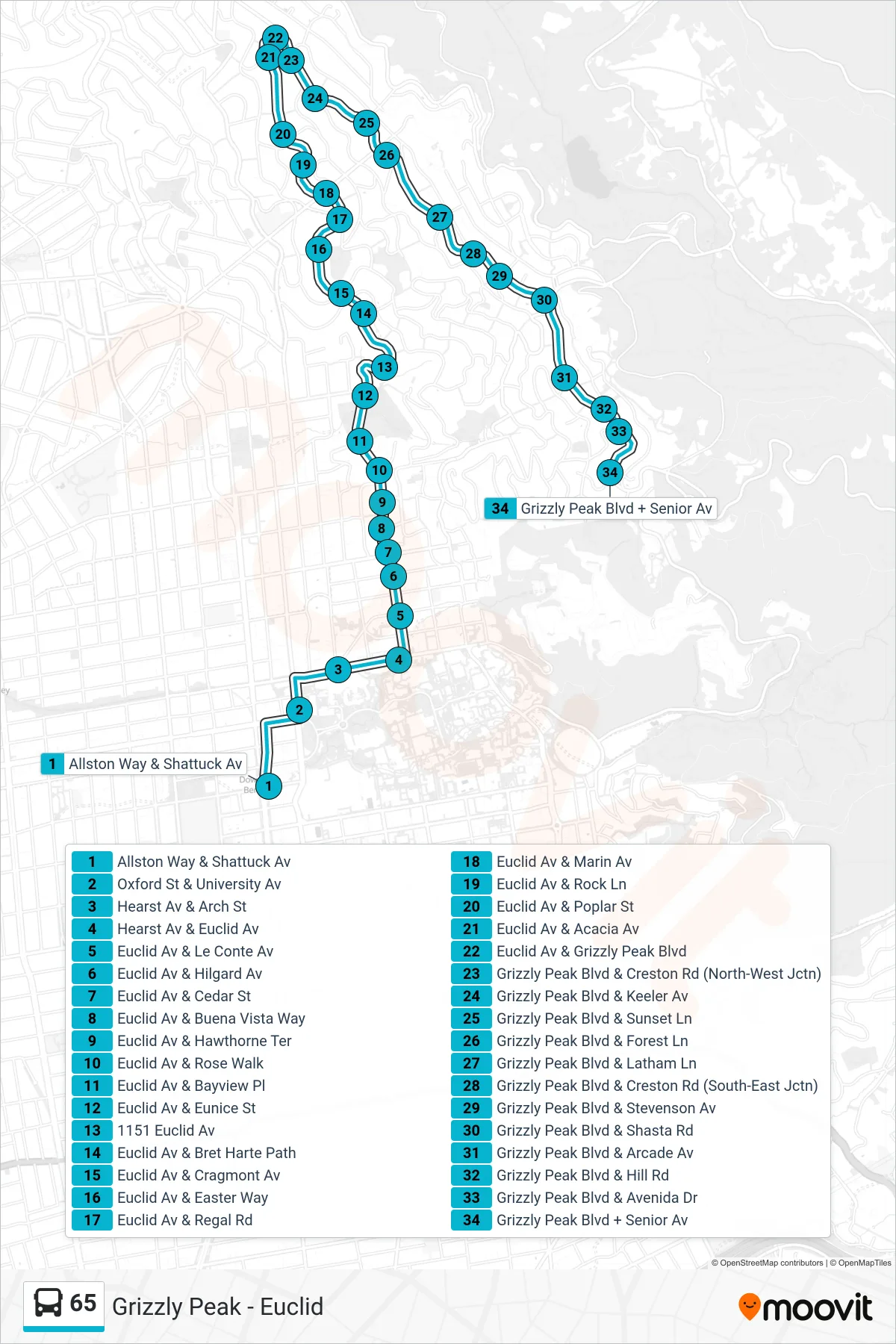
Stops list (65 - Senior Ave. Loop)
- Allston Way & Shattuck Av
- Oxford St & University Av
- Hearst Av & Arch St
- Hearst Av & Euclid Av
- Euclid Av & Le Conte Av
- Euclid Av & Hilgard Av
- Euclid Av & Cedar St
- Euclid Av & Buena Vista Way
- Euclid Av & Hawthorne Ter
- Euclid Av & Rose Walk
- Euclid Av & Bayview Pl
- Euclid Av & Eunice St
- 1151 Euclid Av
- Euclid Av & Bret Harte Path
- Euclid Av & Cragmont Av
- Euclid Av & Easter Way
- Euclid Av & Regal Rd
- Euclid Av & Marin Av
- Euclid Av & Rock Ln
- Euclid Av & Poplar St
- Euclid Av & Acacia Av
- Euclid Av & Grizzly Peak Blvd
- Grizzly Peak Blvd & Creston Rd (North-West Jctn)
- Grizzly Peak Blvd & Keeler Av
- Grizzly Peak Blvd & Sunset Ln
- Grizzly Peak Blvd & Forest Ln
- Grizzly Peak Blvd & Latham Ln
- Grizzly Peak Blvd & Creston Rd (South-East Jctn)
- Grizzly Peak Blvd & Stevenson Av
- Grizzly Peak Blvd & Shasta Rd
- Grizzly Peak Blvd & Arcade Av
- Grizzly Peak Blvd & Hill Rd
- Grizzly Peak Blvd & Avenida Dr
- Grizzly Peak Blvd + Senior Av