
65 Bus Route Map
View the 65 route map and see all 65 stops along the route. The map of 65 shows where the bus travels and the location of each stop, making it easy to understand the entire route at a glance.
Explore Transit Services of Frederick County routes on the map and see where Transit Services of Frederick County bus services operate. Use the 65 map to find bus stops and see how the 65 connects different areas along its trip.
All 65 stops on the map are displayed in route order, helping you follow the 65 bus from the first stop to the last.
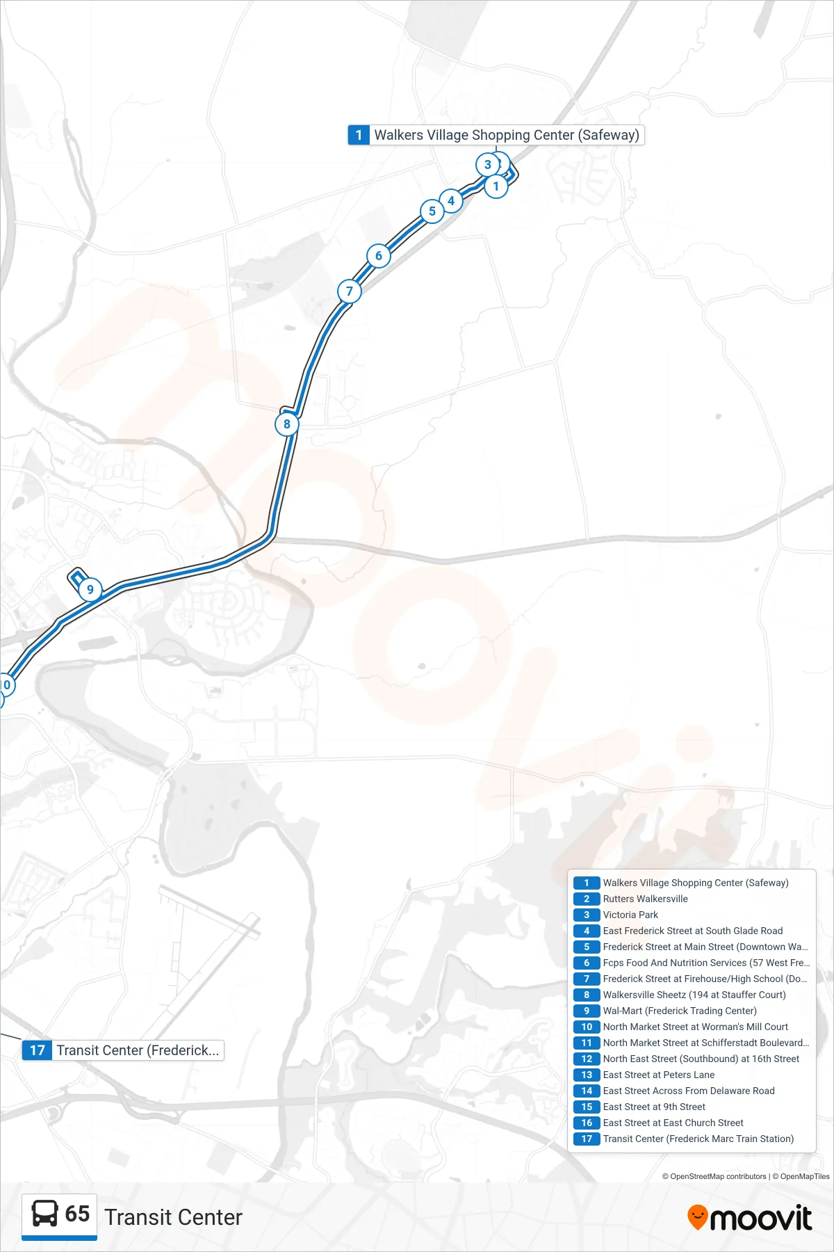
Stops list (65 - Transit Center)
- Walkers Village Shopping Center (Safeway)
- Rutters Walkersville
- Victoria Park
- East Frederick Street at South Glade Road
- Frederick Street at Main Street (Downtown Walkersville)
- Fcps Food And Nutrition Services (57 West Frederick Street)
- Frederick Street at Firehouse/High School (Downtown Walkersville)
- Walkersville Sheetz (194 at Stauffer Court)
- Wal-Mart (Frederick Trading Center)
- North Market Street at Worman's Mill Court
- North Market Street at Schifferstadt Boulevard (Southbound)
- North East Street (Southbound) at 16th Street
- East Street at Peters Lane
- East Street Across From Delaware Road
- East Street at 9th Street
- East Street at East Church Street
- Transit Center (Frederick Marc Train Station)