
65 Tram Route Map
View the 65 route map and see all 65 stops along the route. The map of 65 shows where the tram travels and the location of each stop, making it easy to understand the entire route at a glance.
Explore routes on the map and see where tram services operate. Use the 65 map to find tram stations and see how the 65 connects different areas along its trip.
All 65 stops on the map are displayed in route order, helping you follow the 65 tram from the first station to the last.
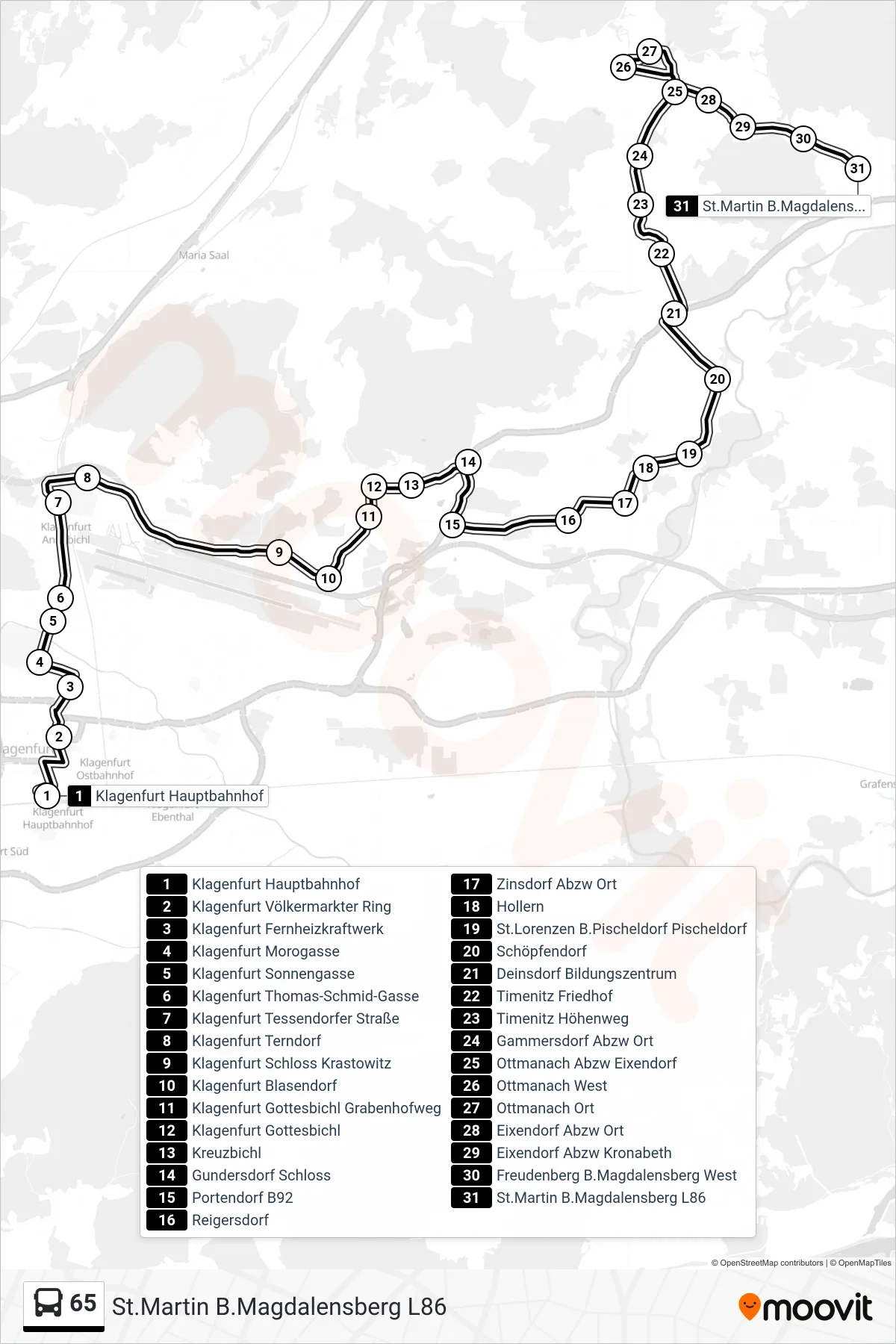
Stops list (65 - St.Martin B.Magdalensberg L86)
- Klagenfurt Hauptbahnhof
- Klagenfurt Völkermarkter Ring
- Klagenfurt Fernheizkraftwerk
- Klagenfurt Morogasse
- Klagenfurt Sonnengasse
- Klagenfurt Thomas-Schmid-Gasse
- Klagenfurt Tessendorfer Straße
- Klagenfurt Terndorf
- Klagenfurt Schloss Krastowitz
- Klagenfurt Blasendorf
- Klagenfurt Gottesbichl Grabenhofweg
- Klagenfurt Gottesbichl
- Kreuzbichl
- Gundersdorf Schloss
- Portendorf B92
- Reigersdorf
- Zinsdorf Abzw Ort
- Hollern
- St.Lorenzen B.Pischeldorf Pischeldorf
- Schöpfendorf
- Deinsdorf Bildungszentrum
- Timenitz Friedhof
- Timenitz Höhenweg
- Gammersdorf Abzw Ort
- Ottmanach Abzw Eixendorf
- Ottmanach West
- Ottmanach Ort
- Eixendorf Abzw Ort
- Eixendorf Abzw Kronabeth
- Freudenberg B.Magdalensberg West
- St.Martin B.Magdalensberg L86