
653A Bus Route Map
View the 653A route map and see all 653A stops along the route. The map of 653A shows where the bus travels and the location of each stop, making it easy to understand the entire route at a glance.
Explore SSB routes on the map and see where SSB bus services operate. Use the 653A map to find bus stops and see how the 653A connects different areas along its trip.
All 653A stops on the map are displayed in route order, helping you follow the 653A bus from the first stop to the last.
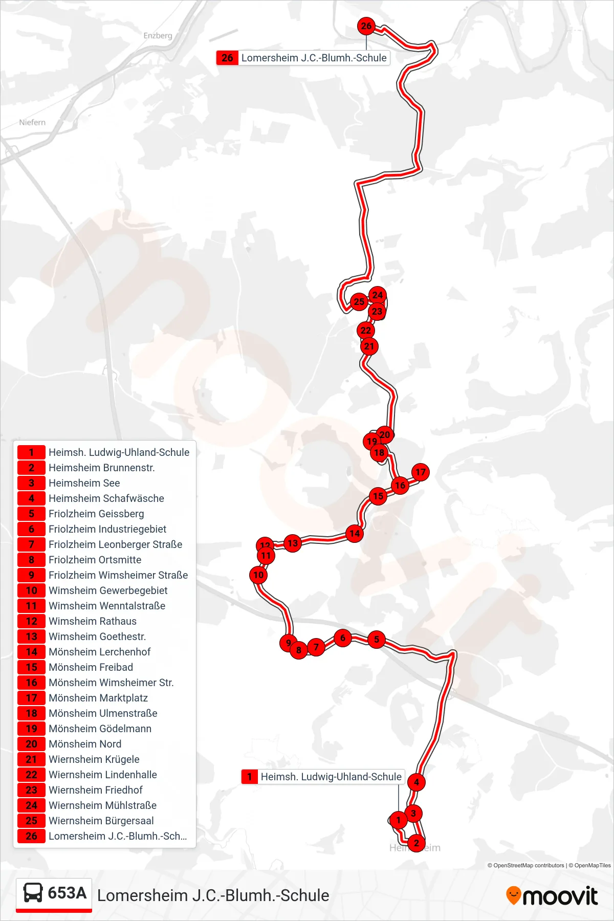
Stops list (653A - Lomersheim J.C.-Blumh.-Schule)
- Heimsh. Ludwig-Uhland-Schule
- Heimsheim Brunnenstr.
- Heimsheim See
- Heimsheim Schafwäsche
- Friolzheim Geissberg
- Friolzheim Industriegebiet
- Friolzheim Leonberger Straße
- Friolzheim Ortsmitte
- Friolzheim Wimsheimer Straße
- Wimsheim Gewerbegebiet
- Wimsheim Wenntalstraße
- Wimsheim Rathaus
- Wimsheim Goethestr.
- Mönsheim Lerchenhof
- Mönsheim Freibad
- Mönsheim Wimsheimer Str.
- Mönsheim Marktplatz
- Mönsheim Ulmenstraße
- Mönsheim Gödelmann
- Mönsheim Nord
- Wiernsheim Krügele
- Wiernsheim Lindenhalle
- Wiernsheim Friedhof
- Wiernsheim Mühlstraße
- Wiernsheim Bürgersaal
- Lomersheim J.C.-Blumh.-Schule
Change direction
- Route Map - 653A - Wiernsheim Bürgersaal
- Route Map - 653A - Leonberg Römerstr.
- Route Map - 653A - Heimsheim See
- Route Map - 653A - Friolzheim Ortsmitte
- Route Map - 653A - Weissach (Bb) Marktplatz
- Route Map - 653A - Rutesheim Schulzentrum
- Route Map - 653A - Tiefenbr. Albrecht-Dürer-Str.
- Route Map - 653A - Wimsheim Goethestr.
- Route Map - 653A - Heimsheim Egelsee