
655 Bus Route Map
View the 655 route map and see all 655 stops along the route. The map of 655 shows where the bus travels and the location of each stop, making it easy to understand the entire route at a glance.
Explore Stadtwerke Remscheid routes on the map and see where Stadtwerke Remscheid bus services operate. Use the 655 map to find bus stops and see how the 655 connects different areas along its trip.
All 655 stops on the map are displayed in route order, helping you follow the 655 bus from the first stop to the last.
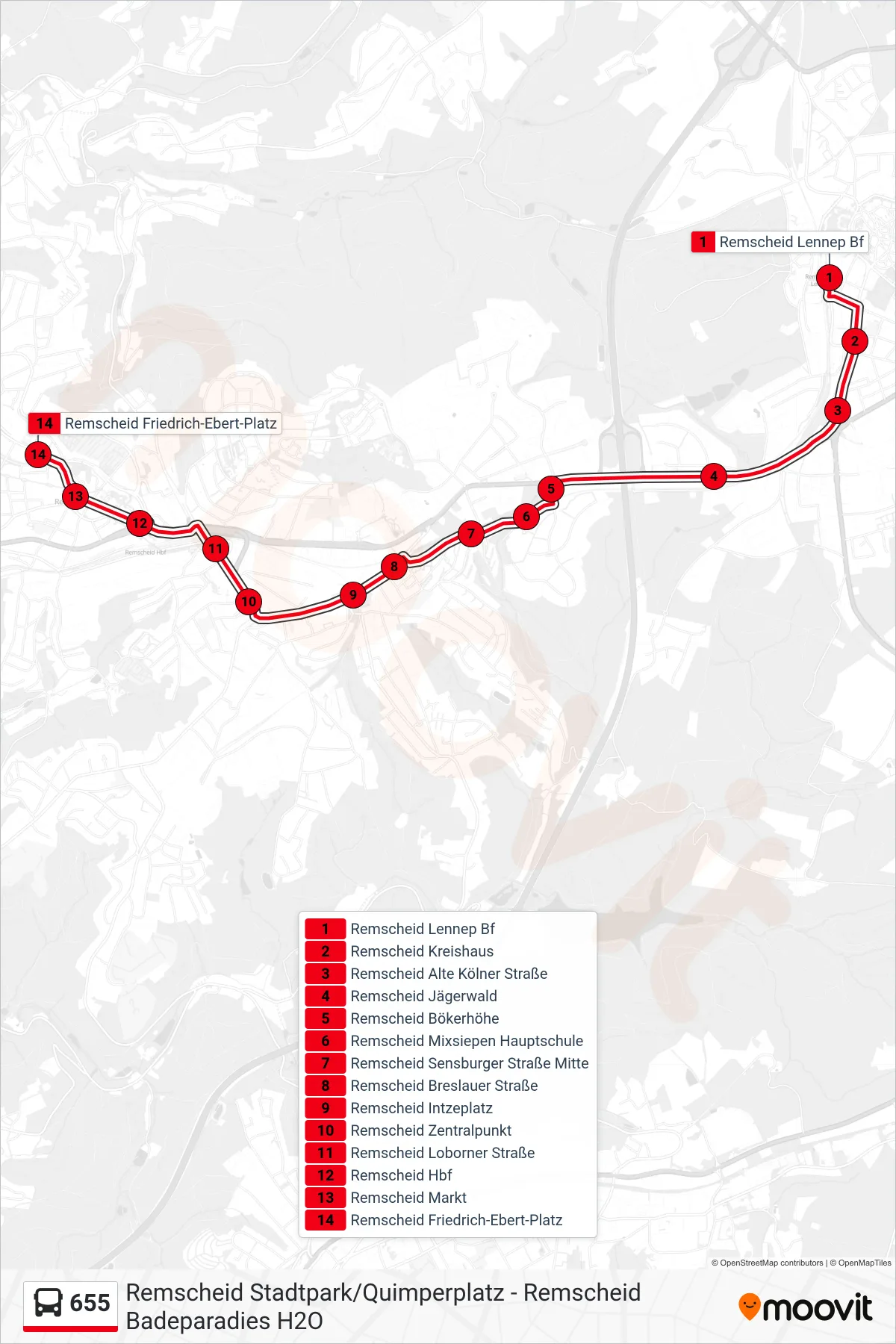
Stops list (655 - Remscheid Friedrich-Ebert-Platz)
- Remscheid Lennep Bf
- Remscheid Kreishaus
- Remscheid Alte Kölner Straße
- Remscheid Jägerwald
- Remscheid Bökerhöhe
- Remscheid Mixsiepen Hauptschule
- Remscheid Sensburger Straße Mitte
- Remscheid Breslauer Straße
- Remscheid Intzeplatz
- Remscheid Zentralpunkt
- Remscheid Loborner Straße
- Remscheid Hbf
- Remscheid Markt
- Remscheid Friedrich-Ebert-Platz
Change direction
- Route Map - 655 - Remscheid Badeparadies H2o
- Route Map - 655 - Remscheid Neuenhaus
- Route Map - 655 - Remscheid Lennep Bf
- Route Map - 655 - Remscheid Friedrich-Ebert-Platz
- Route Map - 655 - Remscheid Stadtpark/Quimperplatz
- Route Map - 655 - Remscheid Hohenhagen Gesamtschule
- Route Map - 655 - Remscheid Hbf
- Route Map - 655 - Remscheid Lennep Bf
- Route Map - 655 - Remscheid Otto-Hahn-Straße