
657 Bus Route Map
View the 657 route map and see all 657 stops along the route. The map of 657 shows where the bus travels and the location of each stop, making it easy to understand the entire route at a glance.
Explore AC Transit routes on the map and see where AC Transit bus services operate. Use the 657 map to find bus stops and see how the 657 connects different areas along its trip.
All 657 stops on the map are displayed in route order, helping you follow the 657 bus from the first stop to the last.
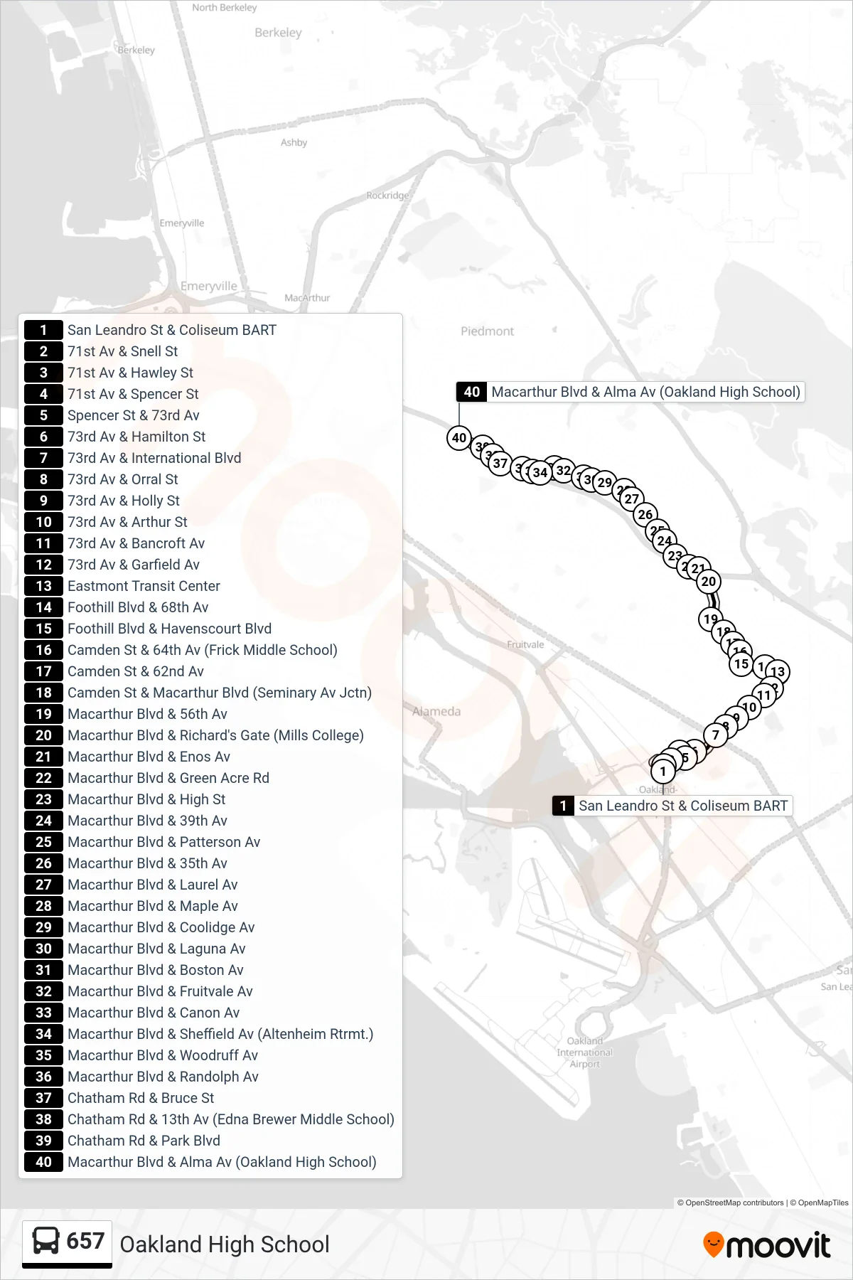
Stops list (657 - Oakland High School)
- San Leandro St & Coliseum BART
- 71st Av & Snell St
- 71st Av & Hawley St
- 71st Av & Spencer St
- Spencer St & 73rd Av
- 73rd Av & Hamilton St
- 73rd Av & International Blvd
- 73rd Av & Orral St
- 73rd Av & Holly St
- 73rd Av & Arthur St
- 73rd Av & Bancroft Av
- 73rd Av & Garfield Av
- Eastmont Transit Center
- Foothill Blvd & 68th Av
- Foothill Blvd & Havenscourt Blvd
- Camden St & 64th Av (Frick Middle School)
- Camden St & 62nd Av
- Camden St & Macarthur Blvd (Seminary Av Jctn)
- Macarthur Blvd & 56th Av
- Macarthur Blvd & Richard's Gate (Mills College)
- Macarthur Blvd & Enos Av
- Macarthur Blvd & Green Acre Rd
- Macarthur Blvd & High St
- Macarthur Blvd & 39th Av
- Macarthur Blvd & Patterson Av
- Macarthur Blvd & 35th Av
- Macarthur Blvd & Laurel Av
- Macarthur Blvd & Maple Av
- Macarthur Blvd & Coolidge Av
- Macarthur Blvd & Laguna Av
- Macarthur Blvd & Boston Av
- Macarthur Blvd & Fruitvale Av
- Macarthur Blvd & Canon Av
- Macarthur Blvd & Sheffield Av (Altenheim Rtrmt.)
- Macarthur Blvd & Woodruff Av
- Macarthur Blvd & Randolph Av
- Chatham Rd & Bruce St
- Chatham Rd & 13th Av (Edna Brewer Middle School)
- Chatham Rd & Park Blvd
- Macarthur Blvd & Alma Av (Oakland High School)