
65B Bus Route Map
View the 65B route map and see all 65B stops along the route. The map of 65B shows where the bus travels and the location of each stop, making it easy to understand the entire route at a glance.
Explore Bus Átha Cliath – Dublin Bus routes on the map and see where Bus Átha Cliath – Dublin Bus bus services operate. Use the 65B map to find bus stops and see how the 65B connects different areas along its trip.
All 65B stops on the map are displayed in route order, helping you follow the 65B bus from the first stop to the last.
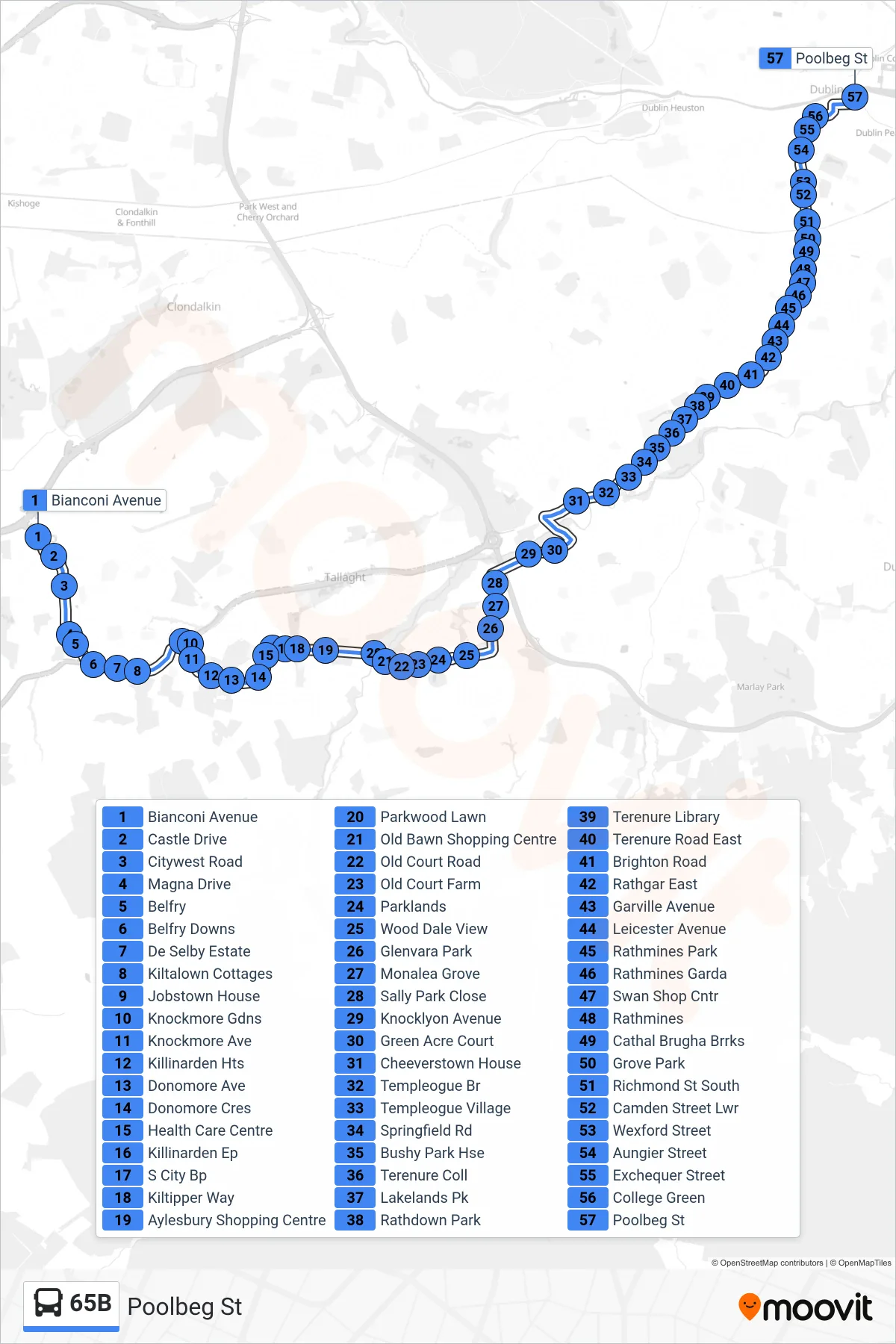
Stops list (65B - Poolbeg St)
- Bianconi Avenue
- Castle Drive
- Citywest Road
- Magna Drive
- Belfry
- Belfry Downs
- De Selby Estate
- Kiltalown Cottages
- Jobstown House
- Knockmore Gdns
- Knockmore Ave
- Killinarden Hts
- Donomore Ave
- Donomore Cres
- Health Care Centre
- Killinarden Ep
- S City Bp
- Kiltipper Way
- Aylesbury Shopping Centre
- Parkwood Lawn
- Old Bawn Shopping Centre
- Old Court Road
- Old Court Farm
- Parklands
- Wood Dale View
- Glenvara Park
- Monalea Grove
- Sally Park Close
- Knocklyon Avenue
- Green Acre Court
- Cheeverstown House
- Templeogue Br
- Templeogue Village
- Springfield Rd
- Bushy Park Hse
- Terenure Coll
- Lakelands Pk
- Rathdown Park
- Terenure Library
- Terenure Road East
- Brighton Road
- Rathgar East
- Garville Avenue
- Leicester Avenue
- Rathmines Park
- Rathmines Garda
- Swan Shop Cntr
- Rathmines
- Cathal Brugha Brrks
- Grove Park
- Richmond St South
- Camden Street Lwr
- Wexford Street
- Aungier Street
- Exchequer Street
- College Green
- Poolbeg St