
66 Bus Route Map
View the 66 route map and see all 66 stops along the route. The map of 66 shows where the bus travels and the location of each stop, making it easy to understand the entire route at a glance.
Explore MBTA routes on the map and see where MBTA bus services operate. Use the 66 map to find bus stops and see how the 66 connects different areas along its trip.
All 66 stops on the map are displayed in route order, helping you follow the 66 bus from the first stop to the last.
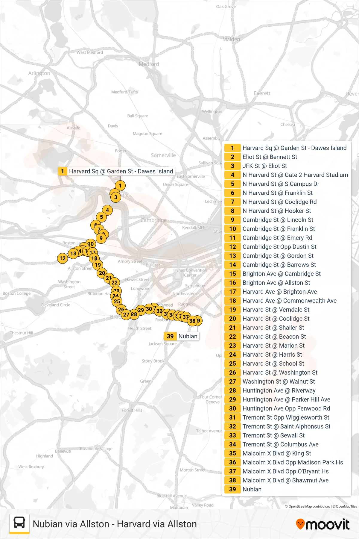
Stops list (66 - Nubian Via Allston)
- Harvard Sq @ Garden St - Dawes Island
- Eliot St @ Bennett St
- JFK St @ Eliot St
- N Harvard St @ Gate 2 Harvard Stadium
- N Harvard St @ S Campus Dr
- N Harvard St @ Franklin St
- N Harvard St @ Coolidge Rd
- N Harvard St @ Hooker St
- Cambridge St @ Lincoln St
- Cambridge St @ Franklin St
- Cambridge St @ Emery Rd
- Cambridge St Opp Dustin St
- Cambridge St @ Gordon St
- Cambridge St @ Barrows St
- Brighton Ave @ Cambridge St
- Brighton Ave @ Allston St
- Harvard Ave @ Brighton Ave
- Harvard Ave @ Commonwealth Ave
- Harvard St @ Verndale St
- Harvard St @ Coolidge St
- Harvard St @ Shailer St
- Harvard St @ Beacon St
- Harvard St @ Marion St
- Harvard St @ Harris St
- Harvard St @ School St
- Harvard St @ Washington St
- Washington St @ Walnut St
- Huntington Ave @ Riverway
- Huntington Ave @ Parker Hill Ave
- Huntington Ave Opp Fenwood Rd
- Tremont St Opp Wigglesworth St
- Tremont St @ Saint Alphonsus St
- Tremont St @ Sewall St
- Tremont St @ Columbus Ave
- Malcolm X Blvd @ King St
- Malcolm X Blvd Opp Madison Park Hs
- Malcolm X Blvd Opp O'Bryant Hs
- Malcolm X Blvd @ Shawmut Ave
- Nubian