
66 Bus Route Map
View the 66 route map and see all 66 stops along the route. The map of 66 shows where the bus travels and the location of each stop, making it easy to understand the entire route at a glance.
Explore Regional Transportation District routes on the map and see where Regional Transportation District bus services operate. Use the 66 map to find bus stops and see how the 66 connects different areas along its trip.
All 66 stops on the map are displayed in route order, helping you follow the 66 bus from the first stop to the last.
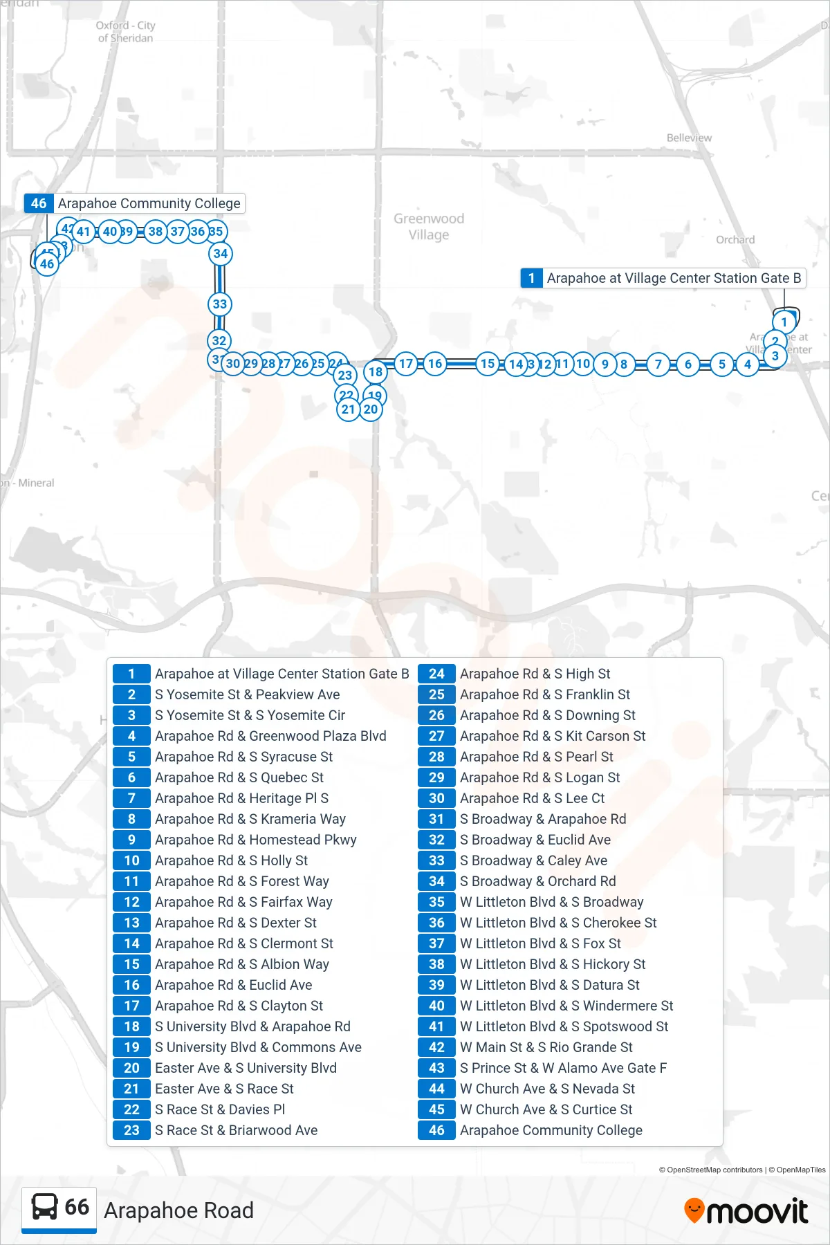
Stops list (66 - Arapahoe Community College)
- Arapahoe at Village Center Station Gate B
- S Yosemite St & Peakview Ave
- S Yosemite St & S Yosemite Cir
- Arapahoe Rd & Greenwood Plaza Blvd
- Arapahoe Rd & S Syracuse St
- Arapahoe Rd & S Quebec St
- Arapahoe Rd & Heritage Pl S
- Arapahoe Rd & S Krameria Way
- Arapahoe Rd & Homestead Pkwy
- Arapahoe Rd & S Holly St
- Arapahoe Rd & S Forest Way
- Arapahoe Rd & S Fairfax Way
- Arapahoe Rd & S Dexter St
- Arapahoe Rd & S Clermont St
- Arapahoe Rd & S Albion Way
- Arapahoe Rd & Euclid Ave
- Arapahoe Rd & S Clayton St
- S University Blvd & Arapahoe Rd
- S University Blvd & Commons Ave
- Easter Ave & S University Blvd
- Easter Ave & S Race St
- S Race St & Davies Pl
- S Race St & Briarwood Ave
- Arapahoe Rd & S High St
- Arapahoe Rd & S Franklin St
- Arapahoe Rd & S Downing St
- Arapahoe Rd & S Kit Carson St
- Arapahoe Rd & S Pearl St
- Arapahoe Rd & S Logan St
- Arapahoe Rd & S Lee Ct
- S Broadway & Arapahoe Rd
- S Broadway & Euclid Ave
- S Broadway & Caley Ave
- S Broadway & Orchard Rd
- W Littleton Blvd & S Broadway
- W Littleton Blvd & S Cherokee St
- W Littleton Blvd & S Fox St
- W Littleton Blvd & S Hickory St
- W Littleton Blvd & S Datura St
- W Littleton Blvd & S Windermere St
- W Littleton Blvd & S Spotswood St
- W Main St & S Rio Grande St
- S Prince St & W Alamo Ave Gate F
- W Church Ave & S Nevada St
- W Church Ave & S Curtice St
- Arapahoe Community College