
66 Cable Car Route Map
View the 66 route map and see all 66 stops along the route. The map of 66 shows where the cable car travels and the location of each stop, making it easy to understand the entire route at a glance.
Explore SEPTA Trolley routes on the map and see where SEPTA Trolley cable car services operate. Use the 66 map to find cable car stations and see how the 66 connects different areas along its trip.
All 66 stops on the map are displayed in route order, helping you follow the 66 cable car from the first station to the last.
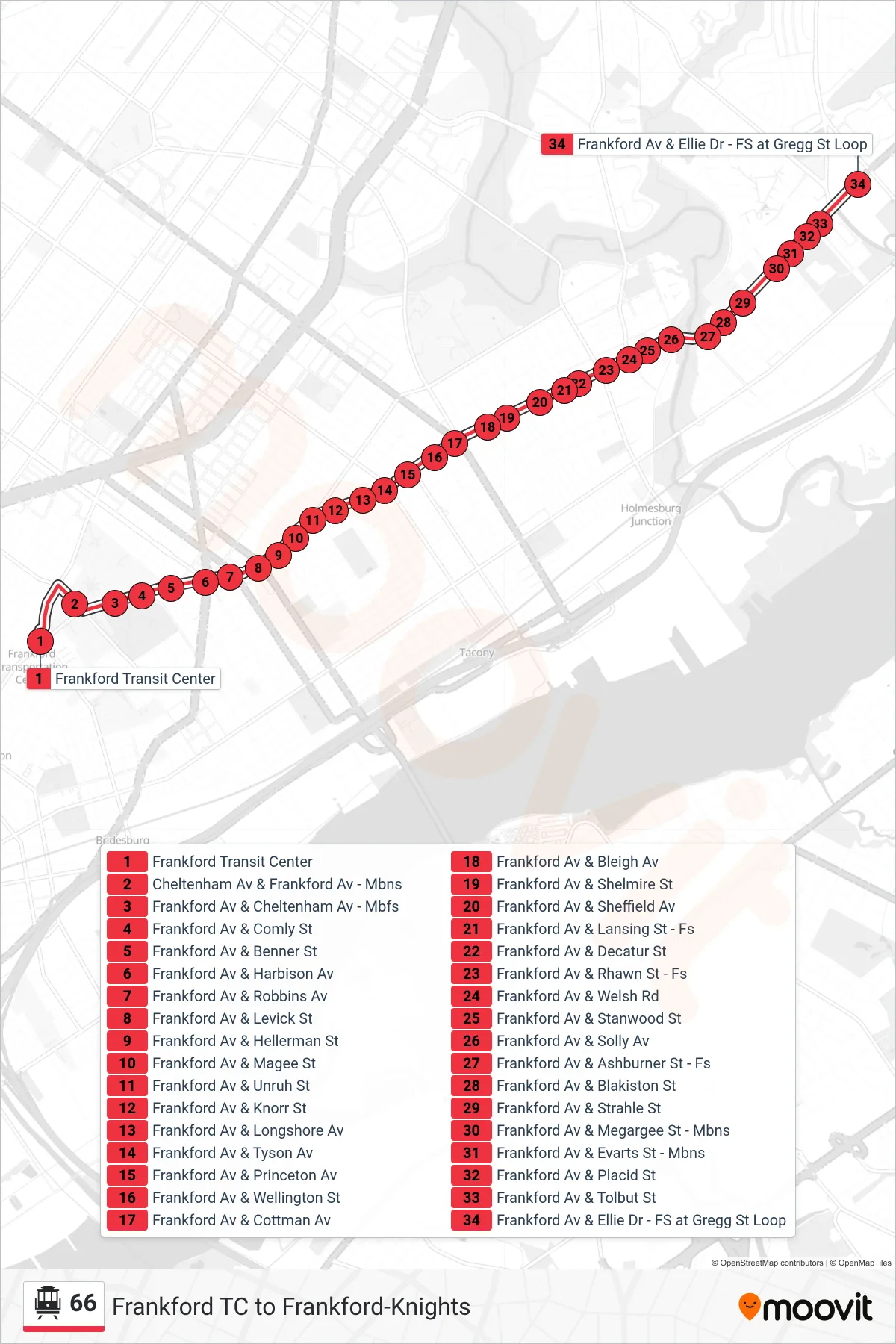
Stops list (66 - Frankford-Gregg)
- Frankford Transit Center
- Cheltenham Av & Frankford Av - Mbns
- Frankford Av & Cheltenham Av - Mbfs
- Frankford Av & Comly St
- Frankford Av & Benner St
- Frankford Av & Harbison Av
- Frankford Av & Robbins Av
- Frankford Av & Levick St
- Frankford Av & Hellerman St
- Frankford Av & Magee St
- Frankford Av & Unruh St
- Frankford Av & Knorr St
- Frankford Av & Longshore Av
- Frankford Av & Tyson Av
- Frankford Av & Princeton Av
- Frankford Av & Wellington St
- Frankford Av & Cottman Av
- Frankford Av & Bleigh Av
- Frankford Av & Shelmire St
- Frankford Av & Sheffield Av
- Frankford Av & Lansing St - Fs
- Frankford Av & Decatur St
- Frankford Av & Rhawn St - Fs
- Frankford Av & Welsh Rd
- Frankford Av & Stanwood St
- Frankford Av & Solly Av
- Frankford Av & Ashburner St - Fs
- Frankford Av & Blakiston St
- Frankford Av & Strahle St
- Frankford Av & Megargee St - Mbns
- Frankford Av & Evarts St - Mbns
- Frankford Av & Placid St
- Frankford Av & Tolbut St
- Frankford Av & Ellie Dr - FS at Gregg St Loop