
66 Bus Route Map
View the 66 route map and see all 66 stops along the route. The map of 66 shows where the bus travels and the location of each stop, making it easy to understand the entire route at a glance.
Explore RÖHLER Touristik GmbH routes on the map and see where RÖHLER Touristik GmbH bus services operate. Use the 66 map to find bus stops and see how the 66 connects different areas along its trip.
All 66 stops on the map are displayed in route order, helping you follow the 66 bus from the first stop to the last.
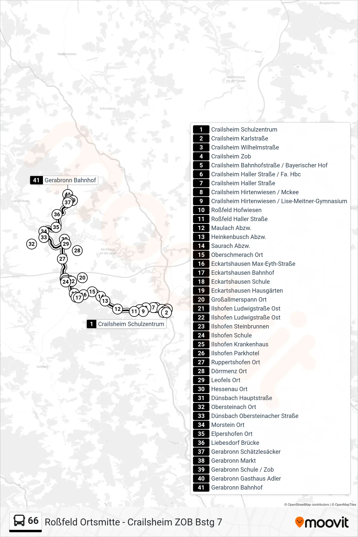
Stops list (66 - Gerabronn Bahnhof)
- Crailsheim Schulzentrum
- Crailsheim Karlstraße
- Crailsheim Wilhelmstraße
- Crailsheim Zob
- Crailsheim Bahnhofstraße / Bayerischer Hof
- Crailsheim Haller Straße / Fa. Hbc
- Crailsheim Haller Straße
- Crailsheim Hirtenwiesen / Mckee
- Crailsheim Hirtenwiesen / Lise-Meitner-Gymnasium
- Roßfeld Hofwiesen
- Roßfeld Haller Straße
- Maulach Abzw.
- Heinkenbusch Abzw.
- Saurach Abzw.
- Oberschmerach Ort
- Eckartshausen Max-Eyth-Straße
- Eckartshausen Bahnhof
- Eckartshausen Schule
- Eckartshausen Hausgärten
- Großallmerspann Ort
- Ilshofen Ludwigstraße Ost
- Ilshofen Ludwigstraße Ost
- Ilshofen Steinbrunnen
- Ilshofen Schule
- Ilshofen Krankenhaus
- Ilshofen Parkhotel
- Ruppertshofen Ort
- Dörrmenz Ort
- Leofels Ort
- Hessenau Ort
- Dünsbach Hauptstraße
- Obersteinach Ort
- Dünsbach Obersteinacher Straße
- Morstein Ort
- Elpershofen Ort
- Liebesdorf Brücke
- Gerabronn Schätzlesäcker
- Gerabronn Markt
- Gerabronn Schule / Zob
- Gerabronn Gasthaus Adler
- Gerabronn Bahnhof
Change direction
- Route Map - 66 - Gerabronn Gasthaus Adler
- Route Map - 66 - Crailsheim Worthingtonstraße / Zob
- Route Map - 66 - Gerabronn Blaufeldener Straße 39
- Route Map - 66 - Roßfeld Ortsmitte
- Route Map - 66 - Crailsheim Hallenbad
- Route Map - 66 - Ilshofen Parkhotel
- Route Map - 66 - Crailsheim Schulzentrum
- Route Map - 66 - Gerabronn Markt
- Route Map - 66 - Crailsheim Zob
- Route Map - 66 - Gerabronn Schule / Zob