
661 Bus Route Map
View the 661 route map and see all 661 stops along the route. The map of 661 shows where the bus travels and the location of each stop, making it easy to understand the entire route at a glance.
Explore Omnibus-Verkehr Ruoff GmbH routes on the map and see where Omnibus-Verkehr Ruoff GmbH bus services operate. Use the 661 map to find bus stops and see how the 661 connects different areas along its trip.
All 661 stops on the map are displayed in route order, helping you follow the 661 bus from the first stop to the last.
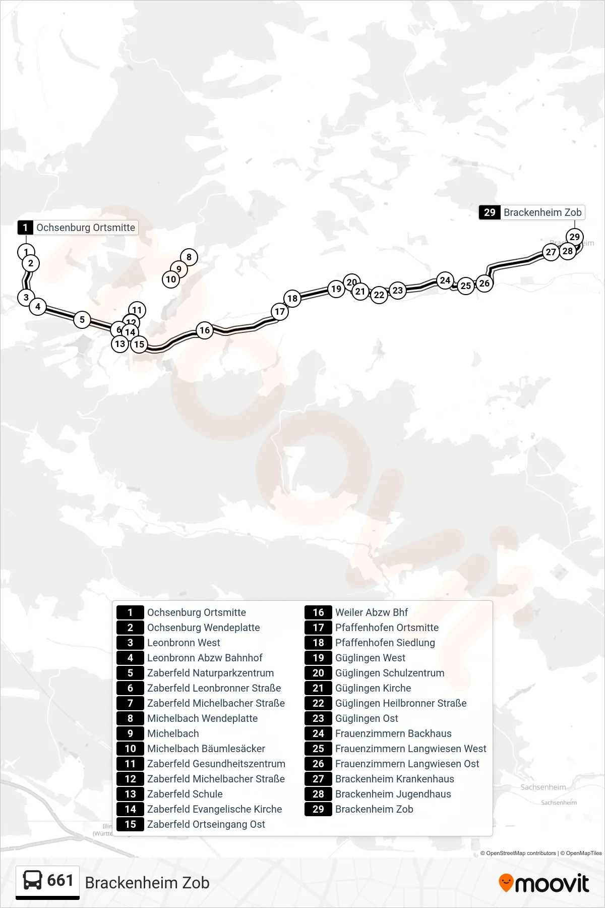
Stops list (661 - Brackenheim Zob)
- Ochsenburg Ortsmitte
- Ochsenburg Wendeplatte
- Leonbronn West
- Leonbronn Abzw Bahnhof
- Zaberfeld Naturparkzentrum
- Zaberfeld Leonbronner Straße
- Zaberfeld Michelbacher Straße
- Michelbach Wendeplatte
- Michelbach
- Michelbach Bäumlesäcker
- Zaberfeld Gesundheitszentrum
- Zaberfeld Michelbacher Straße
- Zaberfeld Schule
- Zaberfeld Evangelische Kirche
- Zaberfeld Ortseingang Ost
- Weiler Abzw Bhf
- Pfaffenhofen Ortsmitte
- Pfaffenhofen Siedlung
- Güglingen West
- Güglingen Schulzentrum
- Güglingen Kirche
- Güglingen Heilbronner Straße
- Güglingen Ost
- Frauenzimmern Backhaus
- Frauenzimmern Langwiesen West
- Frauenzimmern Langwiesen Ost
- Brackenheim Krankenhaus
- Brackenheim Jugendhaus
- Brackenheim Zob
Change direction
- Route Map - 661 - Brackenheim Zob
- Route Map - 661 - Heilbronn Hbf/Busbahnhof
- Route Map - 661 - Heilbronn Hbf/Willy-Brandt-Pl.
- Route Map - 661 - Ochsenburg Ortsmitte
- Route Map - 661 - Güglingen Schulzentrum
- Route Map - 661 - Güglingen Neues Rathaus
- Route Map - 661 - Güglingen Schulzentrum
- Route Map - 661 - Heilbronn Allee/Moltkestraße